Category:Denny Triangle, Seattle, Washington
Jump to navigation
Jump to search
English: 

Generally speaking, following the pattern in the second image at right (see image page for further comments), we classify locations east of Seventh Avenue in category Category:Denny Triangle, Seattle, Washington.


Generally speaking, following the pattern in the second image at right (see image page for further comments), we classify locations east of Seventh Avenue in category Category:Denny Triangle, Seattle, Washington.
Subcategories
This category has the following 22 subcategories, out of 22 total.
2
- 2200 Westlake Plaza (2 F)
- 2201 Westlake (8 F)
9
- 922 Virginia Street, Seattle (3 F)
A
C
- Cirrus (skyscraper, Seattle) (7 F)
D
- Denny Centre (1 F)
H
- Hyatt Regency Seattle (6 F)
L
- Lenora Building (6 F)
M
- Mary's Place (6 F)
- McKenzie Apartments (3 F)
N
- Nexus (building) (3 F)
O
- Olive 8 (6 F)
P
- Puget Sound Notion Building (2 F)
S
- Seattle Greyhound Terminal (15 F)
- Stratus (building) (3 F)
T
- The Olivian (2 F)
- Tilt 49 (5 F)
U
W
- William Volker Building (10 F)
- Williamsburg Court, Seattle (5 F)
Media in category "Denny Triangle, Seattle, Washington"
The following 39 files are in this category, out of 39 total.
-
 8th & Howell hotel project under construction - aerial view, July 2016 (28063261541).jpg 4,752 × 3,168; 6.07 MB
-
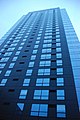
 Aspira from Virginia & Boren, Seattle (23516661022).jpg 3,168 × 4,752; 3.74 MB
-
 Aspira.jpg 435 × 650; 235 KB
-
 Bellevue ^ olive - panoramio.jpg 4,000 × 2,240; 2.66 MB
-
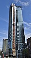 Cirrus under construction, viewed from Lenora Street.jpg 2,111 × 3,889; 2.97 MB
-

-

-
 Denny Regrade borders.jpg 329 × 219; 61 KB
-
 Denny Regrade Commons category map.jpg 333 × 244; 51 KB
-
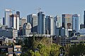 Denny Triangle and South Lake Union skyline, from Westlake & Galer (2018).jpg 4,738 × 3,146; 4.38 MB
-
 Fall 2007 023 - Flickr - GregTheBusker.jpg 3,072 × 2,304; 1.75 MB
-

-

-
 High-rise construction in the Denny Triangle from Boren and Stewart.jpg 4,912 × 3,264; 5.54 MB
-

-
-

-
-
 Pike Pine Retail Core, Seattle, WA, USA - panoramio (2).jpg 4,000 × 3,000; 5.26 MB
-
 Plat of the Second Addition, City of Seattle, December 1876 (MOHAI 14545).jpg 1,000 × 624; 142 KB
-
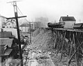
 Seattle - 7th and Lenora during Denny Regrade east of Fifth Avenue, 1930 (51497541199).jpg 3,492 × 2,400; 2.83 MB
-
 Seattle - 8th & Olive, 1932.jpg 4,000 × 3,070; 766 KB
-
 Seattle - 8th & Pike, 1956 (51369926456).jpg 950 × 1,200; 603 KB
-
 Seattle - 9th Avenue looking north toward Denny Way.jpg 4,288 × 2,848; 5.38 MB
-
 Seattle - Gethsemane Lutheran 01.jpg 4,288 × 2,848; 6.85 MB
-
 Seattle - RKCNDY sign.jpg 6,000 × 4,000; 11.28 MB
-
 Seattle - Shake Shack - 2115 Westlake Ave.jpg 4,288 × 2,848; 6.17 MB
-
 Seattle - Westlake Avenue looking north from outside the Westin.jpg 2,848 × 4,288; 5.6 MB
-

-
 Seattle Children's Research Institute 01.jpg 2,848 × 4,288; 6.14 MB
-
 Seattle de nuit.jpg 3,000 × 4,000; 2.23 MB
-

-
 Space Needle scene, Seattle, Washington LCCN2010630409.tif 6,408 × 5,048; 185.13 MB
-

-

-

-

-

-

.jpg)
.jpg)


,_old_Presbyterian_church,_Olive_Way_between_7th_Ave_(CURTIS_0).jpeg)
,_Olive_Way_between_7th_Ave_and_8th_Ave_(CURTIS_1).jpeg)
.jpg)

.jpeg)
.jpeg)

.jpeg)
.jpeg)
.jpeg)
.jpeg)
.jpg)
.jpg)
.jpg)

.jpg)


.jpg)


.jpg)
.jpg)
.jpg)
,_9th_Ave_near_Olive_Way,_Seattle_(CURTIS_1419).jpeg)
_(cropped).jpg)
.jpg)
.jpg)