Category:Dennington
Jump to navigation
Jump to search
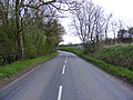
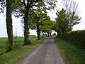
English: Dennington is a small village in Suffolk, England, just north of Framlingham along the A1120 Bypass.
village in Suffolk, UK  | |||||
| Upload media | |||||
| Instance of | |||||
|---|---|---|---|---|---|
| Location |
| ||||
 | |||||
Subcategories
This category has the following 8 subcategories, out of 8 total.
F
- Fishers Farm, Suffolk (2 F)
P
- Dennington Place (2 F)
- Dennington Primary School (3 F)
Q
- Queens Head, Dennington (13 F)
S
V
- Dennington Village Hall (3 F)
- Dennington Village Sign (3 F)
W
- Dennington Water Tower (7 F)
Media in category "Dennington"
The following 200 files are in this category, out of 370 total.
(previous page) (next page)-
 A seat best not sat upon - geograph.org.uk - 4369437.jpg 1,024 × 768; 651 KB
-
 A seat on which to watch the passing traffic - geograph.org.uk - 4369484.jpg 1,024 × 768; 499 KB
-
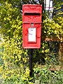
 A1120 and Capons Green Postbox - geograph.org.uk - 1441227.jpg 3,072 × 2,304; 1.43 MB
-
 A1120 Badingham Road, Capon's Green - geograph.org.uk - 1831096.jpg 3,072 × 2,304; 1.44 MB
-
 A1120 Badingham Road, Capon's Green - geograph.org.uk - 1831100.jpg 3,072 × 2,304; 1.26 MB
-
 A1120 Button's Hill - geograph.org.uk - 2379266.jpg 3,072 × 2,304; 1.25 MB
-
 A1120 Button's Hill - geograph.org.uk - 2379268.jpg 3,072 × 2,304; 1.21 MB
-
 A1120 Button's Hill approaches White House Farm - geograph.org.uk - 3593500.jpg 3,648 × 2,736; 1.29 MB
-
 A1120 Button's Hill ^ the footpath to Peppers Wash - geograph.org.uk - 2379260.jpg 3,072 × 2,304; 1.24 MB
-
 A1120 Dennington Road, Badingham - geograph.org.uk - 1828106.jpg 3,072 × 2,304; 1.56 MB
-
 A1120 Dennington Road, Badingham - geograph.org.uk - 1828112.jpg 3,072 × 2,304; 1.66 MB
-
 A1120 Dennington Road, Badingham - geograph.org.uk - 4840503.jpg 3,072 × 2,237; 2.52 MB
-
 A1120 Saxtead Road - geograph.org.uk - 2120339.jpg 3,072 × 2,304; 1.36 MB
-
 A1120 Saxtead Road Running into Dennington - geograph.org.uk - 2985411.jpg 2,560 × 1,920; 1.06 MB
-
 A1120 Saxtead Road south of Red House Farm - geograph.org.uk - 3595768.jpg 3,648 × 2,736; 1.53 MB
-
 A1120 Saxtead Road, Maypole Green - geograph.org.uk - 4208644.jpg 3,072 × 2,304; 1.78 MB
-
 A1120 The Street, Dennington - geograph.org.uk - 3454890.jpg 3,072 × 2,304; 1.36 MB
-
 A1120 The Street, Dennington - geograph.org.uk - 4624717.jpg 2,941 × 2,101; 2.14 MB
-
 A1120 The Street, Dennington - geograph.org.uk - 4624799.jpg 3,072 × 2,304; 2.15 MB
-
 A1120 The Street, Dennington - geograph.org.uk - 4624834.jpg 3,072 × 2,304; 1.76 MB
-
 A1120 The Street, Dennington - geograph.org.uk - 4624857.jpg 3,072 × 2,304; 1.96 MB
-
 Ancient moat - geograph.org.uk - 4369536.jpg 1,024 × 768; 628 KB
-
 Approaching Frostley Bridge over the River Alde - geograph.org.uk - 4369490.jpg 1,024 × 768; 514 KB
-
 B1116 Dennington Road - geograph.org.uk - 1852293.jpg 3,072 × 2,304; 1.28 MB
-
 B1116 Dennington Road - geograph.org.uk - 1852304.jpg 3,072 × 2,304; 1.19 MB
-
 B1116 Laxfield Road - geograph.org.uk - 1852383.jpg 3,072 × 2,304; 1.48 MB
-
 B1116 Laxfield Road - geograph.org.uk - 1852386.jpg 3,072 × 2,304; 1.31 MB
-
 B1116 Laxfield Road - geograph.org.uk - 2378669.jpg 3,072 × 2,304; 1.24 MB
-
 B1116 Laxfield Road - geograph.org.uk - 2724993.jpg 3,072 × 2,304; 1.5 MB
-
 B1116 Laxfield Road at Wells Corner - geograph.org.uk - 2738372.jpg 3,072 × 2,304; 1.46 MB
-
 B1116 Laxfield Road ^ Bell Corner Postbox - geograph.org.uk - 1855564.jpg 3,072 × 2,304; 1.41 MB
-
 B1116 Laxfield Road ^ Bell Corner Postbox - geograph.org.uk - 1855569.jpg 3,072 × 2,304; 1.62 MB
-
 B1116 Laxfield Road ^ Frostley Bridge - geograph.org.uk - 1853188.jpg 3,072 × 2,304; 1.42 MB
-
 B1116 Laxfield Road ^ Goddards Corner Postbox - geograph.org.uk - 1855574.jpg 3,072 × 2,304; 1.64 MB
-
 B1116 Laxfield Road ^ Goddards Corner Postbox - geograph.org.uk - 1855581.jpg 3,072 × 2,304; 1.68 MB
-
 B1116 Laxfield Road, Dennington - geograph.org.uk - 1852340.jpg 3,072 × 2,304; 1.41 MB
-
 B1116 Laxfield Road, Dennington - geograph.org.uk - 4624827.jpg 2,946 × 2,207; 2.6 MB
-
 B1116 Laxfield Road, Dennington - geograph.org.uk - 4624867.jpg 3,072 × 2,304; 1.8 MB
-
 B1116 Laxfield Road, Dennington - geograph.org.uk - 6064247.jpg 4,000 × 2,929; 4.14 MB
-
 B1116 Laxfield Road, Dennington - geograph.org.uk - 6067991.jpg 4,608 × 3,456; 4.14 MB
-
 B1116 south of Laxfield - geograph.org.uk - 3911552.jpg 640 × 480; 73 KB
-
 B1116 ^ Goddards Corner Postbox - geograph.org.uk - 2573498.jpg 3,072 × 2,304; 1.38 MB
-
 B1118 Frostley Bridge Road - geograph.org.uk - 2695488.jpg 3,072 × 2,304; 1.31 MB
-
 B1118 Frostley Bridge Road - geograph.org.uk - 2695494.jpg 3,072 × 2,304; 1.57 MB
-
 B1118 Frostley Bridge Road, Dennington - geograph.org.uk - 6067997.jpg 4,608 × 3,456; 3.95 MB
-
 B1118 Frostley Bridge Road, Dennington - geograph.org.uk - 6092433.jpg 4,000 × 2,962; 3.27 MB
-
 B1118 Frostley Bridge Road, Dennington - geograph.org.uk - 6092434.jpg 4,608 × 3,456; 4 MB
-

-
 Bell Corner Postbox - geograph.org.uk - 1855568.jpg 2,304 × 3,072; 1.66 MB
-
 Bell Corner Postbox - geograph.org.uk - 2573523.jpg 2,304 × 3,072; 1.49 MB
-
 Bell Corner Postbox - geograph.org.uk - 2573524.jpg 2,304 × 3,072; 1.36 MB
-
 Bell Corner Telephone ^ Postbox - geograph.org.uk - 2573520.jpg 3,072 × 2,304; 1.59 MB
-
 Bell Corner Telephone ^ Postbox - geograph.org.uk - 2573521.jpg 2,304 × 3,072; 1.5 MB
-
 Bend On Spring Lane - geograph.org.uk - 3872645.jpg 1,024 × 768; 235 KB
-
 Box Bush Lane footpath to Severalls Lane - geograph.org.uk - 2379926.jpg 3,072 × 2,304; 1.69 MB
-
 Box Bush Lane footpath to Severalls Lane - geograph.org.uk - 2379929.jpg 2,304 × 3,072; 1.37 MB
-
 Box Bush Lane footpath to Severalls Lane - geograph.org.uk - 2379930.jpg 2,304 × 3,072; 1.46 MB
-
 Box Bush Lane, Maypole Green - geograph.org.uk - 1832131.jpg 3,072 × 2,304; 1.55 MB
-
 Boxbush Lane - geograph.org.uk - 3872610.jpg 1,024 × 768; 306 KB
-
 Brandish Lodge - geograph.org.uk - 6474392.jpg 5,354 × 3,569; 4.02 MB
-
 Brandish, Cattle grazing in front of the Lodge - geograph.org.uk - 6474389.jpg 4,886 × 3,257; 5.44 MB
-
 Brundish Lodge name sign - geograph.org.uk - 2424782.jpg 2,304 × 3,072; 1.54 MB
-
 Building site off the A1120 The Street - geograph.org.uk - 4840467.jpg 3,072 × 2,304; 2.05 MB
-
 Building site off the A1120 The Street - geograph.org.uk - 4840469.jpg 3,072 × 2,304; 1.83 MB
-
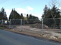 Building site off the A1120 The Street - geograph.org.uk - 4878135.jpg 3,072 × 2,304; 1.78 MB
-
 Building site off the A1120 The Street - geograph.org.uk - 4878138.jpg 3,072 × 2,304; 1.78 MB
-
 Building site off the A1120 The Street - geograph.org.uk - 4969975.jpg 3,072 × 2,304; 1.86 MB
-
 Building site off the A1120 The Street - geograph.org.uk - 4969988.jpg 3,072 × 2,304; 1.92 MB
-
 Button's Hill, Saxtead Bottom - geograph.org.uk - 6352751.jpg 1,810 × 1,186; 1,014 KB
-
 Capon's Green, Dennington - geograph.org.uk - 2401498.jpg 3,072 × 2,304; 1.3 MB
-
 Capons Green Postbox - geograph.org.uk - 1441228.jpg 2,304 × 3,072; 2.33 MB
-
 Children's Play Area - geograph.org.uk - 4314546.jpg 3,072 × 2,304; 1.81 MB
-
 Clay Hill - geograph.org.uk - 1852251.jpg 3,072 × 2,304; 1.42 MB
-
 Clay Hill - geograph.org.uk - 2379977.jpg 3,072 × 2,304; 1.5 MB
-
 Clay Hill - geograph.org.uk - 2379978.jpg 3,072 × 2,304; 1.61 MB
-
 Clay Hill - geograph.org.uk - 2380005.jpg 2,304 × 3,072; 1.52 MB
-
 Clay Hill, Capons Green - geograph.org.uk - 1852246.jpg 3,072 × 2,304; 1.45 MB
-
 Clay Hill, Capons Green - geograph.org.uk - 1852259.jpg 3,072 × 2,304; 1.52 MB
-
 Conservation Walks Map in Severalls Lane - geograph.org.uk - 2725006.jpg 2,304 × 3,072; 1.39 MB
-
 Cottages at Dennington - geograph.org.uk - 4381589.jpg 1,024 × 768; 357 KB
-
 Country Lane - geograph.org.uk - 4117664.jpg 768 × 1,024; 293 KB
-
 Country View - geograph.org.uk - 4117680.jpg 1,024 × 768; 387 KB
-
 Dangerous bend at Ivy House Corner - geograph.org.uk - 4369495.jpg 1,024 × 768; 401 KB
-
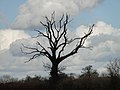 Dead tree in silhouette against a cloudy sky - geograph.org.uk - 4369456.jpg 1,024 × 768; 221 KB
-
 Dead tree near Trust Farm, Spring Lane - geograph.org.uk - 4369438.jpg 1,024 × 768; 301 KB
-
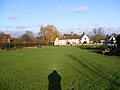
 Dennington - village centre - geograph.org.uk - 4703834.jpg 1,024 × 610; 129 KB
-
 Dennington Bowling Green - geograph.org.uk - 4314584.jpg 3,072 × 2,304; 1.94 MB
-
 Dennington Bridge on the B1118 Frostley Bridge Road - geograph.org.uk - 2695486.jpg 3,072 × 2,304; 1.22 MB
-
 Dennington Church - geograph.org.uk - 6223117.jpg 1,920 × 1,280; 991 KB
-
 Dennington church showing the War Memorial clock - geograph.org.uk - 6365841.jpg 4,499 × 2,885; 5.51 MB
-
 Dennington Conservation Walks Map - geograph.org.uk - 2379973.jpg 2,304 × 3,072; 1.53 MB
-
 Dennington Conservation Walks Map - geograph.org.uk - 2379982.jpg 2,304 × 3,072; 1.31 MB
-
 Dennington Jubilee Hall sign - geograph.org.uk - 4316262.jpg 2,304 × 3,072; 2.37 MB
-
 Dennington Playing Field - geograph.org.uk - 4314597.jpg 3,072 × 2,304; 1.93 MB
-
 Dennington Recycling Bins - geograph.org.uk - 4316266.jpg 3,072 × 2,304; 1.89 MB
-
 Dennington Road, Brundish - geograph.org.uk - 6092400.jpg 3,764 × 2,758; 3.54 MB
-
 Dennington Road, Dennington - geograph.org.uk - 6081929.jpg 4,608 × 3,456; 3.99 MB
-
 Dennington Road, Dennington - geograph.org.uk - 6081932.jpg 4,608 × 3,456; 3.9 MB
-
 Dennington Sports Pavilion - geograph.org.uk - 4314591.jpg 3,072 × 2,304; 1.97 MB
-
 Dennington Tennis Court - geograph.org.uk - 4314575.jpg 3,072 × 2,304; 1.86 MB
-
 Dennington Tennis Court - geograph.org.uk - 4314598.jpg 3,072 × 2,304; 1.83 MB
-
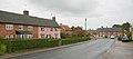
 Dennington Village - geograph.org.uk - 1074737.jpg 3,072 × 2,304; 1.43 MB
-
 Dennington Village Hall signs - geograph.org.uk - 4316260.jpg 2,304 × 3,072; 3.3 MB
-
 Dennington Village Name sign - geograph.org.uk - 4398897.jpg 2,304 × 3,072; 2.1 MB
-
 Dennington Wood - geograph.org.uk - 1828125.jpg 3,072 × 2,304; 1.22 MB
-
 Dennington, B1116 - geograph.org.uk - 6474409.jpg 6,892 × 4,594; 6.15 MB
-
 Dennington, B1116 from Severalls Lane - geograph.org.uk - 6474568.jpg 6,568 × 4,378; 5.81 MB
-
 Dennington, Cereal crop - geograph.org.uk - 6474577.jpg 6,696 × 4,464; 7.57 MB
-
 Dennington, Cereal crop - geograph.org.uk - 6474581.jpg 5,784 × 3,856; 7.1 MB
-
 Dennington, Field of oil seed rape - geograph.org.uk - 6474404.jpg 6,303 × 4,203; 7.35 MB
-
 Dennington, Field of oil seed rape - geograph.org.uk - 6474505.jpg 6,386 × 4,257; 7.03 MB
-
 Dennington, Frostley Bridge (detail) - geograph.org.uk - 6474525.jpg 4,699 × 3,133; 4.65 MB
-
 Dennington, Frostley Bridge - geograph.org.uk - 6474533.jpg 5,590 × 3,726; 6.79 MB
-
 Dennington, Frostley Bridge and the dried up river bed - geograph.org.uk - 6474522.jpg 5,584 × 3,723; 7.38 MB
-
 Dennington, Goddards Corner and Victorian post box - geograph.org.uk - 6474397.jpg 5,446 × 3,631; 7.09 MB
-
 Dennington, Maypole Green - geograph.org.uk - 6474586.jpg 5,107 × 3,405; 5.83 MB
-
 Dennington, Ploughed field - geograph.org.uk - 6474598.jpg 7,350 × 4,900; 6.86 MB
-
 Dennington, village centre - geograph.org.uk - 4703782.jpg 1,024 × 456; 123 KB
-
 Dennington, Where the B1118 joins the B1116 - geograph.org.uk - 6474514.jpg 6,235 × 4,156; 6.89 MB
-
 Entering A Neighbourhood Watch Area - geograph.org.uk - 3872650.jpg 1,024 × 768; 328 KB
-
 Entering Dennington on B1116 Dennington Road - geograph.org.uk - 1852311.jpg 3,072 × 2,304; 1.65 MB
-
 Entering Dennington on the B1117 Saxtead Road - geograph.org.uk - 4398895.jpg 2,737 × 1,986; 1.88 MB
-
 Entering Owls Green - geograph.org.uk - 3889699.jpg 1,024 × 768; 248 KB
-
 Entrance to Ashley House - geograph.org.uk - 4840473.jpg 2,756 × 1,943; 2.23 MB
-
 Entrance to Jacksons Farm - geograph.org.uk - 6064249.jpg 4,608 × 3,456; 4.04 MB
-
 Estate Agent Sale Board off the A1120 The Street - geograph.org.uk - 4969996.jpg 2,260 × 3,017; 3.85 MB
-
 Field Boundary - geograph.org.uk - 4117723.jpg 1,024 × 768; 242 KB
-
 Field by Button's Hill, Maypole Green - geograph.org.uk - 6229559.jpg 1,920 × 1,280; 945 KB
-
 Field Entrance off Severalls Lane - geograph.org.uk - 4208652.jpg 3,072 × 2,304; 1.92 MB
-
 Field looking towards Fishers Farm ^ A1120 - geograph.org.uk - 3454321.jpg 3,072 × 2,304; 1.29 MB
-
 Field next to the footpath to Clay Hill - geograph.org.uk - 3454324.jpg 3,072 × 2,304; 1.32 MB
-
 Field next to the footpath to Clay Hill - geograph.org.uk - 3454327.jpg 3,072 × 2,304; 1.32 MB
-
 Field next to the footpath to Clay Hill - geograph.org.uk - 3454329.jpg 3,072 × 2,304; 1.27 MB
-

-
 Field of stooks for thatching - geograph.org.uk - 2533949.jpg 3,072 × 2,304; 1.22 MB
-
 Field off the A1120 Saxtead Road - geograph.org.uk - 4208647.jpg 3,072 × 2,304; 2.04 MB
-
 Fields beside the Roman Road at Dennington - geograph.org.uk - 4369531.jpg 1,024 × 768; 344 KB
-
 Fields off Severalls Lane - geograph.org.uk - 1832148.jpg 3,072 × 2,304; 1.26 MB
-
 Fingerpost in Dennington - geograph.org.uk - 4381593.jpg 1,024 × 768; 279 KB
-
 Footbridge - geograph.org.uk - 4117727.jpg 768 × 1,024; 257 KB
-
 Footbridge at Capon's Green - geograph.org.uk - 2401529.jpg 2,631 × 1,384; 1.65 MB
-

-

-
 Footpath - geograph.org.uk - 3872531.jpg 1,024 × 768; 238 KB
-
 Footpath - geograph.org.uk - 4117720.jpg 1,024 × 768; 208 KB
-
 Footpath And Footbridge - geograph.org.uk - 4117726.jpg 768 × 1,024; 290 KB
-
 Footpath off B1118 Frostley Bridge Road - geograph.org.uk - 6092432.jpg 4,608 × 3,456; 3.83 MB
-
 Footpath sign - geograph.org.uk - 3453674.jpg 2,304 × 3,072; 1.43 MB
-
 Footpath to Clay Hill - geograph.org.uk - 3453662.jpg 2,304 × 3,072; 1.65 MB
-
 Footpath to Clay Hill - geograph.org.uk - 3453665.jpg 3,072 × 2,304; 1.62 MB
-
 Footpath to Clay Hill - geograph.org.uk - 3454343.jpg 3,072 × 2,304; 1.64 MB
-
 Footpath to Dennington Recreation Ground ^ A1120 - geograph.org.uk - 3453676.jpg 3,072 × 2,304; 1.37 MB
-
 Footpath to Dennington Village Hall ^ A1120 The Street - geograph.org.uk - 2379967.jpg 2,304 × 3,072; 1.34 MB
-
 Footpath to Dennington Village Hall ^ A1120 The Street - geograph.org.uk - 2379968.jpg 2,304 × 3,072; 1.32 MB
-
 Footpath to Dennington Village Hall ^ Clay Hill - geograph.org.uk - 2379956.jpg 3,072 × 2,304; 1.32 MB
-
 Footpath to Dennington Village Hall ^ Clay Hill - geograph.org.uk - 2379957.jpg 3,072 × 2,304; 1.28 MB
-
 Footpath to Dennington Wood - geograph.org.uk - 2401477.jpg 2,304 × 3,072; 1.44 MB
-
 Footpath to Dennington Wood - geograph.org.uk - 2401494.jpg 2,304 × 3,072; 1.29 MB
-
 Footpath to Framlingham Hall ^ the B1116 Dennington Road - geograph.org.uk - 2379903.jpg 2,304 × 3,072; 1.52 MB
-
 Footpath to Framlingham Hall ^ the B1116 Dennington Road - geograph.org.uk - 2379906.jpg 2,304 × 3,072; 1.2 MB
-
 Footpath to Framlingham Hall ^ the B1116 Dennington Road - geograph.org.uk - 2379907.jpg 3,072 × 2,304; 1.29 MB
-
 Footpath to Framlingham ^ Dennington Roads - geograph.org.uk - 2424840.jpg 3,072 × 2,304; 1.45 MB
-
 Footpath to Great Lodge Entrance - geograph.org.uk - 2379998.jpg 3,072 × 2,304; 1.4 MB
-
 Footpath to Lane Farm - geograph.org.uk - 2715017.jpg 3,072 × 2,304; 1.53 MB
-
 Footpath to Lane Farm - geograph.org.uk - 2715018.jpg 3,072 × 2,304; 1.33 MB
-
 Footpath to Lane Farm - geograph.org.uk - 2715025.jpg 3,072 × 2,304; 1.37 MB
-
 Footpath to Mill Road - geograph.org.uk - 2762087.jpg 3,072 × 2,304; 1.5 MB
-
 Footpath to Owl's Green ^ entrance to Brown's Farm - geograph.org.uk - 2378661.jpg 3,072 × 2,304; 1.37 MB
-
 Footpath to Owl's Green ^ entrance to Brown's Farm - geograph.org.uk - 2378671.jpg 3,072 × 2,304; 1.4 MB
-
 Footpath to Peppers Wash - geograph.org.uk - 2379249.jpg 3,072 × 2,304; 1.2 MB
-
 Footpath to Peppers Wash - geograph.org.uk - 2379255.jpg 3,072 × 2,304; 1.26 MB
-
 Footpath to the A1120 - geograph.org.uk - 2379984.jpg 3,072 × 2,304; 1.39 MB
-
 Footpath to the A1120 Saxtead Road-Button's Hill - geograph.org.uk - 2379633.jpg 3,072 × 2,304; 1.35 MB
-
 Footpath to the A1120 Saxtead Road-Button's Hill - geograph.org.uk - 2379636.jpg 3,072 × 2,304; 1.37 MB
-
 Footpath to the A1120 The Street - geograph.org.uk - 4314567.jpg 3,072 × 2,304; 1.85 MB
-
 Footpath to the A1120 The Street - geograph.org.uk - 4314570.jpg 2,304 × 3,072; 2.64 MB
-
 Footpath to the A1120 The Street - geograph.org.uk - 4316267.jpg 3,072 × 2,304; 1.91 MB
-
 Footpath to the A1120 The Street ^ Clay Hill - geograph.org.uk - 2379918.jpg 3,072 × 2,304; 1.68 MB
-
 Footpath to the B1116 Dennington Road ^ A1120 Button's Hill - geograph.org.uk - 2120316.jpg 3,072 × 2,304; 1.46 MB
-
 Footpath to the B1116 Dennington Road ^ A1120 Button's Hill - geograph.org.uk - 2120323.jpg 3,072 × 2,304; 1.49 MB
-
 Footpath to the B1116 Laxfield Road - geograph.org.uk - 2378675.jpg 3,072 × 2,304; 1.37 MB
-
 Framlingham Road at Wells Corner ^ White Horse Postbox - geograph.org.uk - 2573540.jpg 3,072 × 2,304; 1.55 MB
-
 Framlingham, Cowslips at Glebe Farm - geograph.org.uk - 4825660.jpg 1,730 × 2,581; 2.32 MB
-
 Framlingham, View from the B1116 - geograph.org.uk - 4825667.jpg 3,820 × 2,512; 3.82 MB
-
 Frostley Bridge near Dennington - geograph.org.uk - 1852343.jpg 3,072 × 2,304; 1.68 MB
-
 Frostley Bridge on the B1116 Laxfield Road - geograph.org.uk - 6092435.jpg 4,608 × 3,456; 4.02 MB
-
 Gas Pipeline Marker - geograph.org.uk - 3872630.jpg 768 × 1,024; 187 KB
-
 Georgian House in Brundish - geograph.org.uk - 3911542.jpg 640 × 480; 63 KB
-
 Goddards Corner Postbox - geograph.org.uk - 1855576.jpg 2,304 × 3,072; 1.51 MB
-
 Goddards Corner Postbox - geograph.org.uk - 2573494.jpg 3,072 × 2,304; 1.67 MB
-
 Goddards Corner Postbox - geograph.org.uk - 2573495.jpg 2,304 × 3,072; 1.43 MB
-
 Hexagonal type 22 pillbox beside the A1120 - geograph.org.uk - 4369515.jpg 1,024 × 768; 444 KB
-
 Hexagonal type 22 pillbox beside the A1120 - geograph.org.uk - 4369520.jpg 1,024 × 768; 480 KB
-
 Hexagonal type 22 pillbox beside the A1120 - geograph.org.uk - 4369522.jpg 1,024 × 768; 446 KB
-
 In Memory Of Sir Winston Churchill - geograph.org.uk - 3872546.jpg 1,024 × 768; 334 KB
-
 In the churchyard of St Mary's, Dennington - geograph.org.uk - 4851098.jpg 4,608 × 3,456; 3.37 MB
-
 Into The Beet - geograph.org.uk - 3889164.jpg 768 × 1,024; 226 KB
-
 Jacksons Farm sign - geograph.org.uk - 6064250.jpg 3,000 × 4,000; 5.98 MB
-
 Laxfield Road sign - geograph.org.uk - 4624731.jpg 3,072 × 2,304; 1.96 MB
-


_-_geograph.org.uk_-_6474525.jpg)


_-_geograph.org.uk_-_6474381.jpg)