Category:Denmead
Jump to navigation
Jump to search
village and civil parish in Hampshire, United Kingdom _(May_2019)_(2).JPG) | |||||
| Upload media | |||||
| Instance of | |||||
|---|---|---|---|---|---|
| Location | City of Winchester, Hampshire, South East England, England | ||||
| Population |
| ||||
 | |||||
Subcategories
This category has the following 7 subcategories, out of 7 total.
A
B
D
- Denmead War Memorial Hall (1 F)
H
- Harvest Home pub, Denmead (6 F)
S
- Solent Overload Show, Denmead (252 F)
T
- The Cornerstone, Denmead (5 F)
Media in category "Denmead"
The following 200 files are in this category, out of 362 total.
(previous page) (next page)-

-
 "The Harvest Home" PH - geograph.org.uk - 4222863.jpg 800 × 600; 166 KB
-

-
-
 2016, a year on Geograph (Day 355) - geograph.org.uk - 5231927.jpg 640 × 480; 74 KB
-
 400 KV Pylon with mobile phone aerials - geograph.org.uk - 2952166.jpg 627 × 640; 152 KB
-
 A wise prohibition - geograph.org.uk - 2733597.jpg 427 × 640; 113 KB
-
 Abandoned track, Creech Wood - geograph.org.uk - 4084564.jpg 640 × 480; 200 KB
-
 Anmore, Hampshire - geograph.org.uk - 2866567.jpg 3,334 × 2,223; 779 KB
-
 Approaching The Crossroads from the east - geograph.org.uk - 4284180.jpg 800 × 600; 165 KB
-
 Ashling Close (1) - geograph.org.uk - 2342708.jpg 640 × 428; 61 KB
-
 Ashling Close (2) - geograph.org.uk - 2342716.jpg 640 × 428; 62 KB
-
 B2150 approaching the shops in Denmead - geograph.org.uk - 741604.jpg 640 × 427; 162 KB
-
 Barn Green allotments - geograph.org.uk - 2952055.jpg 640 × 464; 142 KB
-
 Barn Green allotments, Hambledon Road - geograph.org.uk - 2951991.jpg 640 × 427; 157 KB
-

-
 Bend in Old Mill Lane - geograph.org.uk - 3607193.jpg 640 × 427; 122 KB
-
 Bend on Denmead Lane - geograph.org.uk - 4283812.jpg 800 × 600; 173 KB
-
 Bent Lane heading towards Bent Farm - geograph.org.uk - 2047212.jpg 640 × 480; 63 KB
-
 Bent Lane south of Hambledon - geograph.org.uk - 5055460.jpg 2,048 × 1,536; 799 KB
-

-

-
 Broad View Cottage, Denmead - geograph.org.uk - 741645.jpg 640 × 427; 134 KB
-
 Bungalow named Nairobi and Kimville - geograph.org.uk - 3669444.jpg 640 × 427; 137 KB
-
 Bunkers Hill, through Creech Woods - geograph.org.uk - 5945238.jpg 1,024 × 683; 336 KB
-

-
 Bus stop on Hambledon Road - geograph.org.uk - 4221063.jpg 800 × 600; 163 KB
-
 Cables passing through High Wood - geograph.org.uk - 3590287.jpg 800 × 600; 99 KB
-
-
 Cemetery Lane - geograph.org.uk - 3590263.jpg 1,037 × 778; 741 KB
-
 Cemetery Lane - geograph.org.uk - 3590268.jpg 800 × 600; 185 KB
-
 Closewood Farm - geograph.org.uk - 2733640.jpg 640 × 427; 134 KB
-
 Closewood Road arrives at Newlands Lane - geograph.org.uk - 4221040.jpg 800 × 600; 194 KB
-

-
 Corner Mead (1) - geograph.org.uk - 2355817.jpg 640 × 428; 54 KB
-
 Corner Mead (2) - geograph.org.uk - 2355912.jpg 640 × 428; 72 KB
-
 Corner Mead (3) - geograph.org.uk - 2355923.jpg 640 × 428; 71 KB
-
 Cottage Close (1) - geograph.org.uk - 2355483.jpg 640 × 428; 62 KB
-
 Cottage Close (2) - geograph.org.uk - 2355486.jpg 640 × 428; 69 KB
-
 Cottage Close (3) - geograph.org.uk - 2355490.jpg 640 × 428; 72 KB
-
 Creech Lodge seen from forestry track - geograph.org.uk - 4220938.jpg 640 × 480; 134 KB
-
 Creech Woods - geograph.org.uk - 1021805.jpg 640 × 480; 203 KB
-
 Creech Woods - geograph.org.uk - 1021814.jpg 640 × 480; 185 KB
-
 Creech Woods - geograph.org.uk - 1021876.jpg 480 × 640; 191 KB
-
 Creech Woods - geograph.org.uk - 1021946.jpg 640 × 480; 209 KB
-
 Crossroads by Pithill Farm - geograph.org.uk - 4284007.jpg 800 × 600; 182 KB
-

-

-
 Denmead Baptist Chapel - geograph.org.uk - 2419574.jpg 546 × 382; 80 KB
-
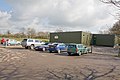
 Denmead Community Centre - geograph.org.uk - 4222817.jpg 800 × 600; 145 KB
-
 Denmead Garage Service, Hambledon Road - geograph.org.uk - 2951997.jpg 640 × 427; 123 KB
-
 Denmead Health Centre - geograph.org.uk - 741760.jpg 640 × 427; 103 KB
-
 Denmead Tyre Services - geograph.org.uk - 741825.jpg 640 × 427; 114 KB
-
 Denmead War Memorial Hall, Hambledon Road, Denmead (May 2019) (1).JPG 2,600 × 1,600; 1.84 MB
-
 Denmead War Memorial Hall, Hambledon Road, Denmead (May 2019) (2).JPG 2,800 × 1,800; 2.1 MB
-
 Denmead, Hampshire - geograph.org.uk - 2865509.jpg 3,504 × 2,336; 633 KB
-

-
 Direction Sign – Signpost - geograph.org.uk - 6519253.jpg 481 × 640; 214 KB
-
 Down House and kennels - geograph.org.uk - 3607110.jpg 640 × 427; 111 KB
-
 Durley Terrace, Green Lane - geograph.org.uk - 2951987.jpg 640 × 427; 164 KB
-

-
 Edney's Lane - geograph.org.uk - 3980102.jpg 640 × 480; 139 KB
-
 Enclosed track up Sawyer's Hill - geograph.org.uk - 935500.jpg 480 × 640; 139 KB
-
 Entrance to Creech Lodge - geograph.org.uk - 4220930.jpg 800 × 600; 265 KB
-
 Entrance to Creech Wood - geograph.org.uk - 4322801.jpg 800 × 533; 202 KB
-
 Entrance to Denmead - geograph.org.uk - 3613960.jpg 640 × 460; 105 KB
-

-
 Entrance to Furzeley Golf Course - geograph.org.uk - 4220973.jpg 800 × 600; 121 KB
-
 Entrance to Mount Edgecombe Farm - geograph.org.uk - 2342829.jpg 640 × 428; 95 KB
-
 Entrance track to Meadows Farmhouse - geograph.org.uk - 5722511.jpg 640 × 427; 94 KB
-
 Fairholme Cottage, Hambledon Road - geograph.org.uk - 2951907.jpg 640 × 427; 157 KB
-
 Fareham Road, Worlds End - geograph.org.uk - 5055530.jpg 2,048 × 1,536; 1.48 MB
-
 Farm buildings at Little Denmead Farm - geograph.org.uk - 3669437.jpg 640 × 427; 133 KB
-
 Farmland near Denmead - geograph.org.uk - 251683.jpg 640 × 478; 42 KB
-
 Farmland with pylons - geograph.org.uk - 3629449.jpg 1,037 × 778; 752 KB
-

-

-
 Field and footpath east of High Wood - geograph.org.uk - 2952152.jpg 640 × 427; 131 KB
-
 Field by Fareham Road, Worlds End - geograph.org.uk - 5052002.jpg 2,048 × 1,536; 895 KB
-
 Field by road with pylon - geograph.org.uk - 4284186.jpg 800 × 600; 97 KB
-
 Field east of Furzeley Road - geograph.org.uk - 3980118.jpg 640 × 480; 117 KB
-
 Field footpath to Old Mill Lane - geograph.org.uk - 4297863.jpg 800 × 600; 127 KB
-
 Field of barley - geograph.org.uk - 3590301.jpg 777 × 906; 781 KB
-
 Field, with Denmead Farm beyond - geograph.org.uk - 3669451.jpg 640 × 427; 110 KB
-

-
 Fields east of High Wood - geograph.org.uk - 2952158.jpg 640 × 427; 154 KB
-
 Fields north of Hambledon Road - geograph.org.uk - 2952050.jpg 640 × 427; 160 KB
-
 Flooded field entrance on Apless Lane - geograph.org.uk - 4322797.jpg 800 × 533; 158 KB
-
 Footbridge - geograph.org.uk - 358099.jpg 640 × 427; 134 KB
-

-
 Footpath approaching Closewood Road - geograph.org.uk - 2733607.jpg 640 × 427; 238 KB
-
 Footpath crosses Harrowgate Lane - geograph.org.uk - 4297203.jpg 800 × 600; 155 KB
-

-
 Footpath from Park Road to Pithill - geograph.org.uk - 2952040.jpg 640 × 427; 166 KB
-
 Footpath goes south from Bent Lane - geograph.org.uk - 4223774.jpg 800 × 600; 243 KB
-
 Footpath in Creech Woods - geograph.org.uk - 1021800.jpg 640 × 480; 202 KB
-
 Footpath in Creech Woods - geograph.org.uk - 1021802.jpg 640 × 480; 194 KB
-
 Footpath in Creech Woods - geograph.org.uk - 1021803.jpg 640 × 480; 188 KB
-
 Footpath in Creech Woods - geograph.org.uk - 1021810.jpg 640 × 480; 202 KB
-
 Footpath in Creech Woods - geograph.org.uk - 1021942.jpg 640 × 480; 184 KB
-
 Footpath in Creech Woods - geograph.org.uk - 1027671.jpg 640 × 480; 185 KB
-
 Footpath in Creech Woods - geograph.org.uk - 1027676.jpg 640 × 480; 169 KB
-
 Footpath near Little Denmead Farm - geograph.org.uk - 3629503.jpg 800 × 600; 266 KB
-
 Footpath near Millfield Farm - geograph.org.uk - 3629454.jpg 975 × 770; 832 KB
-
 Footpath north from Closewood Road - geograph.org.uk - 3980112.jpg 640 × 480; 186 KB
-
 Footpath north of Rookwood View - geograph.org.uk - 2952168.jpg 640 × 427; 189 KB
-
 Footpath on west side of cemetery - geograph.org.uk - 2952043.jpg 640 × 427; 281 KB
-
 Footpath reaches Bent Lane from the west - geograph.org.uk - 4223843.jpg 600 × 800; 162 KB
-
 Footpath to Pithill Farm - geograph.org.uk - 3629451.jpg 778 × 1,037; 559 KB
-
 Footpath, Kimberley House and Pylon - geograph.org.uk - 3669460.jpg 640 × 427; 122 KB
-
 Ford at Martin's Corner - geograph.org.uk - 3748249.jpg 3,872 × 2,592; 4.78 MB
-
 Forest Farm, Forest Road, Denmead - geograph.org.uk - 742036.jpg 640 × 427; 117 KB
-
 Forest track in Creech Woods - geograph.org.uk - 269353.jpg 640 × 480; 115 KB
-

-

-

-
 Hambledon Road - geograph.org.uk - 379268.jpg 640 × 428; 180 KB
-
 Hambledon Road and Denmead boundary sign - geograph.org.uk - 3113781.jpg 640 × 480; 112 KB
-

-
 Hambledon Road at Denmead boundary - geograph.org.uk - 3113777.jpg 640 × 481; 72 KB
-
 Hambledon Road at Forest Gate - geograph.org.uk - 3113808.jpg 640 × 480; 76 KB
-
 Hambledon Road near Harts Copse - geograph.org.uk - 3113794.jpg 640 × 480; 51 KB
-

-
 Harrowgate Lane - geograph.org.uk - 3629405.jpg 800 × 600; 242 KB
-
 Harrowgate Lane - geograph.org.uk - 3629408.jpg 1,037 × 778; 682 KB
-
 Harvest Home public house (1988) - geograph.org.uk - 1599817.jpg 640 × 419; 62 KB
-
 Harvest Home public house (2008) - geograph.org.uk - 1599745.jpg 640 × 480; 66 KB
-
 Harvest Road - geograph.org.uk - 2342574.jpg 640 × 428; 65 KB
-
 Hipley, footbridge, nr. Bunns Lane - geograph.org.uk - 5991165.jpg 960 × 720; 145 KB
-
 Home Mead (1) - geograph.org.uk - 2342890.jpg 640 × 428; 80 KB
-
 Home Mead (2) - geograph.org.uk - 2342906.jpg 640 × 428; 68 KB
-
 Home Mead (3) - geograph.org.uk - 2356001.jpg 640 × 428; 79 KB
-
 House and field on Fareham Road, Worlds End - geograph.org.uk - 5052000.jpg 2,048 × 1,536; 957 KB
-
 House at end of footpath - geograph.org.uk - 4283866.jpg 800 × 600; 229 KB
-
 House at Little Denmead Farm - geograph.org.uk - 3669440.jpg 640 × 427; 156 KB
-
 House named Little Denmead - geograph.org.uk - 3669454.jpg 640 × 427; 166 KB
-
 Houses along Closewood Road - geograph.org.uk - 2733602.jpg 640 × 427; 191 KB
-
 Houses at Home Mead - geograph.org.uk - 2336357.jpg 640 × 428; 75 KB
-

-

-

-

-

-

-

-
 Housing on Hatchmoor Road - geograph.org.uk - 4222757.jpg 800 × 600; 145 KB
-
 How not to dispose of dog poo - geograph.org.uk - 2952154.jpg 640 × 427; 200 KB
-
 Inhams Lane - geograph.org.uk - 4951094.jpg 3,872 × 2,592; 4.74 MB
-
 Junction at Furzeley Corner (2) - geograph.org.uk - 4220951.jpg 800 × 600; 213 KB
-
 Junction at west end of Forest Road - geograph.org.uk - 4322672.jpg 800 × 533; 107 KB
-

-

-

-
 Junction of Harrowgate Lane and Horse Post Lane - geograph.org.uk - 3629434.jpg 1,037 × 778; 817 KB
-
 Junction of Park Road and Ludcombe - geograph.org.uk - 1123238.jpg 640 × 480; 63 KB
-

-

-
 Junction of White Horse Lane and Tanner's Lane - geograph.org.uk - 3629507.jpg 1,037 × 778; 681 KB
-
 Lane through Worlds End - geograph.org.uk - 5722516.jpg 640 × 427; 88 KB
-
 Little Denmead Farm buildings - geograph.org.uk - 3669478.jpg 640 × 427; 111 KB
-

-

-
 Looking across the valley from Horse Post Lane - geograph.org.uk - 3611195.jpg 1,037 × 778; 650 KB
-

-

-

-
 Looking along Mason's Walk - geograph.org.uk - 4222836.jpg 800 × 600; 120 KB
-

-

-

-

-
 Looking east on Bent Lane - geograph.org.uk - 4223778.jpg 800 × 600; 203 KB
-

-

-

-
 Looking into Harvest Road - geograph.org.uk - 4222861.jpg 800 × 600; 128 KB
-
 Looking into Lowland Road - geograph.org.uk - 4222854.jpg 800 × 600; 132 KB
-
 Looking into The Heath - geograph.org.uk - 4283807.jpg 800 × 600; 155 KB
-
 Looking into Yew Tree Gardens - geograph.org.uk - 4222859.jpg 800 × 600; 138 KB
-

-
 Looking north on Inhams Lane - geograph.org.uk - 4222791.jpg 800 × 600; 209 KB
-
 Looking north on Shoot Hill - geograph.org.uk - 6381362.jpg 1,024 × 683; 263 KB
-
 Looking northwards on Furzeley Road - geograph.org.uk - 4220962.jpg 800 × 600; 155 KB
-
 Looking northwards up Park Road - geograph.org.uk - 1123295.jpg 640 × 480; 115 KB
-
 Looking over Kidmore Lane at crossroads - geograph.org.uk - 4284225.jpg 800 × 600; 116 KB
-

-
 Looking south on footpath - geograph.org.uk - 4283856.jpg 800 × 600; 155 KB
-
 Looking south on Inhams Lane - geograph.org.uk - 4222792.jpg 800 × 600; 188 KB
-

-
 Looking southwards along the B2150 - geograph.org.uk - 4221068.jpg 800 × 600; 158 KB
-

-

-
 Looking west from the Wayfarer's Walk footpath - geograph.org.uk - 3590298.jpg 1,037 × 778; 682 KB
-

-

-

-
 Looking westwards along Park Road - geograph.org.uk - 1123236.jpg 640 × 442; 53 KB
-
 Ludcombe - geograph.org.uk - 1123241.jpg 640 × 480; 74 KB
-
 Ludcombe - geograph.org.uk - 2342676.jpg 640 × 428; 92 KB
-
 Lynden Cottages 1894, Denmead - geograph.org.uk - 741775.jpg 640 × 427; 109 KB


_-_geograph.org.uk_-_5231927.jpg)


_-_geograph.org.uk_-_2342708.jpg)
_-_geograph.org.uk_-_2342716.jpg)


_-_geograph.org.uk_-_2355817.jpg)
_-_geograph.org.uk_-_2355912.jpg)
_-_geograph.org.uk_-_2355923.jpg)
_-_geograph.org.uk_-_2355483.jpg)
_-_geograph.org.uk_-_2355486.jpg)
_-_geograph.org.uk_-_2355490.jpg)


_(1).JPG)
_(2).JPG)


_-_geograph.org.uk_-_1599817.jpg)
_-_geograph.org.uk_-_1599745.jpg)


_-_geograph.org.uk_-_2342890.jpg)
_-_geograph.org.uk_-_2342906.jpg)
_-_geograph.org.uk_-_2356001.jpg)


_-_geograph.org.uk_-_4220951.jpg)


