Category:Demographic maps of males by Statistical Area Level 1
Jump to navigation
Jump to search
English: Many files in this category appear similar, but have long descriptive filenames. Logged-in users will find it easier to navigate the files if you turn on the Long Image Names in Categories gadget in the Interface: Files and Categories section of your gadget preferences.
Subcategories
This category has the following 166 subcategories, out of 166 total.
*
0
1
2
3
4
5
6
7
8
9
A
I
M
O
P
Media in category "Demographic maps of males by Statistical Area Level 1"
The following 12 files are in this category, out of 12 total.
-

-
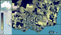
 Australian Census 2011 demographic map - Inner Sydney by SA1 - BCP field 0560 Total Males.svg 2,000 × 1,471; 11.51 MB
-

-
 Australian Census 2011 demographic map - Inner Sydney by SA1 - BCP field 1358 Total Males.svg 2,000 × 1,471; 11.51 MB
-
 Australian Census 2011 demographic map - Inner Sydney by SA1 - BCP field 2707 Total Males.svg 2,000 × 1,471; 11.51 MB
-
 Australian Census 2011 demographic map - Inner Sydney by SA1 - BCP field 2800 Total Males.svg 2,000 × 1,471; 11.51 MB
-

-

-

-
 Australian Census 2011 demographic map - Victoria by SA1 - BCP field 0560 Total Males.svg 2,000 × 1,148; 9.07 MB
-
-
 Australian Census 2011 demographic map - Victoria by SA1 - BCP field 1358 Total Males.svg 2,000 × 1,148; 9.07 MB


