Category:Demographic maps of Mexico
Jump to navigation
Jump to search
Subcategories
This category has the following 4 subcategories, out of 4 total.
H
- HDI maps of Mexico (28 F)
L
- Life expectancy maps for Mexico (15 F)
- Linguistic maps of Mexico (54 F)
P
Media in category "Demographic maps of Mexico"
The following 18 files are in this category, out of 18 total.
-
 Edad de consentimiento sexual en México.png 4,340 × 2,800; 475 KB
-
 European Genetic Admixture in the Mexican Population.png 1,112 × 732; 825 KB
-
 Genetic Studies of Mexico.jpg 1,480 × 1,401; 350 KB
-
 Geographic ancestry distribution of Mexico.png 3,505 × 820; 447 KB
-
 Imparto del mestizaje en el México actual estudio revista Science.png 1,990 × 1,652; 278 KB
-
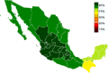
 Indigenous Population Percentage of Mexico by State 2015.png 1,152 × 774; 256 KB
-
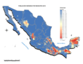
 Inmigración en México por Estados.png 1,904 × 921; 219 KB
-
 Mapa de población por capital estatal en México.png 6,000 × 6,000; 300 KB
-
 Mexican states by population 2015 es.svg 952 × 609; 267 KB
-
 Mexican states by population 2015.svg 952 × 609; 274 KB
-
 Mexico - Catholicism.png 1,000 × 682; 46 KB
-
 MEXICO EUROAMERICAN.png 1,920 × 449; 281 KB
-
 Mexico Map Indigenous population 2010 (smaller).png 1,296 × 871; 277 KB
-
 Mexico total fertility rate by state 2014.png 2,029 × 1,326; 477 KB
-
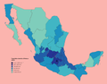
 Percent Population Indigenous 2010 (smaller).png 1,296 × 871; 290 KB
-
 POBLACIÓN INDÍGENA POR MUNICIPIO, 2.png 584 × 452; 203 KB
-
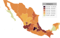
 Pobreza Estados de Mexico 2018.png 1,082 × 704; 113 KB
-
 Population density of Mexico states.png 5,205 × 4,072; 861 KB


.png)

.png)


