Category:Demographic maps of Crimea
Jump to navigation
Jump to search
Subcategories
This category has the following 2 subcategories, out of 2 total.
M
- Maps of ethnic groups in Crimea (28 F)
- Maps of the Crimean Tatars (14 F)
Media in category "Demographic maps of Crimea"
The following 21 files are in this category, out of 21 total.
-
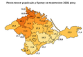
 2001 Крим насел.jpg 978 × 515; 69 KB
-
 CrimeaArmenians1926.PNG 825 × 620; 62 KB
-
 CrimeaAzhkenaziJews1926.PNG 825 × 620; 62 KB
-
 CrimeaBulgarians1926.PNG 825 × 620; 61 KB
-
 CrimeaCrimeanJews1926.PNG 825 × 620; 59 KB
-
 CrimeaGermans1926.PNG 825 × 620; 64 KB
-
 CrimeaGreeks1926.PNG 825 × 620; 63 KB
-
 CrimeaKaraims1926.PNG 825 × 620; 58 KB
-
 CrimeaLanguagesCensus2001detailed.PNG 1,125 × 687; 892 KB
-
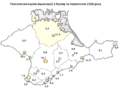
 Crimean Tatar 1939-num.png 2,200 × 1,384; 405 KB
-
 Crimean Tatar 2001-num.svg 635 × 412; 238 KB
-
 CrimeanTatar1926.PNG 825 × 620; 67 KB
-
 CrimeanTatar1939.png 667 × 471; 61 KB
-
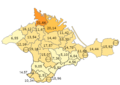
 CrimeanTatar2001.png 660 × 458; 27 KB
-
 CrimeaRussians1926.PNG 825 × 620; 66 KB
-
 CrimeaUkrainians1926.PNG 825 × 620; 65 KB
-
 EthnicCrimea1926.PNG 848 × 629; 81 KB
-
 EthnicCrimea1939.PNG 667 × 471; 45 KB
-
 Russians2001Crimea.PNG 662 × 460; 28 KB
-
 Ukrainians in Crimea, 1939.png 667 × 471; 87 KB
-
 Ukrainians2001Crimea.PNG 663 × 461; 28 KB


