Category:Demographic maps of Cantabria
Jump to navigation
Jump to search
Media in category "Demographic maps of Cantabria"
The following 20 files are in this category, out of 20 total.
-
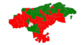 Demografia Cantabria 2005.png 778 × 413; 55 KB
-
 Demografia Cantabria 2009.svg 675 × 425; 232 KB
-
 Map of population of Cantabria 1996.png 936 × 662; 385 KB
-
 Map of population of Cantabria 1996.svg 842 × 596; 836 KB
-
 Map of population of Cantabria 2000.png 936 × 662; 168 KB
-
 Map of population of Cantabria 2000.svg 842 × 596; 836 KB
-
 Map of population of Cantabria 2001.png 936 × 662; 168 KB
-
 Map of population of Cantabria 2001.svg 842 × 596; 836 KB
-
 Map of population of Cantabria 2002.png 936 × 662; 168 KB
-
 Map of population of Cantabria 2002.svg 842 × 596; 836 KB
-
 Map of population of Cantabria 2003.png 936 × 662; 168 KB
-
 Map of population of Cantabria 2003.svg 842 × 596; 836 KB
-
 Map of population of Cantabria 2004.png 936 × 662; 168 KB
-
 Map of population of Cantabria 2004.svg 842 × 596; 836 KB
-
 Map of population of Cantabria 2005.png 936 × 662; 168 KB
-
 Map of population of Cantabria 2005.svg 842 × 596; 836 KB
-
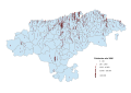
 Map of population of Cantabria 2023.svg 1,052 × 744; 1.46 MB
-
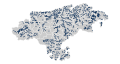 Nucleos poblacion Cantabria.svg 772 × 413; 706 KB
-
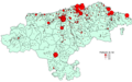 Poblamiento Cantabria-ca.png 943 × 586; 32 KB
-
 Poblamiento Cantabria.png 943 × 586; 35 KB


