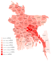
Category:Demographic maps of Bangladesh
Jump to navigation
Jump to search
Subcategories
This category has the following 3 subcategories, out of 3 total.
H
- HDI maps of Bangladesh (1 F)
L
Media in category "Demographic maps of Bangladesh"
The following 5 files are in this category, out of 5 total.
-
Bangladesch Bevölkerungsdichte 2011.svg 700 × 800; 1.76 MB
-
Bangladesh Hindu Map.png 836 × 908; 79 KB
-
Population density of Bangladesh divisions.png 4,345 × 5,054; 667 KB
-
Urban-Rural Population and Land Area Estimates, v2, 2010 Bangladesh (13873798283).jpg 3,181 × 2,418; 1,005 KB
-
বাংলাদেশে জনসংখ্যার ঘনত্ব.svg 512 × 585; 1.25 MB


