Category:Dehann Ditch
Jump to navigation
Jump to search
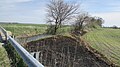
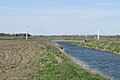
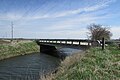
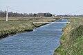
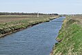
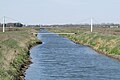
Dehaan Ditch crosses northern Newton County from near 900 W 1150 N, north of w:DeMotte to its mouth on the ancestral Kankakee west of I-65 at N 41.196816, W 87.293009. A further 1.9 miles (3.1 km) to the west, the waters enter the main stem of the Kankakee River.
Media in category "Dehann Ditch"
The following 13 files are in this category, out of 13 total.
-
 Dehann Ditch panorama.jpg 7,649 × 2,356; 3.57 MB
-
 Ditch 20-04-11 001.jpg 4,608 × 2,592; 4.08 MB
-
 Ditch 20-04-11 002.jpg 4,608 × 2,592; 3.51 MB
-
 Ditch 20-04-11 003.jpg 4,608 × 2,592; 3.96 MB
-
 Ditch 20-04-11 005.jpg 4,608 × 3,072; 4.38 MB
-
 Ditch 20-04-11 014.jpg 4,608 × 3,072; 4.13 MB
-
 Ditch 20-04-11 015.jpg 4,608 × 3,072; 3.74 MB
-
 Feeder Ditch (1100w) 20-04-11 013.jpg 3,072 × 4,608; 5.2 MB
-
 Pan southside 20-04-11 009.jpg 4,608 × 3,072; 3.92 MB
-
 Pipeline 20-04-11 006.jpg 4,608 × 3,072; 4.28 MB
-
 Pipeline 20-04-11 007.jpg 4,608 × 3,072; 4.48 MB
-
 Pipeline 20-04-11 008.jpg 4,608 × 3,072; 4.14 MB
-
Windy Day 20-04-11 017.ogv 2 min 15 s, 1,280 × 720; 380.3 MB


_20-04-11_013.jpg)


