Category:Defensive wall of Kazimierz
Jump to navigation
Jump to search
| Object location | | View all coordinates using: OpenStreetMap |
|---|
 | |||||
| Upload media | |||||
| Instance of | |||||
|---|---|---|---|---|---|
| Location | Kraków, Lesser Poland Voivodeship, Poland | ||||
| Heritage designation |
| ||||
| Inception |
| ||||
 | |||||
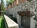
Polski: Mur obronny dawnego miasta Kazimierz. Kraków, ul. Paulińska.
Media in category "Defensive wall of Kazimierz"
The following 21 files are in this category, out of 21 total.
-
 Defence wall of Kazimierz II.JPG 3,456 × 2,592; 3.96 MB
-
 Defence wall of Kazimierz III.JPG 3,456 × 2,592; 3.71 MB
-
 Defence wall of Kazimierz.JPG 3,456 × 2,592; 3.91 MB
-
 Defensive wall of Kazimierz 2014 bk01.jpg 2,048 × 1,536; 1.29 MB
-
 Defensive wall of Kazimierz 2014 bk02.jpg 2,048 × 1,536; 1.91 MB
-
 Defensive wall of Kazimierz 2014 bk03.jpg 2,048 × 1,536; 1.43 MB
-
 Defensive wall of Kazimierz 2014 bk04.jpg 2,048 × 1,536; 1.69 MB
-
 Defensive wall of Kazimierz 2014 bk05.jpg 2,048 × 1,536; 1.66 MB
-
 Defensive wall of Kazimierz 2014 bk06.jpg 2,048 × 1,536; 1.74 MB
-
 Defensive wall of Kazimierz 2014 bk07.jpg 2,048 × 1,536; 1.91 MB
-
 Defensive wall of Kazimierz 2014 bk08.jpg 2,048 × 1,536; 1.8 MB
-
 Defensive wall of Kazimierz 2014 bk09.jpg 2,048 × 1,536; 1.89 MB
-
 Kazimierz 2007-01-07 058.jpg 1,600 × 1,092; 182 KB
-
 Krakow 2006 101.jpg 1,600 × 1,200; 552 KB
-
 Mur obronny Kazimierza przy synagodze Kupa w Krakowie 2019.jpg 7,360 × 4,912; 12.08 MB
-
 Pozostałości murów obronnych dawnego miasta Kazimierza 1.jpg 1,280 × 960; 472 KB
-
 Pozostałości murów obronnych dawnego miasta Kazimierza 2.jpg 1,280 × 960; 455 KB
-
 Pozostałości murów obronnych dawnego miasta Kazimierza 3.jpg 1,280 × 960; 566 KB
-
 Pozostałości murów obronnych dawnego miasta Kazimierza 4.jpg 1,280 × 960; 423 KB
-
 Renovated defenive wall of Kazimierz, 2015.jpg 1,728 × 3,072; 1.07 MB
-
 שריד מהחומה העתיקה של קז'ימייז', קרקוב.jpg 5,184 × 3,888; 4.06 MB


