Category:Deerness
Jump to navigation
Jump to search
peninsula and ecclesiastical parish on Mainland, Orkney Islands, Scotland, UK  | |||||
| Upload media | |||||
| Instance of | |||||
|---|---|---|---|---|---|
| Location |
| ||||
 | |||||
Subcategories
This category has the following 8 subcategories, out of 8 total.
C
D
- Deer Sound (5 F)
M
- Mull Head Nature Reserve (22 F)
P
S
- Sandi Sand (13 F)
- Skaill, Deerness (4 F)
T
- Taracliff Bay (10 F)
- The Gloup (19 F)
Media in category "Deerness"
The following 200 files are in this category, out of 295 total.
(previous page) (next page)-
 "End of footpath" - geograph.org.uk - 1222248.jpg 640 × 417; 105 KB
-
 Access path to the Brough of Deerness - geograph.org.uk - 3109084.jpg 1,024 × 768; 240 KB
-
 Anchor, Newark Bay, Deerness - geograph.org.uk - 3105889.jpg 1,024 × 768; 252 KB
-

-

-
 Barbed Wire - geograph.org.uk - 1091272.jpg 640 × 425; 79 KB
-
 Barbed Wire Fences - geograph.org.uk - 1091142.jpg 640 × 398; 83 KB
-
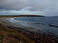
 Beach near Braebuster Ness - geograph.org.uk - 1222252.jpg 640 × 400; 118 KB
-
 Beach near Northquoy Point - geograph.org.uk - 1725303.jpg 640 × 480; 56 KB
-
 Boulder beach - geograph.org.uk - 1090953.jpg 640 × 426; 121 KB
-
 Boulder beach - geograph.org.uk - 1090975.jpg 640 × 426; 135 KB
-
 Boulder Beach and Cliffs at Roanaby - geograph.org.uk - 1091299.jpg 640 × 425; 102 KB
-

-
 Boulders on the path - geograph.org.uk - 1090238.jpg 640 × 425; 72 KB
-
 Boulders, sand and wave-cut platform - geograph.org.uk - 1091282.jpg 640 × 410; 85 KB
-
 Bridge over the burn - geograph.org.uk - 1222256.jpg 640 × 390; 116 KB
-
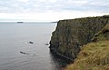
 Brough of Deerness - Church ruins - geograph.org.uk - 5455048.jpg 3,872 × 2,592; 4.79 MB
-
 Brough of Deerness - geograph.org.uk - 3550020.jpg 640 × 427; 298 KB
-
 Brough of Deerness - geograph.org.uk - 491356.jpg 640 × 480; 140 KB
-
 Brough of Deerness - geograph.org.uk - 54078.jpg 640 × 480; 152 KB
-
 Brough of Deerness - geograph.org.uk - 5837315.jpg 1,024 × 686; 166 KB
-
 Brough of Deerness - geograph.org.uk - 5837319.jpg 1,024 × 686; 180 KB
-
 Brough of Deerness - geograph.org.uk - 5837325.jpg 1,024 × 685; 104 KB
-
 Brough of Deerness - geograph.org.uk - 5837333.jpg 1,024 × 690; 141 KB
-
 Brough of Deerness - geograph.org.uk - 931889.jpg 640 × 203; 25 KB
-
 Brough of Deerness access - geograph.org.uk - 4130063.jpg 1,024 × 575; 172 KB
-
 Brough of Deerness from White Fowl Nevi - geograph.org.uk - 3109119.jpg 1,024 × 768; 193 KB
-
 Building at slipway, Geo, Newark Bay - geograph.org.uk - 3105851.jpg 1,024 × 768; 181 KB
-
 Burn entering the sea - geograph.org.uk - 1222264.jpg 640 × 411; 100 KB
-
 Busy Car Park - geograph.org.uk - 1117360.jpg 640 × 367; 83 KB
-
 Cairn at Chip of the Mull - geograph.org.uk - 3109222.jpg 1,024 × 643; 206 KB
-
 Cairn on Deerness Coast - geograph.org.uk - 3819312.jpg 640 × 480; 65 KB
-
 Car park at Newark - geograph.org.uk - 1090294.jpg 640 × 426; 49 KB
-
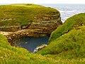
 Caves and arches - geograph.org.uk - 1091285.jpg 640 × 395; 63 KB
-
 Chair for the Devil - Helzie - geograph.org.uk - 2871219.jpg 4,320 × 3,240; 3.69 MB
-
 Chapel on the Brough of Deerness - geograph.org.uk - 2631596.jpg 4,000 × 3,000; 4.42 MB
-
 Chapel on the Brough of Deerness - geograph.org.uk - 2670947.jpg 640 × 436; 69 KB
-
 Choices - Helzie - geograph.org.uk - 2871097.jpg 2,048 × 1,536; 874 KB
-
 Cliff top at Brough of Deerness - geograph.org.uk - 1738389.jpg 640 × 480; 92 KB
-
 Cliffs by the Brough of Deerness - geograph.org.uk - 3622584.jpg 3,872 × 2,592; 4.32 MB
-
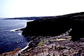
 Cliffs in Deerness - geograph.org.uk - 3155265.jpg 2,048 × 1,536; 1.03 MB
-
 Cliffs leading to Tammy Tiffy - geograph.org.uk - 1091190.jpg 640 × 410; 78 KB
-
 Cliffs with stumps - geograph.org.uk - 1091172.jpg 640 × 410; 57 KB
-
 Cliffs, Geo and Wave-cut platform - geograph.org.uk - 1091134.jpg 426 × 640; 61 KB
-
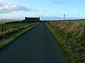
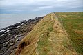 Clifftop path - geograph.org.uk - 1089381.jpg 640 × 425; 87 KB
-
 Coast near Braebuster Ness - geograph.org.uk - 1221633.jpg 640 × 385; 110 KB
-
 Coastal Erosion - geograph.org.uk - 1116480.jpg 640 × 417; 111 KB
-
 Coastal path - geograph.org.uk - 1090218.jpg 640 × 425; 64 KB
-
 Coastal Path - geograph.org.uk - 1090956.jpg 640 × 426; 82 KB
-
 Coastline ^ cliffs N of Brough of Deerness - geograph.org.uk - 3743888.jpg 1,024 × 768; 193 KB
-
 Concrete and wood - geograph.org.uk - 1091121.jpg 640 × 419; 77 KB
-
 Creels and kelp - geograph.org.uk - 1088930.jpg 640 × 425; 89 KB
-
 Daisybank Development - geograph.org.uk - 1117629.jpg 640 × 425; 83 KB
-
 Deerness - geograph.org.uk - 14753.jpg 640 × 413; 87 KB
-
 Deerness Anderson 1881 Fig 13 14 15 scotlandinearlyc00ande 0084.jpg 2,032 × 1,714; 759 KB
-
 Deerness Anderson 1881 Fig 40 scotlandinearlyc00ande 0126.jpg 2,150 × 3,002; 786 KB
-
 Deerness Grazing Land - geograph.org.uk - 5893385.jpg 640 × 427; 328 KB
-
 Deerness WWII Chain Home Low radar station - geograph.org.uk - 14752.jpg 640 × 375; 108 KB
-

-
 Deerness, cows and Copinsay - geograph.org.uk - 2610063.jpg 640 × 480; 62 KB
-
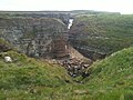
 Deerness, inland view of The Gloup - geograph.org.uk - 2610057.jpg 640 × 480; 81 KB
-
 Deerness, Orkney Islands - geograph.org.uk - 5455053.jpg 2,048 × 1,536; 995 KB
-
 Deerness, Orkney Mainland - geograph.org.uk - 5660569.jpg 640 × 480; 114 KB
-
 Deerness, Orkney Mainland - geograph.org.uk - 5660570.jpg 640 × 480; 104 KB
-
 Deerness, Orkney Mainland - geograph.org.uk - 5726862.jpg 640 × 480; 53 KB
-
 Deerness, Orkney Mainland - geograph.org.uk - 5726863.jpg 640 × 480; 54 KB
-
 Deerness, Orkney Mainland - geograph.org.uk - 5726880.jpg 640 × 640; 133 KB
-
 Deerness, Orkney Mainland - geograph.org.uk - 5726940.jpg 3,264 × 2,448; 2.3 MB
-
 Deerness, Orkney Mainland - geograph.org.uk - 5726942.jpg 640 × 480; 67 KB
-
 Deerness, Orkney Mainland - geograph.org.uk - 5726963.jpg 3,264 × 2,448; 2.07 MB
-
 Deerness, Orkney Mainland - geograph.org.uk - 5726965.jpg 3,264 × 2,448; 3.32 MB
-
 Deerness, Orkney Mainland - geograph.org.uk - 5727239.jpg 3,264 × 2,448; 2.72 MB
-
 Deerness, Orkney Mainland - geograph.org.uk - 5727241.jpg 3,264 × 2,448; 3 MB
-
 Deerness, Orkney Mainland - geograph.org.uk - 5727254.jpg 640 × 480; 88 KB
-
 Deerness, Orkney Mainland - geograph.org.uk - 5727316.jpg 2,048 × 1,536; 814 KB
-
 Deerness, Orkney Mainland - geograph.org.uk - 5727507.jpg 3,264 × 2,448; 1.64 MB
-
 Deerness, postbox № KW17 39 - geograph.org.uk - 2610078.jpg 480 × 640; 87 KB
-
 Deerness, postbox № KW17 68 - geograph.org.uk - 2610075.jpg 640 × 480; 93 KB
-
 Deerness, red telephone box - geograph.org.uk - 2610079.jpg 480 × 640; 68 KB
-
 Deerness, rocky coastline - geograph.org.uk - 2610067.jpg 640 × 480; 63 KB
-
 Deerness, rocky ledges - geograph.org.uk - 2610070.jpg 640 × 480; 70 KB
-
 Deerness, Sandi Sand - geograph.org.uk - 2610080.jpg 640 × 480; 52 KB
-

-
 Deerness, sunset and a wind turbine - geograph.org.uk - 3831963.jpg 640 × 480; 30 KB
-

-
 DeernessSignpost.JPG 2,272 × 1,704; 1.51 MB
-
 Devil's Stool of Helzie - geograph.org.uk - 2870611.jpg 4,320 × 3,240; 2.23 MB
-
 Dingieshowe - geograph.org.uk - 1468524.jpg 640 × 450; 62 KB
-
 Ditch near Mussaquoy Farm, Deerness, Orkney - geograph.org.uk - 4027840.jpg 1,459 × 1,094; 413 KB
-
 Ditches and barbed wire - geograph.org.uk - 1091249.jpg 640 × 425; 113 KB
-
 Don't look down^ - geograph.org.uk - 1091186.jpg 640 × 425; 122 KB
-
 Drain - geograph.org.uk - 1089395.jpg 640 × 425; 65 KB
-
 Drain and fences - geograph.org.uk - 1091266.jpg 640 × 385; 89 KB
-
 Drain and Horraquoy Farm - geograph.org.uk - 1091257.jpg 640 × 411; 97 KB
-
 Drain from Mirkady - geograph.org.uk - 1089427.jpg 640 × 425; 55 KB
-
 Drain from Oback - geograph.org.uk - 1090289.jpg 640 × 426; 75 KB
-
 Drain on the beach - geograph.org.uk - 1090292.jpg 640 × 426; 114 KB
-
 Eves Loch and Eves Howe, Deerness - geograph.org.uk - 232198.jpg 640 × 480; 67 KB
-
 Exposed strata at Northquoy - geograph.org.uk - 1089371.jpg 640 × 425; 114 KB
-
 Farm buildings at Mirkady - geograph.org.uk - 1089423.jpg 640 × 425; 47 KB
-
 Farmland on Deerness - geograph.org.uk - 5893377.jpg 640 × 427; 258 KB
-
 Fea from Stonehall Road, Deerness - geograph.org.uk - 3105821.jpg 1,024 × 770; 337 KB
-
 Fence and Stone - geograph.org.uk - 1091144.jpg 640 × 393; 68 KB
-
 Fences and Stone - geograph.org.uk - 1091154.jpg 640 × 383; 76 KB
-
 Field boundaries - geograph.org.uk - 1090958.jpg 640 × 395; 96 KB
-
 Field of Stubble - geograph.org.uk - 1117442.jpg 640 × 388; 84 KB
-
 Fields and fences - geograph.org.uk - 1116766.jpg 640 × 399; 81 KB
-
 Fields towards Mull Head - geograph.org.uk - 3623151.jpg 3,872 × 2,592; 4.82 MB
-
 Footpath to Braebuster Ness - geograph.org.uk - 1222302.jpg 640 × 425; 121 KB
-
 Footpath to the beach. - geograph.org.uk - 1090297.jpg 640 × 426; 60 KB
-
 Footpath to the memorial - geograph.org.uk - 1117428.jpg 640 × 425; 99 KB
-
 Foreshore at Barns of Ayre, Deerness - geograph.org.uk - 232178.jpg 640 × 480; 92 KB
-
 Fulmars on the clifftop - geograph.org.uk - 1091303.jpg 640 × 425; 104 KB
-
 Gates and car park - geograph.org.uk - 1117557.jpg 640 × 445; 120 KB
-
 Geo at Tammy Tiffy - geograph.org.uk - 1091039.jpg 640 × 425; 80 KB
-
 Geo near Grenigeo Taing - geograph.org.uk - 1091123.jpg 640 × 399; 90 KB
-
 Geo near the Kame of Camy - geograph.org.uk - 1116618.jpg 640 × 401; 105 KB
-
 Geo Road to Newark Bay - geograph.org.uk - 3105841.jpg 1,024 × 768; 172 KB
-
 Geo with boulder beach - geograph.org.uk - 1116425.jpg 640 × 425; 94 KB
-
 Geo with sea stack - geograph.org.uk - 1091223.jpg 640 × 425; 81 KB
-
 Grenigeo Taing - geograph.org.uk - 1091031.jpg 640 × 400; 101 KB
-
 Halley Beach Sunset - geograph.org.uk - 3009820.jpg 4,252 × 2,434; 1.79 MB
-
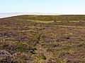
 Heather moorland on Mull Head - geograph.org.uk - 3623109.jpg 3,872 × 2,592; 6.27 MB
-
 Heavy going - geograph.org.uk - 1116741.jpg 640 × 417; 102 KB
-
 Hikers view the Brough of Deerness - geograph.org.uk - 953131.jpg 640 × 426; 64 KB
-
 Horse pasture near The Gloup, Deerness - geograph.org.uk - 3105975.jpg 1,024 × 769; 313 KB
-
 House at Mirkady point. - geograph.org.uk - 1088917.jpg 640 × 426; 74 KB
-
 House at Mirkady Point. - geograph.org.uk - 1088922.jpg 640 × 426; 71 KB
-
 How long would you give it^ - geograph.org.uk - 1116579.jpg 640 × 439; 78 KB
-
 Hurnip's Point View - geograph.org.uk - 3009787.jpg 3,648 × 2,736; 4.34 MB
-
 I'll go all of the way back then^ - geograph.org.uk - 1116793.jpg 640 × 429; 86 KB
-
 Incised Coastline - geograph.org.uk - 1116451.jpg 640 × 409; 110 KB
-
 Information Board - geograph.org.uk - 1117370.jpg 640 × 425; 92 KB
-
 Information Board - geograph.org.uk - 1117378.jpg 640 × 417; 91 KB
-
 Kelp deposits - geograph.org.uk - 1222305.jpg 640 × 409; 105 KB
-
 Kettle Geo - Helzie - geograph.org.uk - 2871037.jpg 4,018 × 2,753; 3.93 MB
-
 Kink in fence - geograph.org.uk - 1116785.jpg 640 × 453; 104 KB
-
 Lastlight in the bay - geograph.org.uk - 4739396.jpg 3,173 × 2,354; 2.74 MB
-
 Line of the old fence - geograph.org.uk - 1091145.jpg 640 × 407; 74 KB
-
 Little Fea, Deerness - geograph.org.uk - 232046.jpg 640 × 480; 88 KB
-
 Lochan near Braebuster Ness - geograph.org.uk - 1221628.jpg 640 × 373; 89 KB
-
 Looking across Lang Geo - geograph.org.uk - 3780017.jpg 1,600 × 1,026; 339 KB
-
 Looking south along the coast of Deerness from The Gloup - geograph.org.uk - 3341715.jpg 1,600 × 1,066; 415 KB
-
 Looking Southwards - geograph.org.uk - 1091301.jpg 640 × 396; 70 KB
-

-

-
 Malisburgh - geograph.org.uk - 3749294.jpg 4,000 × 3,000; 4.07 MB
-
 Mirkady Point - geograph.org.uk - 1088925.jpg 640 × 386; 63 KB
-
 Mirkady Point, Deerness - geograph.org.uk - 232209.jpg 640 × 480; 114 KB
-
 Mirkady Point, Deerness, from the air - geograph.org.uk - 5033723.jpg 1,024 × 682; 127 KB
-
 Mirkaldy Farm - geograph.org.uk - 1089435.jpg 640 × 425; 67 KB
-
 Mirkaldy Farmhouse - geograph.org.uk - 1089414.jpg 640 × 425; 60 KB
-
 Moorland south-west of Mull Head - geograph.org.uk - 3109178.jpg 1,024 × 768; 209 KB
-
-
 Mull Head - geograph.org.uk - 3622723.jpg 3,872 × 2,592; 5.52 MB
-
 Mull Head from the south - geograph.org.uk - 3109207.jpg 1,024 × 770; 373 KB
-
 Mull Head, Deerness - geograph.org.uk - 3549549.jpg 1,024 × 682; 92 KB
-
 Mull Head, Deerness - geograph.org.uk - 3775011.jpg 1,536 × 864; 325 KB
-
 Narrow Geo - geograph.org.uk - 1091219.jpg 640 × 425; 92 KB
-
 Natural Arch - geograph.org.uk - 1091235.jpg 640 × 440; 78 KB
-
 Natural Arch - geograph.org.uk - 1091238.jpg 640 × 456; 89 KB
-
 New building at Northfield - geograph.org.uk - 1117510.jpg 640 × 429; 70 KB
-
 New drain - geograph.org.uk - 1116817.jpg 640 × 425; 117 KB
-
 New Fence, Old Fence - geograph.org.uk - 1091056.jpg 640 × 425; 95 KB
-
 New Lighthouse, Deerness, Orkney Mainland - geograph.org.uk - 5727320.jpg 3,872 × 2,592; 2.31 MB
-

-
 Newark - geograph.org.uk - 1090275.jpg 640 × 426; 51 KB
-
 Newark Bay jetty - geograph.org.uk - 4130123.jpg 1,280 × 719; 274 KB
-
 Newark Bay, Deerness - geograph.org.uk - 3105904.jpg 1,024 × 768; 215 KB
-
 Newark Bay, Deerness - geograph.org.uk - 3105951.jpg 1,024 × 768; 252 KB
-
 Newark Bay, Deerness, from the air - geograph.org.uk - 5033753.jpg 1,024 × 682; 118 KB
-
 Newark Bay, Deerness. - geograph.org.uk - 1511104.jpg 640 × 480; 61 KB
-
 Newark House - geograph.org.uk - 1090281.jpg 640 × 408; 64 KB
-
 Newark, Deerness - geograph.org.uk - 3105897.jpg 1,024 × 768; 217 KB
-
 Newly dug drain - geograph.org.uk - 1117571.jpg 640 × 425; 63 KB
-
 North Halley - geograph.org.uk - 1116583.jpg 640 × 425; 90 KB
-
-
 Northwards along the clifftops - geograph.org.uk - 1091177.jpg 640 × 425; 73 KB
-
 Notster geo or narrow inlet - geograph.org.uk - 3304035.jpg 649 × 1,000; 112 KB
-
 Notster, a narrow inlet on Mull Head - geograph.org.uk - 3109169.jpg 768 × 1,024; 357 KB
-
 Offshore skerry - geograph.org.uk - 1091020.jpg 640 × 425; 70 KB
-
 Old boundary ditch, Mull Head - geograph.org.uk - 3109195.jpg 1,024 × 768; 282 KB
-
 Old Fence, Older Fence - geograph.org.uk - 1091148.jpg 640 × 422; 83 KB
-
 Old Shelter - geograph.org.uk - 1117460.jpg 640 × 425; 83 KB
-

-
 On the ebb - geograph.org.uk - 1090279.jpg 640 × 426; 74 KB
-
 On the ebb - geograph.org.uk - 1090966.jpg 640 × 427; 100 KB
-
 On the ebb - geograph.org.uk - 1221647.jpg 640 × 411; 98 KB
-
 On the ebb - geograph.org.uk - 1222268.jpg 640 × 402; 87 KB
-

-
 Orcadian Summer Sky - geograph.org.uk - 3009813.jpg 4,316 × 2,651; 6.47 MB
-

-
 Parallel Lines, Heart of Grass - geograph.org.uk - 1222326.jpg 640 × 426; 120 KB
-
 Path to the memorial - geograph.org.uk - 1117638.jpg 640 × 425; 91 KB
-
 Pebbles and St Peter's Pool - geograph.org.uk - 1221657.jpg 640 × 425; 123 KB
-
 PicDeerness.jpg 464 × 352; 49 KB
-

-
 Pond near Aikerskaill Road, Deerness - geograph.org.uk - 3105914.jpg 1,024 × 768; 224 KB
-
-
 Precarious Arch at Northquoy - geograph.org.uk - 1116578.jpg 640 × 422; 83 KB


