Category:Deerhurst
Jump to navigation
Jump to search
village in United Kingdom  | |||||
| Upload media | |||||
| Instance of | |||||
|---|---|---|---|---|---|
| Location | Tewkesbury, Gloucestershire, South West England, England | ||||
| Located in or next to body of water | |||||
| Population |
| ||||
| official website | |||||
 | |||||
Main Wikipedia article: Deerhurst.
Subcategories
This category has the following 6 subcategories, out of 6 total.
A
- Abbot's Court, Deerhurst (25 F)
D
- Deerhurst WWI Memorial (5 F)
M
O
P
- Priory Farm, Deerhurst (15 F)
Media in category "Deerhurst"
The following 200 files are in this category, out of 317 total.
(previous page) (next page)-
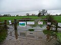
 'Keep out' sign near the River Severn - geograph.org.uk - 5312791.jpg 5,184 × 3,456; 7.02 MB
-
 121 of 'Deerhurst. A parish of the Vale of Gloucester. (With plates.)' (11197344255).jpg 1,235 × 1,967; 403 KB
-
 2nd World War memorial plaque - geograph.org.uk - 4976249.jpg 1,600 × 864; 337 KB
-
 A still September morning - geograph.org.uk - 2051280.jpg 640 × 480; 252 KB
-
 A swollen River Severn - geograph.org.uk - 3385744.jpg 1,024 × 680; 229 KB
-
 A38 north of Coombe Hill - geograph.org.uk - 6414147.jpg 800 × 600; 111 KB
-
 A38 northbound at Tredington - geograph.org.uk - 6414156.jpg 800 × 601; 109 KB
-
 Abandoned - geograph.org.uk - 3872168.jpg 800 × 602; 341 KB
-
 Abandoned caravan - geograph.org.uk - 2367537.jpg 1,024 × 768; 712 KB
-
 Algernon Guy Strickland - geograph.org.uk - 4976246.jpg 1,600 × 949; 394 KB
-
 Alongside Coombe Hill Canal - geograph.org.uk - 3881728.jpg 800 × 600; 303 KB
-
 Apperley to Norton road closed owing to flooding - geograph.org.uk - 3826622.jpg 2,560 × 1,920; 2.91 MB
-
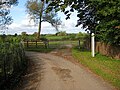
 Approach to Deerhurst - geograph.org.uk - 986765.jpg 640 × 480; 128 KB
-
 Approaching Deerhurst from the southeast - geograph.org.uk - 987249.jpg 640 × 480; 126 KB
-
 Approaching junction with B4213 - geograph.org.uk - 6586597.jpg 4,608 × 3,456; 3.52 MB
-
 Arable farmland at Deerhurst Walton - geograph.org.uk - 5792319.jpg 1,024 × 768; 246 KB
-
 Autumnal willows - geograph.org.uk - 4233703.jpg 800 × 452; 271 KB
-

-
 B4213 heading west - geograph.org.uk - 4744603.jpg 1,600 × 901; 648 KB
-
 B4213 leading towards Deerhurst - geograph.org.uk - 5878431.jpg 1,600 × 964; 627 KB
-
 B4213 rising to join the A38 at traffic light junction - geograph.org.uk - 6586619.jpg 3,830 × 2,872; 1.37 MB
-
 B4213 The Turning For Deerhurst - geograph.org.uk - 3615684.jpg 640 × 480; 52 KB
-
 Barn Cottage and the road to Deerhurst - geograph.org.uk - 2120890.jpg 640 × 480; 257 KB
-
 Bloody Meadow - geograph.org.uk - 20492.jpg 640 × 479; 81 KB
-
 Bridge over Handkerchief Pool - geograph.org.uk - 5104505.jpg 1,600 × 1,200; 602 KB
-
 Bridleway leading to Hoo Lane - geograph.org.uk - 4975732.jpg 1,600 × 1,065; 586 KB
-
 Bridleway off Wainlode Lane - geograph.org.uk - 4976528.jpg 1,600 × 1,065; 572 KB
-
 Bull in the distance^ - geograph.org.uk - 2048888.jpg 640 × 480; 218 KB
-
 Bull sign - geograph.org.uk - 2048907.jpg 640 × 480; 259 KB
-
 Buttercup bridleway - geograph.org.uk - 2428733.jpg 800 × 600; 391 KB
-
 Canada Geese by the Severn.jpg 3,768 × 2,848; 4.67 MB
-
 Cattle grid on Gabb Lane - geograph.org.uk - 4702848.jpg 800 × 531; 171 KB
-
 Cattle in spring pasture - geograph.org.uk - 2428753.jpg 800 × 602; 391 KB
-
 Cattle pasture by the Severn - geograph.org.uk - 2631082.jpg 800 × 466; 269 KB
-
 Christmas Eve Handkerchief - geograph.org.uk - 2211390.jpg 800 × 600; 349 KB
-
 Cobney meadows - geograph.org.uk - 3321734.jpg 800 × 451; 197 KB
-
 Cobney meadows at dawn, 1 - geograph.org.uk - 3263916.jpg 900 × 1,200; 490 KB
-
 Cobney meadows at dawn, 2 - geograph.org.uk - 3263922.jpg 1,200 × 676; 425 KB
-
 Cobney meadows at dawn, 3 - geograph.org.uk - 3263929.jpg 1,200 × 676; 441 KB
-
 Cockbury Hall, Chaceley - geograph.org.uk - 643341.jpg 640 × 426; 80 KB
-

-
 Coombe Hill Canal (disused) - geograph.org.uk - 4975679.jpg 1,600 × 1,065; 768 KB
-
 Coombe Hill Canal - geograph.org.uk - 3234845.jpg 1,200 × 676; 453 KB
-
 Coombe Hill Canal - geograph.org.uk - 5221399.jpg 1,024 × 768; 510 KB
-
 Coombe Hill Canal at dawn - geograph.org.uk - 3298637.jpg 800 × 451; 195 KB
-
 Coombe Hill Canal towpath - geograph.org.uk - 4702881.jpg 800 × 531; 175 KB
-
 Coombe Hill Canal, 2 - geograph.org.uk - 5169110.jpg 1,600 × 1,200; 1.18 MB
-
 Coombe Hill Canal, 3 - geograph.org.uk - 5169111.jpg 1,600 × 1,200; 1.14 MB
-
 Coombe Hill Meadows - geograph.org.uk - 2315891.jpg 800 × 600; 263 KB
-
 Coombe Hill Nature Reserve - geograph.org.uk - 1898958.jpg 640 × 426; 120 KB
-
 Coombe Hill Nature Reserve - geograph.org.uk - 1936188.jpg 640 × 480; 227 KB
-
 Coombe Hill Nature Reserve - geograph.org.uk - 4702878.jpg 1,024 × 680; 294 KB
-
 Coombe Hill Nature Reserve - geograph.org.uk - 4774731.jpg 1,600 × 1,060; 1.51 MB
-
 Coombe Hill Nature Reserve and Canal - geograph.org.uk - 1902632.jpg 3,008 × 2,000; 1.51 MB
-
 Cottage on road junction, Lower Apperley - geograph.org.uk - 3263500.jpg 800 × 561; 101 KB
-
 Country Lane from Deerhurst toward B4213 - geograph.org.uk - 6586586.jpg 3,403 × 2,552; 1.27 MB
-
 Country Lane nearing Barn Cottage - geograph.org.uk - 6586582.jpg 4,184 × 3,138; 2.53 MB
-
 Country road to Deerhurst - geograph.org.uk - 3822224.jpg 1,024 × 680; 181 KB
-
 Cows grazing near the River Severn - geograph.org.uk - 4264798.jpg 5,400 × 3,600; 2.22 MB
-
 Cows guard the path - geograph.org.uk - 5047977.jpg 1,600 × 1,200; 536 KB
-
 Crop spraying at Deerhurst Walton - geograph.org.uk - 778110.jpg 640 × 426; 97 KB
-
 Cut maize field near Deerhurst - geograph.org.uk - 4265967.jpg 5,400 × 3,600; 3.2 MB
-
 Dairy herd, Deerhurst - geograph.org.uk - 988688.jpg 640 × 480; 165 KB
-
 Dawn over Cobney Meadows, 1 - geograph.org.uk - 3298642.jpg 800 × 451; 176 KB
-
 Dawn over Cobney Meadows, 2 - geograph.org.uk - 3298645.jpg 800 × 600; 233 KB
-
 Dead end lane at Walton Hill - geograph.org.uk - 2037237.jpg 640 × 480; 258 KB
-
 Flood defences, lane to Odda's Chapel (2).JPG 4,000 × 3,000; 4.47 MB
-
 Flood defences, lane to Odda's Chapel (3).JPG 4,000 × 3,000; 4.01 MB
-
 Flood defences, lane to Odda's Chapel.JPG 4,000 × 3,000; 4.38 MB
-
 Formerly Deerhurst School - geograph.org.uk - 987317.jpg 640 × 480; 153 KB
-
 House near Odda's Chapel.JPG 4,000 × 3,000; 4.24 MB
-
 Part of Odda's Barn, Deerhurst, Gloucestershire.jpg 7,098 × 4,486; 12.51 MB
-
 Path from Odda's Chapel to River Severn.JPG 4,000 × 3,000; 4.06 MB
-
 South gable wall detail of Odda's Barn, Deerhurst, Gloucestershire.jpg 7,360 × 4,912; 21.45 MB
-
 Deerhurst Lane - geograph.org.uk - 2106886.jpg 640 × 480; 226 KB
-
 Deerhurst viewed from the riverbank - geograph.org.uk - 643344.jpg 640 × 426; 73 KB
-
 Deerhurst village street on bin day - geograph.org.uk - 6586577.jpg 4,608 × 3,456; 3.46 MB
-
 Deerhurst Walton - geograph.org.uk - 6466410.jpg 1,200 × 802; 794 KB
-
 Deerhurst Walton field-edge - geograph.org.uk - 1501253.jpg 640 × 480; 201 KB
-
 Deerhurst, Gloucestershire from a low ridge - geograph.org.uk - 5048049.jpg 1,600 × 1,200; 452 KB
-
 Depth gauge, Deerhurst - geograph.org.uk - 1729876.jpg 800 × 600; 212 KB
-
 Depth gauge, Deerhurst - geograph.org.uk - 987365.jpg 640 × 480; 175 KB
-
 Ditch, Cobney Meadows - geograph.org.uk - 5221395.jpg 1,024 × 768; 363 KB
-
 Doorway into Odda's Chapel. Anglo-Saxon built 1056 - geograph.org.uk - 6599998.jpg 3,456 × 4,608; 3.71 MB
-

-
 Dovecote and cider house, Grange Farm (geograph 5792310).jpg 1,024 × 768; 244 KB
-
 Drain alongside Coombe Hill Canal - geograph.org.uk - 2281046.jpg 800 × 600; 414 KB
-
 Drain on Cobney Meadows - geograph.org.uk - 1936181.jpg 640 × 480; 253 KB
-
 Early morning cobwebs 1 - geograph.org.uk - 2106932.jpg 640 × 480; 253 KB
-
 Early morning cobwebs 2 - geograph.org.uk - 2106962.jpg 640 × 558; 297 KB
-
 Eclectus sails down the River Severn - geograph.org.uk - 4975923.jpg 1,600 × 1,065; 748 KB
-
 European mistletoe - Viscum album - geograph.org.uk - 1105331.jpg 625 × 640; 232 KB
-
 Farm buildings at Deerhurst Walton, Gloucestershire - geograph.org.uk - 1874275.jpg 3,008 × 2,000; 1.53 MB
-
 Farm next to St Mary's Priory Church, Deerhurst - geograph.org.uk - 5048057.jpg 1,600 × 1,200; 343 KB
-
 Farmland at Deerhurst Walton - geograph.org.uk - 772770.jpg 640 × 426; 114 KB
-
 Farmland east of Notcliffe House - geograph.org.uk - 1501261.jpg 640 × 480; 238 KB
-
 Farmland of the Severn Vale - geograph.org.uk - 1501264.jpg 640 × 480; 189 KB
-
 Farmland south of Tewkesbury - geograph.org.uk - 1898976.jpg 3,008 × 2,000; 1.5 MB
-
 Fence across the flood plain - geograph.org.uk - 1105337.jpg 466 × 640; 155 KB
-
 Fields between Odda's Chapel and River Severn - geograph.org.uk - 6599991.jpg 4,608 × 3,456; 4.67 MB
-
 Finger Post near Deerhurst - geograph.org.uk - 4975734.jpg 1,600 × 1,065; 580 KB
-
 Fishing pond by the Severn - geograph.org.uk - 2048871.jpg 640 × 480; 283 KB
-
 Fishing pool by the Severn - geograph.org.uk - 4744607.jpg 1,600 × 901; 683 KB
-
 Flat farmland east of the flood defences - geograph.org.uk - 1105265.jpg 640 × 480; 141 KB
-
 Flood Gate at Deerhurst - geograph.org.uk - 4975985.jpg 1,600 × 1,065; 797 KB
-
 Flood gate at Deerhurst - geograph.org.uk - 5878437.jpg 1,200 × 1,600; 891 KB
-
 Flood gate on the lane to Odda's Chapel, Deerhurst - geograph.org.uk - 4916951.jpg 1,536 × 2,048; 753 KB
-
 Flood Gauge on Wainlode Lane - geograph.org.uk - 4976533.jpg 1,600 × 999; 554 KB
-
 Flood line - geograph.org.uk - 3881702.jpg 800 × 600; 329 KB
-
 Flood plain at Deerhurst - geograph.org.uk - 1104552.jpg 640 × 480; 171 KB
-
 Flooded nature reserve - geograph.org.uk - 3347897.jpg 800 × 600; 243 KB
-
 Flooded road at Deerhurst - geograph.org.uk - 3822233.jpg 1,024 × 680; 245 KB
-
 Flooded road to Wainlode - geograph.org.uk - 2935155.jpg 1,024 × 641; 340 KB
-
 Flooded road to Wainlode - geograph.org.uk - 2945851.jpg 1,024 × 577; 276 KB
-
 Floodgate at the entrance to the churchyard, Deerhurst - geograph.org.uk - 5878924.jpg 1,600 × 1,200; 747 KB
-
 Flooding at Deerhurst - geograph.org.uk - 3823006.jpg 1,024 × 680; 190 KB
-
 Flytipsville - geograph.org.uk - 2842112.jpg 1,024 × 577; 340 KB
-
 Footpath stile near Odda's Chapel - geograph.org.uk - 2522659.jpg 1,024 × 768; 144 KB
-
 Footpath through a cornfield near Deerhurst - geograph.org.uk - 5048034.jpg 1,600 × 1,200; 562 KB
-
 Footpath through farmland - geograph.org.uk - 1501250.jpg 640 × 480; 242 KB
-
 Footpath through meadows - geograph.org.uk - 2120419.jpg 640 × 480; 228 KB
-
 Former course of the A38 - geograph.org.uk - 2589320.jpg 1,024 × 680; 229 KB
-
 Former School, Deerhurst - geograph.org.uk - 5047569.jpg 1,600 × 1,200; 487 KB
-
 Four ducks-a-swimming - geograph.org.uk - 1929193.jpg 640 × 480; 280 KB
-
 Four willows - geograph.org.uk - 3891622.jpg 800 × 451; 168 KB
-
 Fridge on Severn - geograph.org.uk - 1105262.jpg 640 × 480; 151 KB
-
 Friesian cows in two minds about the weather - geograph.org.uk - 2522668.jpg 1,024 × 768; 150 KB
-
 Frosted footpath - geograph.org.uk - 1104322.jpg 480 × 640; 161 KB
-
 Frosted pontoon - geograph.org.uk - 1107232.jpg 480 × 640; 135 KB
-
 Frozen floods, 1 - geograph.org.uk - 3254790.jpg 1,200 × 752; 525 KB
-
 Frozen floods, 2 - geograph.org.uk - 3254798.jpg 1,200 × 675; 414 KB
-
 Frozen Handkerchief - geograph.org.uk - 2183717.jpg 800 × 600; 394 KB
-
 Gabb Lane - geograph.org.uk - 2048919.jpg 640 × 480; 245 KB
-
 Gate onto Coombe Hill Meadows - geograph.org.uk - 2321421.jpg 800 × 600; 311 KB
-
 Gate onto the watermeadows - geograph.org.uk - 3338617.jpg 800 × 506; 212 KB
-
 Gated track leading to the Severn - geograph.org.uk - 2522662.jpg 1,024 × 768; 142 KB
-
 Globe Thistle, Echinops bannaticus - geograph.org.uk - 3574900.jpg 800 × 450; 228 KB
-
 Globe Thistle, Echinops bannaticus - geograph.org.uk - 3574905.jpg 800 × 800; 395 KB
-
 Gloucester Road, Tredington - geograph.org.uk - 6393442.jpg 1,764 × 1,177; 776 KB
-
 Golden October - geograph.org.uk - 5167152.jpg 1,600 × 1,069; 1.15 MB
-
 Grazing land at Deerhurst - geograph.org.uk - 4264819.jpg 5,400 × 3,600; 2.55 MB
-
 Green pasture in January - geograph.org.uk - 4806209.jpg 1,600 × 899; 928 KB
-
 Grey Hill - geograph.org.uk - 2504208.jpg 3,072 × 2,304; 6.23 MB
-
 Handkerchief Pool - expanded - geograph.org.uk - 3826683.jpg 2,560 × 1,920; 2.83 MB
-
 Handkerchief Pool 1 - geograph.org.uk - 2152601.jpg 800 × 602; 456 KB
-
 Handkerchief Pool 2 - geograph.org.uk - 2152609.jpg 800 × 601; 481 KB
-
 Handkerchief Pool in flood - geograph.org.uk - 2935168.jpg 1,024 × 577; 246 KB
-
 Handkerchief Pool, late winter - geograph.org.uk - 2301535.jpg 800 × 600; 416 KB
-
 Haw Bridge - geograph.org.uk - 5221700.jpg 1,024 × 768; 284 KB
-
 Haw Bridge - geograph.org.uk - 5839976.jpg 1,024 × 768; 336 KB
-
 Haw Bridge with the River Severn in spate - geograph.org.uk - 3827575.jpg 2,560 × 1,920; 2.94 MB
-
 Haw Bridge, north face - geograph.org.uk - 2969382.jpg 1,024 × 768; 424 KB
-
 Highfield junction - geograph.org.uk - 2037246.jpg 640 × 427; 159 KB
-
 Holey Oak - 2 - geograph.org.uk - 4301546.jpg 3,648 × 2,736; 3.82 MB
-
 Holey oak - geograph.org.uk - 1104488.jpg 640 × 480; 163 KB
-
 Iced water - geograph.org.uk - 1107228.jpg 480 × 640; 153 KB
-
 Junction onto B4213. Left to A38 - geograph.org.uk - 6586604.jpg 4,068 × 3,051; 2.48 MB
-
 Lane to Deerhurst - geograph.org.uk - 3459886.jpg 800 × 451; 210 KB
-
 Liable to floods - geograph.org.uk - 5221691.jpg 1,024 × 768; 343 KB
-
 Like shooting stars - geograph.org.uk - 1104563.jpg 640 × 480; 42 KB
-
 Line of a footpath - geograph.org.uk - 4212179.jpg 800 × 534; 245 KB
-
 Line of willows - geograph.org.uk - 969074.jpg 640 × 480; 139 KB
-
 Looking south along the Sabrina Way east of Deerhurst - geograph.org.uk - 1902626.jpg 3,008 × 2,000; 1.63 MB
-
 Lower Lode Ferry Crossing, River Severn - geograph.org.uk - 5052.jpg 640 × 479; 56 KB
-
 Maize on a misty morning - geograph.org.uk - 2106917.jpg 640 × 480; 230 KB
-
 Manor Farm, Deerhurst Walton - geograph.org.uk - 778100.jpg 640 × 426; 84 KB
-
 Manor Farm, Deerhurst Walton - geograph.org.uk - 83876.jpg 640 × 479; 64 KB
-
 Maples and Oak - geograph.org.uk - 3750195.jpg 800 × 600; 342 KB
-
 Meadow below Grey Hill - geograph.org.uk - 6281885.jpg 1,024 × 768; 150 KB
-
 Meadowland below Apperley - geograph.org.uk - 4702841.jpg 1,024 × 680; 276 KB
-
 Minor road crosses disused canal - geograph.org.uk - 969065.jpg 640 × 480; 173 KB
-
 Minor road leading to Deerhurst - geograph.org.uk - 4975752.jpg 1,600 × 1,103; 614 KB
-
 Minor road, Deerhurst - geograph.org.uk - 3263499.jpg 1,024 × 739; 133 KB
-
 Misty autumnal oak - geograph.org.uk - 4234479.jpg 800 × 640; 298 KB
-
 Misty willows - geograph.org.uk - 2843639.jpg 1,024 × 577; 208 KB
-
 Ms Grace sails down the River Severn - geograph.org.uk - 4975912.jpg 1,600 × 1,065; 731 KB
-
 Near Apperley - geograph.org.uk - 6466418.jpg 1,200 × 805; 983 KB
-
 No elevering - geograph.org.uk - 5221393.jpg 1,024 × 768; 426 KB
-
 Not the Severn Bore - geograph.org.uk - 1104537.jpg 640 × 480; 120 KB
-
 Oak on the Severn floodplain - geograph.org.uk - 1929191.jpg 640 × 480; 218 KB
-
 Oak on the Severn floodplain 2 - geograph.org.uk - 3004690.jpg 1,024 × 768; 407 KB
-
 Oak on the Severn floodplain, 3 - geograph.org.uk - 3305474.jpg 800 × 600; 234 KB
-
 Oak stump - geograph.org.uk - 3004697.jpg 1,024 × 768; 459 KB
-
 Oak tree on a flood bank - geograph.org.uk - 986921.jpg 426 × 640; 96 KB
-
 Odda's Barn and Abbot's Court, Deerhurst - geograph.org.uk - 1874194.jpg 3,008 × 2,000; 1.52 MB
-
 Odda's Barn in Deerhurst - geograph.org.uk - 1874210.jpg 3,008 × 2,000; 1.57 MB
-
 Odda's Chapel from footpath over fields to Deerhurst - geograph.org.uk - 6599983.jpg 4,608 × 3,456; 4.87 MB
-
 Old oak on a field edge - geograph.org.uk - 2321441.jpg 800 × 600; 289 KB
-
 Old oak stump - geograph.org.uk - 2315880.jpg 3,072 × 2,304; 3.23 MB
-

-
 On second thoughts... - geograph.org.uk - 3321737.jpg 800 × 600; 303 KB
-
 Orchard Park Caravan Park - geograph.org.uk - 4976500.jpg 1,600 × 1,065; 525 KB
-
 Ordnance Survey Cut Mark - geograph.org.uk - 4053422.jpg 480 × 640; 125 KB
-
 Park Cottages - geograph.org.uk - 988335.jpg 426 × 640; 95 KB
-
 Passing place on narrow road to Deerhurst - geograph.org.uk - 5878434.jpg 1,600 × 915; 562 KB
-
 Path by the Severn - geograph.org.uk - 2334072.jpg 800 × 600; 377 KB
-
 Path leading to the River Severn - geograph.org.uk - 4975880.jpg 1,600 × 1,065; 522 KB
-
 Path leading to the River Severn - geograph.org.uk - 4975883.jpg 1,600 × 1,065; 729 KB
-
 Path to the River Severn, Deerhurst - geograph.org.uk - 1729894.jpg 800 × 600; 245 KB
-
 Phone box at Deerhurst - geograph.org.uk - 987375.jpg 640 × 480; 127 KB

%27_(11197344255).jpg)


_-_geograph.org.uk_-_4975679.jpg)


.JPG)
.JPG)


.jpg)


