Category:Deene
Jump to navigation
Jump to search
village and civil parish in Northamptonshire, United Kingdom  | |||||
| Upload media | |||||
| Instance of | |||||
|---|---|---|---|---|---|
| Location | North Northamptonshire, Northamptonshire, East Midlands, England | ||||
| Population |
| ||||
 | |||||
Subcategories
This category has the following 2 subcategories, out of 2 total.
D
P
- St Peter's Church, Deene (9 F)
Media in category "Deene"
The following 112 files are in this category, out of 112 total.
-
 A few hardy souls eating - geograph.org.uk - 1302317.jpg 640 × 480; 68 KB
-

-
 A white horse in Deene - geograph.org.uk - 3481837.jpg 4,320 × 3,240; 5.08 MB
-
 A43 northbound - geograph.org.uk - 6225414.jpg 640 × 480; 61 KB
-
 Alongside Kirby Lane - geograph.org.uk - 5272993.jpg 480 × 640; 83 KB
-
 An early JCB 1 - geograph.org.uk - 2740095.jpg 3,648 × 2,736; 2.12 MB
-
 Beats a spade any day - geograph.org.uk - 2739700.jpg 3,648 × 2,736; 2.09 MB
-
 Blacksmiths Cottage, Main Street, Deene - geograph.org.uk - 5529281.jpg 4,966 × 3,310; 4.88 MB
-
 Cherry Tree Cottage, Main Street, Deene - geograph.org.uk - 5529286.jpg 4,704 × 3,136; 6.28 MB
-
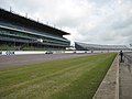
 Circuit at Rockingham - geograph.org.uk - 2446269.jpg 640 × 405; 58 KB
-
 Clear footpath through wheat - geograph.org.uk - 5843782.jpg 3,776 × 2,520; 2.88 MB
-
 Corby - geograph.org.uk - 2902496.jpg 480 × 640; 85 KB
-
 Corby - geograph.org.uk - 2902503.jpg 640 × 480; 55 KB
-
 Country road entering Deene - geograph.org.uk - 4750319.jpg 800 × 531; 127 KB
-
 Crushing developments - geograph.org.uk - 2740083.jpg 3,648 × 2,736; 2.18 MB
-
 Deene Hall - geograph.org.uk - 4750316.jpg 800 × 531; 131 KB
-
 Deene Hall near Corby - geograph.org.uk - 3481319.jpg 4,320 × 3,240; 4.68 MB
-
 Deene NN17, UK - panoramio.jpg 4,608 × 3,456; 5.4 MB
-
 Deene Park bridge, Stamford Road, Deene - geograph.org.uk - 5546833.jpg 5,056 × 3,371; 6.75 MB
-
 Deene Park Estate (27) (geograph 7173366).jpg 4,320 × 3,240; 4.83 MB
-
 Deene Park Estate (4) (geograph 7172626).jpg 4,320 × 3,240; 5.07 MB
-
 Deene village (1) (geograph 7172568).jpg 3,972 × 2,789; 7.14 MB
-
 Deene village (11) (geograph 7172603).jpg 4,320 × 3,240; 4.66 MB
-
 Deene village (5) (geograph 7172579).jpg 4,126 × 2,320; 5.19 MB
-
 Deene village (6) (geograph 7172584).jpg 4,320 × 3,240; 7.72 MB
-
 Deene village (7) (geograph 7172587).jpg 4,320 × 2,430; 7.06 MB
-
 Deene village (8) (geograph 7172591).jpg 4,004 × 2,841; 7.81 MB
-
 Deene village (9) (geograph 7172596).jpg 4,085 × 2,298; 7.24 MB
-
 Deenethorpe NN17, UK - panoramio (1).jpg 4,608 × 3,456; 3.79 MB
-
 Deenethorpe NN17, UK - panoramio (2).jpg 4,608 × 3,456; 4.88 MB
-
 Deenethorpe NN17, UK - panoramio (3).jpg 4,608 × 3,456; 4.73 MB
-
 Deenethorpe NN17, UK - panoramio (4).jpg 4,608 × 3,456; 5.99 MB
-
 Deenethorpe NN17, UK - panoramio (5).jpg 4,608 × 3,456; 4.59 MB
-
 Deenethorpe NN17, UK - panoramio (6).jpg 4,608 × 3,456; 4.49 MB
-
 Deenethorpe NN17, UK - panoramio.jpg 4,608 × 3,456; 4.98 MB
-
 Demonstrating a crushing bucket - geograph.org.uk - 2740085.jpg 3,648 × 2,736; 2.21 MB
-
 Dig, dig, dig - geograph.org.uk - 1302324.jpg 640 × 480; 90 KB
-
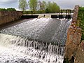
 Dry Ford at Deene - geograph.org.uk - 3020166.jpg 3,264 × 2,448; 3.34 MB
-
 Exhibitor space SED - geograph.org.uk - 1302331.jpg 640 × 480; 63 KB
-
 Footbridge over a drain - geograph.org.uk - 6566618.jpg 1,024 × 768; 340 KB
-
 Footpath and closure notices. But why bother^ - geograph.org.uk - 5843374.jpg 3,776 × 2,520; 2.82 MB
-
 Footpath into Dibbins Wood - geograph.org.uk - 5843805.jpg 3,776 × 2,520; 3.81 MB
-
 Footpath to Deene - geograph.org.uk - 5843377.jpg 3,776 × 2,520; 3.14 MB
-
 Footpath towards Home farm, Deene - geograph.org.uk - 5843795.jpg 3,776 × 2,520; 3.44 MB
-
 Ford over Gretton Brook - geograph.org.uk - 6075094.jpg 3,776 × 2,520; 4 MB
-
 French Car Show - geograph.org.uk - 2446255.jpg 640 × 480; 104 KB
-
 Gates to the Horizon Centre - geograph.org.uk - 5571565.jpg 640 × 480; 318 KB
-
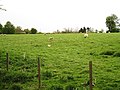
 Grass field and plantation - geograph.org.uk - 6564611.jpg 1,024 × 768; 203 KB
-
 Gretton Brook near Kirby Hall - geograph.org.uk - 6566214.jpg 1,024 × 768; 260 KB
-
 Gretton Road - geograph.org.uk - 5571558.jpg 640 × 480; 289 KB
-
 Hedge between two overgrown grass fields - geograph.org.uk - 6566629.jpg 1,024 × 768; 230 KB
-
 How boring ^ - geograph.org.uk - 2740079.jpg 3,648 × 2,736; 2.12 MB
-
 Is this the footpath past The Rookery^ - geograph.org.uk - 5843774.jpg 3,776 × 2,520; 3.46 MB
-
 JCB's at SED - geograph.org.uk - 2739697.jpg 3,648 × 2,736; 2.13 MB
-
 Kirby Hall - geograph.org.uk - 5657241.jpg 4,577 × 3,433; 3.19 MB
-
 Kirby Hall in the distance - geograph.org.uk - 4443840.jpg 480 × 640; 69 KB
-
 Kirby Lane - geograph.org.uk - 6567832.jpg 1,024 × 768; 305 KB
-
 Materials handling - geograph.org.uk - 2740087.jpg 3,648 × 2,736; 2.19 MB
-
 Millennium Obelisk, Deene Park - geograph.org.uk - 5529320.jpg 5,184 × 3,456; 5.26 MB
-
 Motorised barrow - geograph.org.uk - 2739707.jpg 3,648 × 2,736; 2.04 MB
-
 Not dead yet - geograph.org.uk - 6567825.jpg 768 × 1,024; 261 KB
-
 On the road from Deene to Spanhoe Airfield - geograph.org.uk - 6075068.jpg 3,776 × 2,520; 4.18 MB
-
 Ordnance Survey Trig Pillar S6786 - geograph.org.uk - 3293185.jpg 4,000 × 3,000; 3.79 MB
-
 Path through Dibbins Wood - geograph.org.uk - 5843808.jpg 3,776 × 2,520; 3.69 MB
-
 Path to Kirby Hall - geograph.org.uk - 5272986.jpg 480 × 640; 87 KB
-
 Perimeter fence, Horizon Centre - geograph.org.uk - 6564488.jpg 1,024 × 768; 190 KB
-
 Pits complex at Rockingham - geograph.org.uk - 1082078.jpg 640 × 427; 57 KB
-
 Prepared field near Manor Farm, Deene - geograph.org.uk - 6567827.jpg 1,024 × 768; 192 KB
-
 Priors Hall Development Site - geograph.org.uk - 256721.jpg 640 × 480; 124 KB
-
 Road junction and grass triangle - geograph.org.uk - 5308479.jpg 800 × 600; 135 KB
-
 Road to Kirby Hall - geograph.org.uk - 4750781.jpg 800 × 531; 123 KB
-
 Roadway to Kirby Lodge - geograph.org.uk - 6566631.jpg 1,024 × 768; 163 KB
-
 Roadway to Manor Farm, Deene - geograph.org.uk - 6564620.jpg 1,024 × 768; 210 KB
-
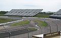
 Rockingham main stand from the pits - geograph.org.uk - 2832171.jpg 3,072 × 2,304; 2.44 MB
-
 Rockingham Motor Speedway - geograph.org.uk - 2901067.jpg 640 × 480; 68 KB
-

-

-
 Seasonal ford - geograph.org.uk - 6567821.jpg 1,024 × 768; 239 KB
-

-

-
 SED plant (construction) exhibition - geograph.org.uk - 1301613.jpg 640 × 403; 74 KB
-
 Silage bales near Kirby Lodge - geograph.org.uk - 6566674.jpg 1,024 × 768; 180 KB
-
 Skid steer loader - geograph.org.uk - 2740081.jpg 640 × 480; 91 KB
-
 St. Peter's church, Deene - geograph.org.uk - 6471601.jpg 659 × 1,024; 122 KB
-
 St. Peter's church, Deene - geograph.org.uk - 6471608.jpg 705 × 1,024; 155 KB
-

-

-
 Stubble field and Kirby Hall - geograph.org.uk - 6566216.jpg 1,024 × 768; 181 KB
-
 Thatched cottage, Deene - geograph.org.uk - 255786.jpg 640 × 480; 82 KB
-
 The entrance to Deene Park - geograph.org.uk - 3477454.jpg 4,320 × 3,240; 4.73 MB
-
 Too cold to sit today - geograph.org.uk - 1301606.jpg 640 × 479; 90 KB
-
 Towards Deene Park - geograph.org.uk - 487367.jpg 640 × 480; 58 KB
-
 Towards Kirby Hall - geograph.org.uk - 5272994.jpg 480 × 640; 53 KB
-
 Track through a hayfield towards The Rookery - geograph.org.uk - 5843389.jpg 3,776 × 2,520; 3.8 MB
-
 Track through Deene Park - geograph.org.uk - 5843802.jpg 3,776 × 2,520; 3.73 MB
-
 View to the obelisk in Deene Park - geograph.org.uk - 4750314.jpg 1,024 × 680; 240 KB
-
 Wheat field near Kirby Hall - geograph.org.uk - 6564617.jpg 1,024 × 768; 205 KB
-
 At the field edge - geograph.org.uk - 486643.jpg 640 × 480; 77 KB
-
 Bridleway south-east of Deenethorpe - geograph.org.uk - 270204.jpg 640 × 480; 104 KB
-
 Corby golf course - geograph.org.uk - 1428210.jpg 640 × 480; 51 KB
-
 Corby golf course - geograph.org.uk - 1428216.jpg 640 × 480; 69 KB
-
 Deenethorpe Lane - geograph.org.uk - 270199.jpg 640 × 480; 75 KB
-
 Driveway to Lodge Farm - geograph.org.uk - 487385.jpg 640 × 480; 72 KB
-
 Entering Deene, Northamptonshire - geograph.org.uk - 255779.jpg 640 × 480; 99 KB
-
 Fly-tipping off Kirby Lane - geograph.org.uk - 256707.jpg 640 × 480; 156 KB
-
 Footpath crossing - geograph.org.uk - 486612.jpg 640 × 480; 73 KB
-
 Footpath towards Rockingham Stadium - geograph.org.uk - 486608.jpg 640 × 480; 65 KB
-
 Road leaving Deene - geograph.org.uk - 255793.jpg 640 × 480; 67 KB
-

-
 Sweethill Spinney - geograph.org.uk - 486630.jpg 640 × 480; 98 KB
-
 The A43 - Corby to Stamford Road. - geograph.org.uk - 443555.jpg 640 × 480; 94 KB
-
 The entrance to Corby Golf Course - geograph.org.uk - 488266.jpg 640 × 480; 105 KB


_(geograph_7173366).jpg)
_(geograph_7172626).jpg)
_(geograph_7172568).jpg)
_(geograph_7172603).jpg)
_(geograph_7172579).jpg)
_(geograph_7172584).jpg)
_(geograph_7172587).jpg)
_(geograph_7172591).jpg)
_(geograph_7172596).jpg)
.jpg)
.jpg)
.jpg)
.jpg)
.jpg)
.jpg)


_exhibition_-_geograph.org.uk_-_1301613.jpg)


