Category:December 2016 in Rhode Island
Jump to navigation
Jump to search
English: Images/pictures taken in Rhode Island during December 2016. Note this is not the date of the upload, nor the date a photo was scanned.
States of the United States: Alabama · Alaska · Arizona · Arkansas · California · Colorado · Connecticut · Delaware · Florida · Georgia · Hawaii · Idaho · Illinois · Indiana · Iowa · Kansas · Louisiana · Maine · Maryland · Massachusetts · Michigan · Minnesota · Mississippi · Missouri · Nevada · New Hampshire · New Jersey · New Mexico · New York · North Carolina · North Dakota · Ohio · Oklahoma · Oregon · Pennsylvania · Rhode Island · South Carolina · South Dakota · Tennessee · Texas · Utah · Vermont · Virginia · Washington · West Virginia · Wisconsin · Wyoming – Washington, D.C.
Guam · Puerto Rico · United States Virgin Islands
Guam · Puerto Rico · United States Virgin Islands
| December 2015 | ← | December 2016 | → | December 2017 | |||||||||
| Jan | Feb | Mar | Apr | May | Jun | Jul | Aug | Sep | Oct | Nov | Dec | ||
| ← | 1 | 14 | 2 | 89 | 29 | 17 | 7 | 18 | 67 | 11 | 1 | 74 | → |
|---|---|---|---|---|---|---|---|---|---|---|---|---|---|
Media in category "December 2016 in Rhode Island"
The following 74 files are in this category, out of 74 total.
-
 American Herring Gull at Napatree Point (52308).jpg 1,943 × 1,057; 1.75 MB
-
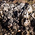 Barnacles (52285).jpg 2,316 × 2,379; 3.49 MB
-
 Barnacles (52286).jpg 3,188 × 2,477; 4.5 MB
-
 Beach cusps at Napatree Point (52404).jpg 4,117 × 2,819; 7.81 MB
-
 Beach cusps at Napatree Point (52405).jpg 3,198 × 3,456; 7.79 MB
-
 Beach cusps at Napatree Point (52407).jpg 3,423 × 3,456; 6.58 MB
-
 Block Island Turbine.jpg 3,744 × 5,616; 7 MB
-
 Block Island Wind Turbines.jpg 5,616 × 3,744; 7.43 MB
-
 Dirty seafoam (52214).jpg 2,675 × 1,594; 3.27 MB
-
 Dirty seafoam (52216).jpg 3,456 × 2,311; 5.63 MB
-
 Dirty seafoam (52217).jpg 2,610 × 1,792; 3.36 MB
-
 Dirty seafoam (52218).jpg 2,826 × 2,017; 3.91 MB
-
 Dirty seafoam (52219).jpg 2,698 × 1,606; 2.63 MB
-
 Fall on College Hill.png 11,011 × 3,090; 42.22 MB
-
 Heading to Work.jpg 5,616 × 3,744; 10.06 MB
-
 Horseshoe crab shell (52231).jpg 2,849 × 2,744; 6.21 MB
-
 I-95 North - Exit 10 - RI117 (43272186530).jpg 2,400 × 1,600; 2.03 MB
-
 I-95 North RI - Exit 11 - Interstate 295 (44173995235).jpg 2,400 × 1,600; 1.84 MB
-
 I-95+295 Split Over Warwick and Cranston Night - December 2016 (43272189000).jpg 2,400 × 1,600; 1.96 MB
-
 India Point Park Providence Rhode Island.jpg 3,264 × 2,448; 2.44 MB
-
 Juniper tree at Napatree Point (52422).jpg 3,756 × 2,712; 8.32 MB
-
 Napatree Point (52232).jpg 4,608 × 2,340; 6.7 MB
-
 Napatree Point (52241).jpg 3,648 × 1,997; 5.85 MB
-
 Napatree Point (52242).jpg 4,206 × 2,242; 7.51 MB
-
 Napatree Point (52416).jpg 4,608 × 2,771; 9.32 MB
-
 Osprey nest (52381).jpg 3,678 × 3,055; 6.33 MB
-
 Osprey nest (52382).jpg 1,513 × 2,301; 1.83 MB
-
 Red pine bits (52375).jpg 2,238 × 2,027; 2.71 MB
-
 Red pine cones (52371).jpg 3,256 × 3,005; 7.37 MB
-
 Red pine cones (52374).jpg 1,866 × 1,919; 2.53 MB
-
 Red Pine foliage & conelets, Napatree Point Conservation Area, Rhode Island (52357).jpg 3,041 × 3,064; 6.04 MB
-
 Red Pine foliage & conelets, Napatree Point Conservation Area, Rhode Island (52359).jpg 4,608 × 3,456; 9.84 MB
-
 Red Pine, Napatree Point Conservation Area, Rhode Island (52379).jpg 4,608 × 3,456; 14.06 MB
-
 RI 401 (32479674284).jpg 2,400 × 1,600; 1.84 MB
-
 RI102sRoadSign (32479678674).jpg 2,400 × 1,600; 2.38 MB
-
 RI113wRoadSign (33281663376).jpg 2,400 × 1,600; 3.56 MB
-
 RI117 West - Jct RI116 Sign (44173991865).jpg 2,400 × 1,600; 2.04 MB
-
 RI117 West RI33 - RI116 Signs (44173992755).jpg 2,400 × 1,600; 2.82 MB
-
 RI117 West RI33 South Signs (45085339041).jpg 2,400 × 1,600; 1.89 MB
-
 RI117 West Sign (44173991475).jpg 2,400 × 1,600; 2.58 MB
-
 RI117A South at RI117 West Signs (43272187710).jpg 2,400 × 1,600; 1.98 MB
-
 RI117eRoad-BadCurveSign (33167117792).jpg 2,400 × 1,600; 3.29 MB
-
 RI117eRoadSign (32479677244).jpg 2,400 × 1,600; 3.02 MB
-
 RI1A South - Begin RI117 Signs (43272183830).jpg 2,400 × 1,600; 2.2 MB
-
 RI1A South Sign - Providence (44173993635).jpg 2,400 × 1,600; 2.24 MB
-
 RI2 North Ramp - RI117 Signs (45085338891).jpg 2,400 × 1,600; 2.39 MB
-
 RI2sRI3sSigns-Warwick (32479673414).jpg 1,600 × 2,400; 1.91 MB
-
 RI401 East - RI4 South To RI403 I-95 Signs (45085338581).jpg 2,400 × 1,600; 2.08 MB
-
 RI4nRoad-Exit7-RI403 (33167116222).jpg 2,400 × 1,600; 1.52 MB
-
 RI4sRoad-Exit7AB-RI402-RI403sign (32479675794).jpg 2,400 × 1,600; 1.72 MB
-
 Ripply spiky sand at Napatree Point (52307).jpg 2,150 × 1,116; 2.79 MB
-
 Ruddy Turnstone at Napatree Point (52329).jpg 2,110 × 1,488; 2.67 MB
-
 Ruddy Turnstone at Napatree Point, Rhode Island (52330).jpg 1,866 × 1,126; 1.75 MB
-
 Sand mason worm tube (52264).jpg 2,375 × 1,841; 2 MB
-
 Sand mason worm tube (52265).jpg 2,609 × 1,889; 2.06 MB
-
 Sanderling (52288).jpg 1,963 × 1,018; 1.44 MB
-
 Sanderling (52293).jpg 2,297 × 1,322; 2.04 MB
-
 Sanderling (52294).jpg 1,688 × 1,223; 1.43 MB
-
 Seafoam at Napatree Point (52296).jpg 2,629 × 1,155; 2.56 MB
-
 Seafoam at Napatree Point (52298).jpg 3,099 × 1,204; 3.31 MB
-
 Seafoam closeup (52262) (cropped).jpg 2,037 × 1,292; 2.98 MB
-
 Seafoam closeup (52262).jpg 2,179 × 1,625; 3.36 MB
-
 Seagrass (52314).jpg 3,324 × 2,359; 5.91 MB
-
 Shells and rocks (52310).jpg 3,021 × 1,899; 4.98 MB
-
 Sidney E Frank Hall walkway.jpeg 3,883 × 2,912; 2.2 MB
-
 Turbine Structure.jpg 3,744 × 5,616; 11.83 MB
-
 Underside of a shell detail (52353).jpg 1,885 × 1,586; 1.98 MB
-
 Unidentified berry (52362).jpg 4,412 × 3,456; 6.28 MB
-
 Unidentified plant at Napatree Point (52246).jpg 1,445 × 1,156; 1.22 MB
-
 Watch Hill Light (52412).jpg 3,295 × 2,183; 5.2 MB
-
 Watch Hill Light (52413).jpg 4,549 × 2,692; 9.46 MB
-
 Watch Hill Light (52415).jpg 3,394 × 2,076; 5.42 MB
-
 Wave at Napatree Point (52389).jpg 4,607 × 2,555; 9.51 MB
-
 Wayland Arch in the winter.jpg 4,000 × 3,000; 3.3 MB
.jpg)
.jpg)
.jpg)
.jpg)
.jpg)
.jpg)


.jpg)
.jpg)
.jpg)
.jpg)
.jpg)

.jpg)
.jpg)
.jpg)
.jpg)

.jpg)
.jpg)
.jpg)
.jpg)
.jpg)
.jpg)
.jpg)
.jpg)
.jpg)
.jpg)
.jpg)
.jpg)
.jpg)
.jpg)
.jpg)
.jpg)
.jpg)
.jpg)
.jpg)
.jpg)
.jpg)
.jpg)
.jpg)
.jpg)
.jpg)
.jpg)
.jpg)
.jpg)
.jpg)
.jpg)
.jpg)
.jpg)
.jpg)
.jpg)
.jpg)
.jpg)
.jpg)
.jpg)
.jpg)
_(cropped).jpg)
.jpg)
.jpg)
.jpg)


.jpg)
.jpg)
.jpg)
.jpg)
.jpg)
.jpg)
.jpg)

.jpg)