Category:December 2011 in the East Riding of Yorkshire
Jump to navigation
Jump to search
Ceremonial counties of England: Bedfordshire · Berkshire · Buckinghamshire · Cambridgeshire · Cheshire · Cornwall · Cumbria · Derbyshire · Devon · Dorset · Durham · East Riding of Yorkshire · East Sussex · Essex · Gloucestershire · Greater London · Greater Manchester · Hampshire · Herefordshire · Hertfordshire · Isle of Wight · Kent · Lancashire · Leicestershire · Lincolnshire · Merseyside · Norfolk · North Yorkshire · Northumberland · Nottinghamshire · Oxfordshire · Shropshire · Somerset · South Yorkshire · Staffordshire · Suffolk · Surrey · Tyne and Wear · Warwickshire · West Midlands · West Sussex · West Yorkshire · Wiltshire · Worcestershire
City-counties: Bristol ·
Former historic counties:
Other former counties:
City-counties: Bristol ·
Former historic counties:
Other former counties:
Ok
Deutsch: Bilder, die im Dezember 2011 in the East Riding of Yorkshire aufgenommen worden sind. Bitte beachten Sie, dass dies weder das Datum des Uploads noch das Datum des Scannens eines Fotos ist.
English: Images/pictures taken in the East Riding of Yorkshire during December 2011. Note this is not the date of the upload, nor the date a photo was scanned.
Español: Fotografías o imágenes tomadas en the East Riding of Yorkshire durante diciembre 2011. No es la fecha de subida ni escaneo, sino la fecha en que las fotografías o imágenes se crearon.
Esperanto: Bildoj faritaj en the East Riding of Yorkshire en decembro 2011. Tio ne estas la dato, kiam la bildoj estis alŝutitaj aŭ skanitaj.
Français : Photographies ou images prises en the East Riding of Yorkshire durant décembre 2011. Ce n'est pas la date du téléchargement ou du scan.
Galego: Fotografías ou imaxes tomadas en the East Riding of Yorkshire durante decembro 2011. Non é a data de subida nin escaneamento, senón a data na que se crearon as fotografías ou imaxes.
Italiano: Fotografie o immagini scattate a the East Riding of Yorkshire nel dicembre 2011. Nota bene: la data non si riferisce né a quella di upload né a quella in cui la foto è stata digitalizzata.
Norsk bokmål: Bilder tatt i the East Riding of Yorkshire i løpet av desember 2011. Merk at dette ikke er datoen for opplasting, eller når et bilde har blitt skannet.
Norsk nynorsk: Bilete teke i the East Riding of Yorkshire i løpet av desember 2011. Merk at dette ikkje er datoen for opplasting, eller når eit bilete har vorte skanna.
Русский: Изображения, сделанные в the East Riding of Yorkshire в течение декабрь 2011 (не дата загрузки изображения).
Українська: Зображення, зроблені в the East Riding of Yorkshire протягом грудень 2011. Зауважте, що це не дата завантаження чи дата сканування фотографії.
| December 2010 | ← | December 2011 | → | December 2012 | |||||||
| Jan | Feb | Mar | Apr | May | Jun | Jul | Aug | Sep | Oct | Nov | Dec |
| 16 | 35 | 82 | 46 | 84 | 30 | 58 | 28 | 28 | 52 | 50 | 43 |
|---|---|---|---|---|---|---|---|---|---|---|---|
Media in category "December 2011 in the East Riding of Yorkshire"
The following 43 files are in this category, out of 43 total.
-
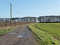 Access track to Burton Fleming Grange (geograph 2723672).jpg 1,024 × 768; 140 KB
-
 All Saints Church, Wold Newton (geograph 2724637).jpg 1,024 × 768; 146 KB
-
 Beverley at night - panoramio.jpg 1,200 × 706; 402 KB
-
 Bus shelter, Wold Newton (geograph 2724655).jpg 1,024 × 768; 199 KB
-
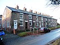 Church Row, Wold Newton (geograph 2724648).jpg 1,024 × 768; 149 KB
-
 Churchyard and former school, Wressle (geograph 2749473).jpg 1,024 × 768; 178 KB
-
 Crop field, north-west side of the Hunmanby Road (geograph 2723658).jpg 1,024 × 768; 203 KB
-
 East Field (geograph 2723902).jpg 1,024 × 768; 109 KB
-
 Edge of a crop field, west of Burton Fleming Grange (geograph 2723674).jpg 1,024 × 768; 191 KB
-
 Entrance to Westfield House (geograph 2724672).jpg 1,024 × 768; 137 KB
-
 Farmland west of Burton Fleming Grange (geograph 2723667).jpg 1,024 × 768; 181 KB
-
 Folly Lane towards, Sigglesthorne (geograph 2746303).jpg 800 × 600; 94 KB
-
 Footbridge, south side of the pond, Wold Newton (geograph 2724661).jpg 1,024 × 768; 152 KB
-
 From Front Street to Back Street (geograph 2723920).jpg 1,024 × 768; 225 KB
-
 Gappy hedge along Burton Fleming Road (geograph 2723819).jpg 1,024 × 768; 196 KB
-
 Gappy hedge alongside a crop field (geograph 2723857).jpg 1,024 × 768; 173 KB
-
 Gate into East Field, off Burton Fleming Road (geograph 2723886).jpg 1,024 × 768; 187 KB
-
 Large crop field east of The Grange (geograph 2723661).jpg 1,024 × 768; 177 KB
-
 Large rectangular field, east of Burton Fleming Road (geograph 2723826).jpg 1,024 × 768; 142 KB
-
 Left for Wold Newton, right for Hunmanby (geograph 2723676).jpg 1,024 × 768; 142 KB
-
 Looking north across East Field (geograph 2723908).jpg 1,024 × 768; 119 KB
-
 New use for old telegraph pole (geograph 2723853).jpg 1,024 × 768; 171 KB
-
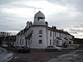 Old Lighthouse, Paull.jpg 4,288 × 3,216; 3.6 MB
-
 Pylons on the south side of Burton Fleming Road (geograph 2723846).jpg 1,024 × 768; 120 KB
-
 Rectangular crop field, south of Burton Fleming Road (geograph 2723870).jpg 1,024 × 768; 182 KB
-
 Snaith Road, Pollington - geograph.org.uk - 2750364.jpg 1,280 × 959; 612 KB
-
 St Marys Church Ellerton 2.jpg 1,024 × 768; 111 KB
-
 St. John of Beverley, Wressle (geograph 2749464).jpg 1,024 × 768; 225 KB
-
 St. John of Beverley, Wressle - interior (geograph 2749469).jpg 1,024 × 768; 108 KB
-
 The 11th century church of All Saints (geograph 2724629).jpg 1,024 × 768; 167 KB
-
 The flat-bottomed valley of the Gypsey Race (geograph 2723834).jpg 1,024 × 768; 114 KB
-
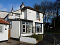 The Old Post Office, Wold Newton (geograph 2724664).jpg 1,024 × 768; 145 KB
-
 The road to Wold Newton (geograph 2724683).jpg 1,024 × 768; 121 KB
-
 The smaller pond, Wold Newton (geograph 2724665).jpg 1,024 × 768; 125 KB
-
 The valley of the Gypsey Race (geograph 2724675).jpg 1,024 × 768; 181 KB
-
 The western edge of East Field (geograph 2723899).jpg 1,024 × 768; 158 KB
-
 Turn left for Fordon (geograph 2724658).jpg 1,024 × 768; 155 KB
-
 Well-maintained roadside hedge (geograph 2724678).jpg 1,024 × 768; 149 KB
-
 Well-used field gate (geograph 2723655).jpg 1,024 × 768; 141 KB
-
 Wold Road, Hull (geograph 3110138).jpg 1,024 × 740; 218 KB
-
 Wold Road, Hull (geograph 3110141).jpg 1,024 × 739; 161 KB
-
 Wressle Castle (geograph 2749461).jpg 1,024 × 713; 105 KB
-
 Yew tree in the churchyard (geograph 2724633).jpg 1,024 × 768; 179 KB
.jpg)
.jpg)

.jpg)
.jpg)
.jpg)
.jpg)
.jpg)
.jpg)
.jpg)
.jpg)
.jpg)
.jpg)
.jpg)
.jpg)
.jpg)
.jpg)
.jpg)
.jpg)
.jpg)
.jpg)
.jpg)

.jpg)
.jpg)


.jpg)
.jpg)
.jpg)
.jpg)
.jpg)
.jpg)
.jpg)
.jpg)
.jpg)
.jpg)
.jpg)
.jpg)
.jpg)
.jpg)
.jpg)
.jpg)