Category:December 2011 floods in York
Jump to navigation
Jump to search
Media in category "December 2011 floods in York"
The following 17 files are in this category, out of 17 total.
-

-
 York, a beer garden underwater - geograph.org.uk - 2731018.jpg 480 × 640; 59 KB
-
 York, brief glug in Terry Street - geograph.org.uk - 2730924.jpg 640 × 480; 75 KB
-
 York, King’s Staith underwater - geograph.org.uk - 2736892.jpg 640 × 480; 76 KB
-

-
 York, no entry into the River Ouse - geograph.org.uk - 2736894.jpg 480 × 640; 78 KB
-

-

-

-
 York, Skeldergate Bridge - geograph.org.uk - 2730918.jpg 640 × 480; 74 KB
-
 York, steps into the river - geograph.org.uk - 2730998.jpg 640 × 480; 51 KB
-

-
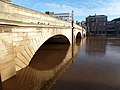 York, the arches of Ouse Bridge - geograph.org.uk - 2731009.jpg 640 × 480; 67 KB
-
 York, the Ouse has receded - geograph.org.uk - 2739880.jpg 640 × 480; 52 KB
-
 York, view across the flooded Ouse - geograph.org.uk - 2730994.jpg 640 × 480; 70 KB
-

-
 York, Woodsmill Quay - geograph.org.uk - 2736898.jpg 640 × 480; 78 KB


