Category:December 2005 in Lincolnshire
Jump to navigation
Jump to search
Deutsch: Bilder, die im Dezember 2005 in Lincolnshire aufgenommen worden sind. Bitte beachten Sie, dass dies weder das Datum des Uploads noch das Datum des Scannens eines Fotos ist.
English: Images/pictures taken in Lincolnshire during December 2005. Note this is not the date of the upload, nor the date a photo was scanned.
Español: Fotografías o imágenes tomadas en Lincolnshire durante diciembre 2005. No es la fecha de subida ni escaneo, sino la fecha en que las fotografías o imágenes se crearon.
Esperanto: Bildoj faritaj en Lincolnshire en decembro 2005. Tio ne estas la dato, kiam la bildoj estis alŝutitaj aŭ skanitaj.
Français : Photographies ou images prises en Lincolnshire durant décembre 2005. Ce n'est pas la date du téléchargement ou du scan.
Galego: Fotografías ou imaxes tomadas en Lincolnshire durante decembro 2005. Non é a data de subida nin escaneamento, senón a data na que se crearon as fotografías ou imaxes.
Italiano: Fotografie o immagini scattate a Lincolnshire nel dicembre 2005. Nota bene: la data non si riferisce né a quella di upload né a quella in cui la foto è stata digitalizzata.
Norsk bokmål: Bilder tatt i Lincolnshire i løpet av desember 2005. Merk at dette ikke er datoen for opplasting, eller når et bilde har blitt skannet.
Norsk nynorsk: Bilete teke i Lincolnshire i løpet av desember 2005. Merk at dette ikkje er datoen for opplasting, eller når eit bilete har vorte skanna.
Русский: Изображения, сделанные в Lincolnshire в течение декабрь 2005 (не дата загрузки изображения).
Українська: Зображення, зроблені в Lincolnshire протягом грудень 2005. Зауважте, що це не дата завантаження чи дата сканування фотографії.
| December 2004 | ← | December 2005 | → | December 2006 | |||||||
| Jan | Feb | Mar | Apr | May | Jun | Jul | Aug | Sep | Oct | Nov | Dec |
| 7 | 11 | 12 | 27 | 83 | 16 | 17 | 45 | 47 | 29 | 23 | 104 |
|---|---|---|---|---|---|---|---|---|---|---|---|
Subcategories
This category has only the following subcategory.
Media in category "December 2005 in Lincolnshire"
The following 103 files are in this category, out of 103 total.
-
 Bardney Lock Farm - geograph.org.uk - 95321.jpg 640 × 427; 63 KB
-
 Malcolm Arms - geograph.org.uk - 90480.jpg 640 × 427; 73 KB
-
 Methodist Chapel - geograph.org.uk - 90701.jpg 640 × 427; 81 KB
-
 Cottages and old malthouse - geograph.org.uk - 90305.jpg 640 × 481; 126 KB
-
 Disused malthouse - geograph.org.uk - 90301.jpg 640 × 481; 146 KB
-
 Edge Of Pickworth Wood. - geograph.org.uk - 87316.jpg 640 × 480; 125 KB
-
 West Deeping parish church, Lincs - geograph.org.uk - 87498.jpg 640 × 480; 270 KB
-
 West Deeping parish church, Lincs - geograph.org.uk - 87500.jpg 640 × 480; 271 KB
-

-
 Further from Folly - geograph.org.uk - 90251.jpg 640 × 480; 109 KB
-
 Track and Field - geograph.org.uk - 90292.jpg 640 × 480; 88 KB
-
 Woodland Edge - geograph.org.uk - 90265.jpg 640 × 480; 112 KB
-
 First Step - geograph.org.uk - 91441.jpg 640 × 480; 74 KB
-
 At Old Somerby, Lincolnshire - St Mary Magdalene's Church, - Dec 2005.JPG 2,560 × 1,920; 3.93 MB
-
 Ermine Street Roman Road - geograph.org.uk - 95748.jpg 480 × 640; 146 KB
-
 Apple tree, Grantham, Lincolnshire - Dec 2005.JPG 2,560 × 1,920; 5.41 MB
-
 Church Lane, Old Somerby, Lincolnshire - Dec 2005.JPG 2,560 × 1,920; 4.32 MB
-
 A view south from the A52 east from Grantham, Lincolnshire - Dec 2005 (1).JPG 2,560 × 1,512; 2.78 MB
-
 A road into Old Somerby, Lincolnshire - Dec 2005.JPG 2,560 × 1,920; 3.88 MB
-
 Southrey Wood - geograph.org.uk - 95336.jpg 640 × 427; 107 KB
-
 St.Edward's church, Barlings, Lincs. - geograph.org.uk - 93734.jpg 640 × 427; 64 KB
-
 Nocton Fen - geograph.org.uk - 95317.jpg 640 × 427; 51 KB
-
 Bardney Dairies methodist Church - geograph.org.uk - 94484.jpg 640 × 427; 71 KB
-
 Bardney Sugar Factory - geograph.org.uk - 95318.jpg 640 × 427; 60 KB
-
 Wasps Nest - geograph.org.uk - 95313.jpg 640 × 427; 47 KB
-
 Providence House, Barton-Upon-Humber - geograph.org.uk - 142091.jpg 640 × 480; 170 KB
-
 Manor House, Sapperton. - geograph.org.uk - 87320.jpg 640 × 480; 120 KB
-
 Saint Nicholas Church, Sapperton. - geograph.org.uk - 87502.jpg 640 × 480; 129 KB
-
 Barton Haven - geograph.org.uk - 1377746.jpg 640 × 388; 70 KB
-
 Flat Screen - geograph.org.uk - 89594.jpg 640 × 480; 75 KB
-
 St. Peter's Churchyard - geograph.org.uk - 115139.jpg 640 × 480; 196 KB
-
 Branston Moor - geograph.org.uk - 89591.jpg 640 × 480; 92 KB
-
 Bloxholm Lane - geograph.org.uk - 90228.jpg 640 × 480; 128 KB
-
 Field - geograph.org.uk - 90271.jpg 640 × 480; 93 KB
-
 St. Andrew's church, Hacconby, Lincs - geograph.org.uk - 90719.jpg 640 × 427; 83 KB
-
 Timberland Drove - geograph.org.uk - 90640.jpg 640 × 480; 74 KB
-
 St.George's church, Goltho, Lincs. - geograph.org.uk - 94459.jpg 640 × 427; 133 KB
-
 Bardney Lock - geograph.org.uk - 95326.jpg 640 × 427; 111 KB
-
 Blankney Church.jpg 640 × 427; 103 KB
-
 Abbey Hill - geograph.org.uk - 95309.jpg 640 × 427; 83 KB
-
 St.Andrew's church, Potterhanworth, Lincs. - geograph.org.uk - 95300.jpg 640 × 427; 115 KB
-
 Artwork in Bourne Wood - geograph.org.uk - 97199.jpg 640 × 495; 138 KB
-
 Edge of Town - geograph.org.uk - 97292.jpg 640 × 406; 63 KB
-
 In Bourne Wood - geograph.org.uk - 97192.jpg 640 × 430; 144 KB
-
 Wooden Mushrooms in Bourne Wood - geograph.org.uk - 97204.jpg 640 × 453; 150 KB
-
 Top Hat - geograph.org.uk - 95672.jpg 640 × 480; 101 KB
-
 Thurlby - geograph.org.uk - 97019.jpg 640 × 425; 98 KB
-
 A game shooting party at Denton, Lincolnshire - Dec 2005.JPG 2,560 × 1,920; 4.31 MB
-
 A road near Denton, Lincolnshire - Dec 2005.JPG 2,560 × 1,920; 3.09 MB
-

-
 Denton Manor gates, Lincolnshire - Dec 2005.JPG 2,560 × 1,920; 5.03 MB
-
 Fields near Denton, Lincolnshire - Dec 2005 (1).JPG 2,560 × 1,920; 3.95 MB
-
 Fields near Denton, Lincolnshire - Dec 2005 (2).JPG 2,560 × 1,920; 5.24 MB
-
 Fields near Denton, Lincolnshire - Dec 2005 (3).JPG 2,560 × 1,920; 5.12 MB
-
 Fields near Denton, Lincolnshire - Dec 2005 (4).JPG 2,560 × 1,920; 4.46 MB
-
 A field with bales near Ropsley, Lincolnshire - Dec 2005.JPG 2,560 × 1,920; 3.01 MB
-
 Cold Day at Barton Waterside - geograph.org.uk - 134816.jpg 640 × 480; 83 KB
-
 Waning Year at Barton Haven - geograph.org.uk - 147387.jpg 640 × 480; 73 KB
-
 Garthorpe, North Lincolnshire 2.jpg 3,072 × 2,304; 1.64 MB
-
 Deepdale - New Years Eve 2005 - geograph.org.uk - 293857.jpg 640 × 480; 108 KB
-
 Frognall village, Deeping St James, Lincs - geograph.org.uk - 95107.jpg 640 × 480; 318 KB
-
 Bardney Lock Bridge - geograph.org.uk - 95322.jpg 640 × 427; 72 KB
-
 Potterhanworth Water Tower - geograph.org.uk - 95303.jpg 640 × 427; 111 KB
-
 The Queen Inn - geograph.org.uk - 95708.jpg 519 × 640; 121 KB
-
 Bourne Town Centre - geograph.org.uk - 96987.jpg 640 × 550; 94 KB
-
 Bourne Town Centre clipped.jpg 633 × 396; 66 KB
-
 Ermine Street - geograph.org.uk - 95599.jpg 640 × 480; 112 KB
-
 Leadenham Heath - geograph.org.uk - 95654.jpg 640 × 480; 131 KB
-
 Leadenham Heath - geograph.org.uk - 95655.jpg 640 × 480; 95 KB
-
 Leadenham Heath - geograph.org.uk - 95659.jpg 640 × 480; 138 KB
-
 Bourne Bus Station in the Snow - geograph.org.uk - 528131.jpg 640 × 480; 97 KB
-
 Barton Haven - 28th December 2005 - geograph.org.uk - 97591.jpg 640 × 273; 73 KB
-
 Looking south on to Metheringham Barff - geograph.org.uk - 98552.jpg 640 × 480; 81 KB
-
 Sleaford Cemetery - geograph.org.uk - 850659.jpg 640 × 480; 87 KB
-
 Obthorpe Lane, looking south, Xmas 2005. - geograph.org.uk - 270290.jpg 480 × 640; 114 KB
-
 Wintry scene in Doddington - geograph.org.uk - 97374.jpg 640 × 427; 73 KB
-
 A tree at Aunsby, Lincolnshire, England.JPG 2,290 × 1,465; 2.15 MB
-
 A view south from the A52 east from Grantham, Lincolnshire - Dec 2005 (2).JPG 2,560 × 1,920; 4.28 MB
-
 A view south from the A52 east from Grantham, Lincolnshire - Dec 2005 (3).JPG 2,560 × 1,920; 3.99 MB
-
 A view south from the A52 east from Grantham, Lincolnshire - Dec 2005 (4).JPG 2,560 × 1,920; 3.92 MB
-
 A view south from the A52 east from Grantham, Lincolnshire - Dec 2005 (5).JPG 2,560 × 1,920; 3.82 MB
-
 Club House - geograph.org.uk - 90216.jpg 640 × 480; 148 KB
-
 Church of St Peter, Creeton, Lincolnshire - Dec 2005.JPG 2,560 × 1,920; 4.36 MB
-
 Parish Church of Deeping St. James - geograph.org.uk - 860501.jpg 2,048 × 1,536; 1.08 MB
-
 Disused Railway - geograph.org.uk - 92084.jpg 640 × 427; 96 KB
-
 Entrance to Water's Edge - geograph.org.uk - 109091.jpg 640 × 480; 103 KB
-
 A view of St Wulfram's Church from Castlegate, Grantham, Lincolnshire - Dec 2005 (1).JPG 1,920 × 2,560; 3.64 MB
-
 A view of St Wulfram's Church from Castlegate, Grantham, Lincolnshire - Dec 2005 (2).JPG 1,920 × 2,560; 4.01 MB
-
 A view of St Wulfram's Church, Grantham from playing field - Dec 2005.JPG 2,527 × 1,779; 2.73 MB
-
 Harvey Close - geograph.org.uk - 97000.jpg 640 × 420; 69 KB
-
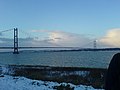 Humber Bridge in the snow - geograph.org.uk - 109084 (cropped).jpg 600 × 450; 57 KB
-
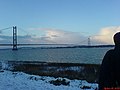 Humber Bridge in the snow - geograph.org.uk - 109084.jpg 640 × 480; 64 KB
-

-
 Newtonlincschurch.jpg 640 × 480; 119 KB
-
 Pinfold Bridge - geograph.org.uk - 90637.jpg 640 × 480; 87 KB
-
 Shore Road in snow - geograph.org.uk - 647130.jpg 640 × 480; 87 KB
-

-
 Stubber Hill Plantation, Stubton. - geograph.org.uk - 95867.jpg 640 × 480; 291 KB
-
 Thatched Cottage - geograph.org.uk - 95374.jpg 640 × 427; 88 KB
-
 The Mill, West Deeping, Lincs - geograph.org.uk - 87499.jpg 640 × 480; 330 KB
-

-
 Rawson's Bridge - geograph.org.uk - 90473.jpg 640 × 427; 91 KB
-
 Water's Edge - geograph.org.uk - 109086.jpg 640 × 480; 93 KB


.JPG)


.JPG)
.JPG)
.JPG)
.JPG)


.JPG)
.JPG)
.JPG)
.JPG)


.JPG)
.JPG)


.jpg)


