Category:Deansgrange
Jump to navigation
Jump to search
suburb of Dublin, Ireland | |||||
| Upload media | |||||
| Instance of | |||||
|---|---|---|---|---|---|
| Location | Dún Laoghaire–Rathdown, Ireland | ||||
| Elevation above sea level |
| ||||
 | |||||
English: Deansgrange (Gráinseach an Déin, formerly Cluain Chaoin, in Irish) is a suburban area of South Dublin, centered around a crossroads, between Blackrock, Dún Laoghaire and Foxrock. The crossroads is a commercial centre for the surrounding low density housing estates, providing a medium sized supermarket, a bank, a pub, a library, a pharmacy and an Italian takeaway food outlet. South of the crossroads is Clonkeen Road leading to Clonkeen College, west is Kill Lane, leading up to Foxrock Church and the N11. North of the crossroads are some car showrooms, a pizzeria, a cafe, a bookies, a bakery and a large but now fully allotted Deans Grange Cemetery, while east Kill Lane leads to Baker's Corner at Kill O'The Grange. There is an office block and a small industrial estate containing offices of the World GSM Association, an office supply shop, furniture shop and a golf shop off the eastern end of Kill Lane.
Français : Deansgrange (Gráinseach an Déin en Irlandais) est une ville de banlieue au sud de Dublin, située à un carrefour entre Dún Laoghaire et Foxrock.
Media in category "Deansgrange"
The following 16 files are in this category, out of 16 total.
-
 Baker's Corner - geograph.org.uk - 3371664.jpg 2,592 × 1,936; 1.78 MB
-
 Church of Our Lady of Perpetual Succour, Foxrock - geograph.org.uk - 3627324.jpg 2,592 × 1,936; 1.4 MB
-
 Clonkeen Road - geograph.org.uk - 6010248.jpg 800 × 533; 532 KB
-
 Clonkeen Road - geograph.org.uk - 6010354.jpg 800 × 533; 501 KB
-
 Clonkeen Road, Blackrock - geograph.org.uk - 376299.jpg 640 × 480; 87 KB
-
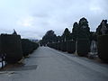 Dean's Grange Cemetery Main Walkway.JPG 3,072 × 2,304; 2.51 MB
-
 Deans Grange Cemetery.jpg 2,304 × 3,072; 2.4 MB
-
 Deansgrange Crossroads - geograph.org.uk - 1828007.jpg 3,212 × 2,138; 4.02 MB
-
 Deansgrange.jpg 8,719 × 1,048; 2.16 MB
-
 Dermot Morgan Grave.jpg 1,280 × 1,024; 1.36 MB
-
 Earnest Walton Grave.jpg 1,280 × 1,024; 517 KB
-
 Irish Car Scrappage.jpg 1,920 × 1,200; 437 KB
-
 Kill Lane - geograph.org.uk - 458686.jpg 640 × 480; 82 KB
-
 Rochestown Avenue - geograph.org.uk - 458675.jpg 480 × 640; 97 KB
-
 Street scene - geograph.org.uk - 4211373.jpg 4,608 × 3,456; 3.73 MB
-
 The Grange - geograph.org.uk - 3627336.jpg 2,592 × 1,936; 1.22 MB


