Category:Dean Prior
Jump to navigation
Jump to search
village in the United Kingdom  | |||||
| Upload media | |||||
| Instance of | |||||
|---|---|---|---|---|---|
| Location | South Hams, Devon, South West England, England | ||||
| Population |
| ||||
 | |||||
Subcategories
This category has the following 4 subcategories, out of 4 total.
A
- Avon Dam Reservoir (50 F)
G
- St George the Martyr, Dean Prior (16 F)
L
- Lower Dean, Devon (4 F)
U
- Upper Dean, Devon (8 F)
Media in category "Dean Prior"
The following 200 files are in this category, out of 396 total.
(previous page) (next page)-
 A sharp downhill bend north of Pennywell - geograph.org.uk - 1991724.jpg 640 × 480; 400 KB
-
 A small change in Upper Dean - geograph.org.uk - 5126819.jpg 1,600 × 1,219; 457 KB
-
 A38 overbridge, Lower Dean - geograph.org.uk - 1993292.jpg 640 × 480; 502 KB
-
 A38 passing Dean Prior church - geograph.org.uk - 2859556.jpg 800 × 600; 277 KB
-
 A38, Lower Dean - geograph.org.uk - 1367411.jpg 640 × 455; 69 KB
-
 A38, Lower Dean - geograph.org.uk - 1367416.jpg 640 × 455; 91 KB
-
 A38, near Dean Prior, Devon - geograph.org.uk - 88333.jpg 640 × 427; 201 KB
-
 A38, North of Rattery Turnoff - geograph.org.uk - 1367263.jpg 640 × 455; 90 KB
-
 A38, Rattery Turnoff - geograph.org.uk - 1367258.jpg 640 × 455; 68 KB
-
 A38, South of Dean Prior - geograph.org.uk - 1367270.jpg 640 × 455; 87 KB
-
 A38, South of Dean Prior - geograph.org.uk - 1367272.jpg 640 × 455; 74 KB
-
 A38, South of Drybridge Cross - geograph.org.uk - 1367253.jpg 640 × 455; 74 KB
-
 Abbot's Way - geograph.org.uk - 1353787.jpg 640 × 480; 104 KB
-
 Abbot's Way crosses Dean Moor - geograph.org.uk - 1353762.jpg 640 × 480; 94 KB
-
 Across the Harbourne valley - geograph.org.uk - 6425007.jpg 4,288 × 2,848; 2.41 MB
-
 Addislade - geograph.org.uk - 238019.jpg 640 × 480; 141 KB
-
 Addislade - geograph.org.uk - 5347092.jpg 2,316 × 1,727; 963 KB
-
 Ancient settlement (geograph 5954616).jpg 4,320 × 3,240; 4.16 MB
-
 Approaching Dean Lane End - geograph.org.uk - 1991521.jpg 480 × 640; 335 KB
-
 Approaching Gidley Bridge - geograph.org.uk - 6423536.jpg 2,848 × 4,288; 2.28 MB
-
 Approaching Reddacleave Kiln Cross - geograph.org.uk - 6423554.jpg 4,288 × 2,848; 2.66 MB
-
 Arable field west of Dean Prior - geograph.org.uk - 5346550.jpg 2,791 × 1,650; 1.2 MB
-
 At the shrine of the old blue plough - geograph.org.uk - 1991722.jpg 640 × 480; 547 KB
-
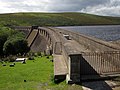 Avon Dam - geograph.org.uk - 3649440.jpg 4,000 × 3,000; 1.39 MB
-
 Avon Dam Reservoir - geograph.org.uk - 3855865.jpg 800 × 532; 118 KB
-
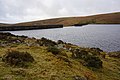 Avon Dam Reservoir - geograph.org.uk - 3855867.jpg 800 × 532; 124 KB
-
 Avon Dam Reservoir - geograph.org.uk - 5113876.jpg 4,912 × 3,240; 4.84 MB
-
 Avon Dam Reservoir - geograph.org.uk - 6315978.jpg 768 × 1,024; 219 KB
-
 Avon valley - Dartmoor - geograph.org.uk - 22856.jpg 640 × 425; 116 KB
-
 Avon valley above Avon Dam Reservoir (1793).jpg 4,288 × 2,848; 6.48 MB
-
 Avon valley above Avon Dam Reservoir (1795).jpg 4,288 × 2,848; 6.47 MB
-
-
 Avon valley near Huntingdon Cross (1785).jpg 4,288 × 2,848; 5.93 MB
-
 Avon valley near Huntingdon Cross (1791).jpg 4,288 × 2,848; 5.76 MB
-
 Back entrance to Bigadon - geograph.org.uk - 1992655.jpg 640 × 480; 522 KB
-
 Barbed wire on stile above Moorshead Brook - geograph.org.uk - 5346582.jpg 2,718 × 1,686; 896 KB
-
 Barbed wire on stile above Moorshead Brook - geograph.org.uk - 5346586.jpg 3,072 × 2,048; 1.25 MB
-
 Barn above Dean - geograph.org.uk - 1126516.jpg 640 × 480; 95 KB
-
 Barn at Nurston - geograph.org.uk - 5341382.jpg 2,787 × 1,774; 998 KB
-
 Barn at Nurston - geograph.org.uk - 5347109.jpg 3,072 × 2,048; 1.32 MB
-
 Barns at Nurston - geograph.org.uk - 5347157.jpg 3,072 × 2,048; 1.4 MB
-
 Bench mark, Harbourne Head menhir - geograph.org.uk - 6424747.jpg 2,452 × 2,451; 1.22 MB
-
 Bonfire by the Moorshead Brook - geograph.org.uk - 5346757.jpg 2,818 × 1,911; 1.38 MB
-

-
 Bowdown Cross - geograph.org.uk - 2472663.jpg 1,024 × 683; 191 KB
-
 Bowdown Cross - geograph.org.uk - 2472676.jpg 1,024 × 683; 187 KB
-
 Brent Hill from Bowdown Cross - geograph.org.uk - 2472727.jpg 1,024 × 683; 159 KB
-
 Bridge across Moorshead Brook - geograph.org.uk - 5347474.jpg 3,072 × 2,048; 1.51 MB
-
 Bridge over the Moorshead Brook at Deancombe - geograph.org.uk - 2894007.jpg 1,024 × 768; 362 KB
-
 Bridge parapet, Upper Dean - geograph.org.uk - 1128587.jpg 427 × 640; 82 KB
-
 Bridge parapet, Upper Dean - geograph.org.uk - 1128592.jpg 640 × 427; 109 KB
-
 Bridge, Upper Dean - geograph.org.uk - 1128580.jpg 427 × 640; 128 KB
-
 Bridleway at Moor Cross - geograph.org.uk - 2893959.jpg 1,024 × 768; 421 KB
-
 Bridleway from Moor Cross - geograph.org.uk - 1043603.jpg 640 × 427; 143 KB
-
 Bridleway from Moor Cross - geograph.org.uk - 6420472.jpg 4,288 × 2,848; 2.99 MB
-
 Bridleway from Moor Cross - geograph.org.uk - 6423757.jpg 4,214 × 2,848; 2.64 MB
-
 Bridleway from Moor Cross - geograph.org.uk - 6423764.jpg 4,288 × 2,848; 1.86 MB
-
 Bridleway near Harbourne Head - geograph.org.uk - 1042586.jpg 640 × 427; 62 KB
-
 Bridleway to Cross Furzes - geograph.org.uk - 4197606.jpg 640 × 425; 112 KB
-
 Bridleway to Moor Cross - geograph.org.uk - 4198594.jpg 640 × 425; 146 KB
-
 Bridleway to Moor Cross - geograph.org.uk - 6423758.jpg 4,288 × 2,848; 2.34 MB
-
 Bridleway to Moor Cross - geograph.org.uk - 6424206.jpg 4,220 × 2,262; 1.57 MB
-
 Bridleway to Skerraton Gate - geograph.org.uk - 1042625.jpg 640 × 427; 60 KB
-
 Bridleway to Skerraton Gate - geograph.org.uk - 4198586.jpg 640 × 425; 83 KB
-
 Bridleway to Skerraton Gate - geograph.org.uk - 6423977.jpg 3,662 × 2,400; 1.72 MB
-
 Brockhill Ford - geograph.org.uk - 3855871.jpg 800 × 532; 165 KB
-
 Brockhill ford1.jpg 2,048 × 1,536; 1.37 MB
-
 Brockhill Stream (1768).jpg 4,288 × 2,848; 6.48 MB
-
 Brockhill Stream - geograph.org.uk - 5954653.jpg 3,240 × 4,320; 4.07 MB
-
 Brushwood near Moorshead Brook - geograph.org.uk - 5346810.jpg 2,048 × 3,072; 1.47 MB
-
 Buckfastleigh Moor (10) - geograph.org.uk - 5954567.jpg 4,320 × 3,240; 3.38 MB
-
 Buckfastleigh Moor (11) - geograph.org.uk - 5954570.jpg 4,320 × 3,240; 4.96 MB
-
 Buckfastleigh Moor (12) - geograph.org.uk - 5954572.jpg 4,320 × 3,240; 3.99 MB
-
 Buckfastleigh Moor (13) - geograph.org.uk - 5954574.jpg 4,320 × 3,240; 3.5 MB
-
 Buckfastleigh Moor (6) - geograph.org.uk - 5954559.jpg 4,320 × 3,240; 2.77 MB
-
 Buckfastleigh Moor (7) - geograph.org.uk - 5954560.jpg 4,320 × 3,240; 2.4 MB
-
 Buckfastleigh Moor (8) - geograph.org.uk - 5954565.jpg 4,320 × 3,240; 2.81 MB
-
 Buckfastleigh Moor (9) - geograph.org.uk - 5954566.jpg 4,320 × 3,240; 3.82 MB
-
 Buckfastleigh Race Course - geograph.org.uk - 1097802.jpg 640 × 427; 51 KB
-
 Buckfastleigh Racecourse - geograph.org.uk - 1700085.jpg 1,024 × 680; 170 KB
-
 Butts Cross - geograph.org.uk - 2893985.jpg 1,024 × 768; 331 KB
-
 Cairn, Pupers Hill - geograph.org.uk - 1182323.jpg 640 × 480; 101 KB
-
 Cattle Grazing on Open Moorland - geograph.org.uk - 3646742.jpg 1,024 × 768; 385 KB
-
 Cattle near Wallaford Cross - geograph.org.uk - 1126635.jpg 640 × 378; 87 KB
-
 Clampits Stile - geograph.org.uk - 165787.jpg 640 × 480; 116 KB
-
 Clampits Stile - geograph.org.uk - 2472767.jpg 683 × 1,024; 190 KB
-
 Clampits Stile - geograph.org.uk - 2934530.jpg 800 × 600; 425 KB
-
 Clampitts Stile - geograph.org.uk - 2472751.jpg 1,024 × 683; 206 KB
-
 Clapper Bridge at Harbourneford - geograph.org.uk - 2903267.jpg 1,024 × 768; 402 KB
-
 Clapper Cottage, Upper Dean - geograph.org.uk - 1127726.jpg 640 × 427; 74 KB
-
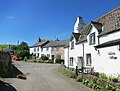
 Cottages in Dean - geograph.org.uk - 2934549.jpg 800 × 600; 335 KB
-
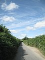
 Country Lane from Dean Prior to Smallacombe Cross - geograph.org.uk - 6586722.jpg 4,608 × 3,456; 4.56 MB
-
 Countryside by the Moorshead Brook valley - geograph.org.uk - 5347615.jpg 2,962 × 1,992; 1.29 MB
-
 Cow near Wallaford Cross - geograph.org.uk - 1126679.jpg 640 × 480; 68 KB
-
 Cow on Pupers.jpg 3,464 × 2,528; 2.25 MB
-
 Coxhill Cross - geograph.org.uk - 1125852.jpg 640 × 361; 54 KB
-
 Coxhill Cross - geograph.org.uk - 1125853.jpg 480 × 640; 85 KB
-
 Coxhill Cross, near Buckfastleigh - geograph.org.uk - 4191693.jpg 640 × 475; 58 KB
-
 Cumston Track - geograph.org.uk - 4197554.jpg 640 × 425; 64 KB
-
 Dartmoor Reservoir.jpg 2,760 × 1,863; 3.49 MB
-
 Dean Burn - geograph.org.uk - 1128606.jpg 427 × 640; 105 KB
-
 Dean Court Bungalow, Lower Dean - geograph.org.uk - 1992670.jpg 640 × 480; 363 KB
-
 Dean Cross - geograph.org.uk - 2934515.jpg 800 × 600; 415 KB
-
 Dean Moor - geograph.org.uk - 1470188.jpg 640 × 480; 88 KB
-
 Dean Moor - geograph.org.uk - 3614987.jpg 1,024 × 768; 466 KB
-
 Dean Moor, Dartmoor - geograph.org.uk - 98973.jpg 640 × 425; 138 KB
-
 Dean Prior , Devon Expressway A38 - geograph.org.uk - 6339748.jpg 6,000 × 4,000; 7 MB
-
 Dean Prior , Devon Expressway A38 - geograph.org.uk - 6339750.jpg 6,000 × 4,000; 7.54 MB
-
 Dean Prior , Devon Expressway A38 - geograph.org.uk - 6339751.jpg 6,000 × 4,000; 5.66 MB
-
 Dean Prior , Devon Expressway A38 - geograph.org.uk - 6339752.jpg 6,000 × 4,000; 5.86 MB
-
 Dean Prior , Devon Expressway A38 - geograph.org.uk - 6339753.jpg 6,000 × 4,000; 6.09 MB
-
 Dean Prior - geograph.org.uk - 1097728.jpg 640 × 427; 93 KB
-
 Dean Prior - geograph.org.uk - 1097762.jpg 640 × 427; 68 KB
-
 Dean Prior ordanance survey snip.png 493 × 473; 586 KB
-
 Dean Prior Parish Church. St George the Martyr - geograph.org.uk - 6586747.jpg 4,608 × 3,456; 3.95 MB
-
 Dean Prior population 201 - 2011.png 500 × 400; 10 KB
-
 Dean Prior, Dean Moor - geograph.org.uk - 2538249.jpg 640 × 427; 401 KB
-
-
 Dean Wood - South Devon - geograph.org.uk - 116595.jpg 640 × 481; 111 KB
-
 Derelict Farm Buildings near Lower Dean - geograph.org.uk - 2443518.jpg 4,000 × 3,000; 4.33 MB
-
 Derelict Rover Motor car, Upper Dean - geograph.org.uk - 1127695.jpg 640 × 427; 99 KB
-
 Descending on the Two Moors Way - geograph.org.uk - 1175232.jpg 640 × 427; 206 KB
-
 Disused Grandstand, Dean Prior, Devon - geograph.org.uk - 88335.jpg 640 × 427; 172 KB
-
 Disused pit shaft - geograph.org.uk - 991186.jpg 640 × 427; 121 KB
-
 Dockwell Hole - geograph.org.uk - 6420538.jpg 4,288 × 2,848; 2.86 MB
-
 Double field boundary, Skerraton Down - geograph.org.uk - 6424153.jpg 4,102 × 2,533; 2.79 MB
-
 Dry Bridge over A38 near Drybridge Cross - geograph.org.uk - 2826098.jpg 800 × 600; 300 KB
-
 Dry Bridge, Dean Prior, Devon - geograph.org.uk - 88331.jpg 640 × 427; 241 KB
-
 Edge of a field of maize - geograph.org.uk - 1992656.jpg 640 × 480; 482 KB
-

-
 Farm buildings at Addislade - geograph.org.uk - 5347085.jpg 2,317 × 1,302; 668 KB
-
 Farm buildings at Addislade - geograph.org.uk - 5347097.jpg 3,072 × 2,048; 1.15 MB
-
 Farm buildings at Nurston - geograph.org.uk - 5347137.jpg 3,068 × 1,863; 1.2 MB
-
 Farm buildings at Nurston - geograph.org.uk - 5347169.jpg 2,793 × 1,958; 1.05 MB
-
 Farm track to Reddacleave - geograph.org.uk - 6423492.jpg 3,998 × 2,602; 1.53 MB
-
 Farmland near Reddacleave - geograph.org.uk - 6427124.jpg 2,896 × 1,600; 860 KB
-
 Farmland west of Dean Prior - geograph.org.uk - 5346529.jpg 3,072 × 2,048; 1.46 MB
-
 Farmland west of Dean Prior - geograph.org.uk - 5346538.jpg 3,072 × 2,048; 1.72 MB
-
 Field and gate above Dean Cross - geograph.org.uk - 2934520.jpg 800 × 600; 322 KB
-
 Field by Moorshead Brook - geograph.org.uk - 5346804.jpg 3,072 × 2,048; 1.49 MB
-
 Field enclosures at Huntingdon Warren - geograph.org.uk - 4193119.jpg 1,600 × 1,067; 497 KB
-
 Field Enclosures on Huntingdon Warren - geograph.org.uk - 3646714.jpg 1,024 × 768; 422 KB
-
 Field near Addisdale - geograph.org.uk - 5346983.jpg 3,072 × 2,048; 1.44 MB
-
 Field near Addisdale - geograph.org.uk - 5347073.jpg 3,072 × 2,048; 1.39 MB
-
 Field near Coxhill Cross - geograph.org.uk - 3922444.jpg 1,920 × 1,234; 701 KB
-
 Field near Moor Cross - geograph.org.uk - 6423756.jpg 4,288 × 2,848; 2.49 MB
-
 Field near Wallaford Cross - geograph.org.uk - 4002336.jpg 1,920 × 1,093; 485 KB
-
 Field south of Skerraton Gate - geograph.org.uk - 6424064.jpg 4,288 × 2,848; 1.93 MB
-
 Footbridge, A38 - geograph.org.uk - 4765397.jpg 640 × 369; 43 KB
-
 Footpath at Nurston - geograph.org.uk - 5347304.jpg 3,072 × 2,048; 1.52 MB
-
 Footpath in Avon valley near the dam (1757).jpg 4,288 × 2,848; 6.49 MB
-
 Ford below Brockhill Mire - geograph.org.uk - 987383.jpg 640 × 427; 104 KB
-
 Ford near Brockhill Mire - geograph.org.uk - 1541146.jpg 640 × 480; 96 KB
-
 Ford near Huntingdon Cross - geograph.org.uk - 990945.jpg 640 × 427; 86 KB
-
 Ford, Moorshead Brook - geograph.org.uk - 5346762.jpg 2,048 × 3,072; 1.5 MB
-
 Ford, Moorshead Brook - geograph.org.uk - 5346769.jpg 3,072 × 2,048; 1.78 MB
-
 From O Pupers last light-3 crop.jpg 3,600 × 1,869; 2.66 MB
-
 From O Pupers last light-3.jpg 3,600 × 1,954; 2.54 MB
-
 Gidley Bridge - geograph.org.uk - 4198621.jpg 640 × 425; 141 KB
-
 Gidley Bridge - geograph.org.uk - 6420463.jpg 4,288 × 2,848; 2.7 MB
-
 Gidley Bridge - geograph.org.uk - 6423287.jpg 3,997 × 2,670; 1.59 MB
-
 Gidley Bridge - geograph.org.uk - 6423436.jpg 4,288 × 2,848; 2.12 MB
-
 Gorse bush near Moorshead Brook - geograph.org.uk - 5347315.jpg 3,072 × 2,048; 1.62 MB
-
 Gorse on Hickaton Hill - geograph.org.uk - 1175238.jpg 640 × 427; 168 KB
-
 Granite rock near Smallbrook Plains - geograph.org.uk - 6425432.jpg 4,288 × 2,848; 2.63 MB
-
 Green lane entrance near Clampitts Stile - geograph.org.uk - 2472737.jpg 1,024 × 683; 328 KB
-
 Green lane to Higher Dean - geograph.org.uk - 1126535.jpg 640 × 491; 123 KB
-
 Green lane to Higher Dean - geograph.org.uk - 4002177.jpg 1,920 × 2,422; 1.1 MB
-
 Green lane, Bowdown Cross - geograph.org.uk - 1086355.jpg 640 × 480; 95 KB
-
 Green lane, Reddacleave Brakes - geograph.org.uk - 6423908.jpg 4,288 × 2,848; 2.82 MB
-
 Gripper's Hill - geograph.org.uk - 1043510.jpg 640 × 427; 78 KB
-
 Gripper's Hill - geograph.org.uk - 1043519.jpg 640 × 427; 92 KB
-
 Harbourne Head - geograph.org.uk - 6420487.jpg 4,288 × 2,848; 2.47 MB
-
 Harbourne Head - geograph.org.uk - 6424879.jpg 4,073 × 2,835; 2.57 MB
-
 Harbourne Head - geograph.org.uk - 6424919.jpg 4,288 × 2,848; 2.38 MB
-
 Harbourne Head menhir - geograph.org.uk - 6424671.jpg 2,848 × 4,288; 2.2 MB
-
 Harbourne Head menhir.jpg 1,543 × 2,319; 2.38 MB
-
 Harbourne valley - geograph.org.uk - 6424962.jpg 4,288 × 2,848; 2.42 MB
-
 Harbourneford footbridge - geograph.org.uk - 2933371.jpg 800 × 600; 517 KB
-
 Hedgebank above Moorshead Brook - geograph.org.uk - 5346961.jpg 3,072 × 2,048; 1.53 MB
-
 Hedgebank above Moorshead Brook - geograph.org.uk - 5347008.jpg 3,072 × 2,048; 1.38 MB
-
 Hedgebank above Moorshead Brook - geograph.org.uk - 5347065.jpg 3,072 × 2,048; 1.42 MB
-
 Hickaton Hill - geograph.org.uk - 991207.jpg 640 × 427; 106 KB
-
 Hillside above Moorshead Brook - geograph.org.uk - 5347531.jpg 2,903 × 1,751; 1.29 MB
-
 Hillside, Lower Dean - geograph.org.uk - 1206165.jpg 640 × 480; 81 KB
-
 Housing on Timbers Road, Buckfastleigh - geograph.org.uk - 1125854.jpg 640 × 480; 102 KB
-
 Huntingdon Mine wheel pit - geograph.org.uk - 4196986.jpg 1,600 × 1,067; 855 KB
-
 Huntingdon Tin Mine - geograph.org.uk - 1481934.jpg 640 × 473; 104 KB
-
 Huntingdon Warren - geograph.org.uk - 830807.jpg 640 × 480; 82 KB
-
 Huntingdon wheelpit2.jpg 1,536 × 2,048; 1.38 MB
-
 Hut circle north of Avon Dam Reservoir (1770).jpg 4,288 × 2,848; 6.28 MB
-
 Hut circle north of Avon Dam Reservoir (1771).jpg 4,288 × 2,848; 6.43 MB
-
 Hut circle north of Avon Dam Reservoir (1772).jpg 4,288 × 2,848; 6.59 MB
-
 Ice on Avon Reservoir.jpg 3,742 × 2,654; 3.18 MB
-
 Jawbone on Dean Moor - geograph.org.uk - 6424922.jpg 2,376 × 3,724; 1.66 MB
-
 Keble Martin Chapel incised cross - geograph.org.uk - 381521.jpg 640 × 480; 184 KB
-
 Keble Martin Chapel, Dartmoor - geograph.org.uk - 381510.jpg 640 × 480; 149 KB
-
 Landscape near Clampits Stile - geograph.org.uk - 5109912.jpg 4,000 × 3,000; 2.83 MB
-
 Lane above the Harbourne valley - geograph.org.uk - 1086525.jpg 640 × 480; 135 KB
-
 Lane at Zempson Cross - geograph.org.uk - 1086505.jpg 640 × 480; 124 KB


.jpg)


.jpg)
.jpg)

.jpg)
.jpg)


.jpg)


_-_geograph.org.uk_-_5954567.jpg)
_-_geograph.org.uk_-_5954570.jpg)
_-_geograph.org.uk_-_5954572.jpg)
_-_geograph.org.uk_-_5954574.jpg)
_-_geograph.org.uk_-_5954559.jpg)
_-_geograph.org.uk_-_5954560.jpg)
_-_geograph.org.uk_-_5954565.jpg)
_-_geograph.org.uk_-_5954566.jpg)


.jpg)


.jpg)
.jpg)
.jpg)


