Category:Dead trees in California
Jump to navigation
Jump to search
States of the United States: Arizona · California · Colorado · Idaho · Illinois · Indiana · Michigan · Montana · New Mexico · North Carolina · Ohio · Oregon · South Carolina · Texas · Utah · Washington · Wyoming
Media in category "Dead trees in California"
The following 36 files are in this category, out of 36 total.
-
 160000-FS-Tahoe-MR-001 (32665645761).jpg 3,000 × 2,000; 4.04 MB
-
 Cooper's hawk, California (50042097036).jpg 2,000 × 1,429; 773 KB
-
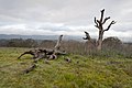
 Dead and dying trees in Blue Canyon (30955166461).jpg 640 × 480; 112 KB
-
 Dead and dying trees on forested landscape (30277842923).jpg 917 × 1,024; 176 KB
-
 Dead Cypress at 17-Mile Drive 2013.jpg 4,926 × 3,263; 7.16 MB
-
 Dead tree at Bumpass Hell parking lot, Lassen Volcanic National Park.jpg 5,714 × 4,415; 16.62 MB
-
 Dead tree at Rush Creek Open Space Preserve, Novato.jpg 4,769 × 3,179; 10.31 MB
-

-
 Dead Tree near Rush Creek Preserve, Novato California.jpg 2,448 × 3,264; 3.27 MB
-
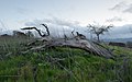
 Dead wood (33534291955).jpg 2,048 × 1,459; 5.27 MB
-
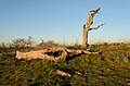
 Dead Wood (8025095336).jpg 3,888 × 2,592; 8.61 MB
-
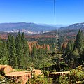
 Fall colors, Lassen NP (9734349639).jpg 4,928 × 3,264; 8.22 MB
-
 Life and Death (16443510370).jpg 5,346 × 3,282; 14.79 MB
-
 Mirror (62162969).jpeg 2,048 × 1,360; 1.27 MB
-
 Point Lobos SNR 1989 05.jpg 972 × 650; 881 KB
-
 Reach (119309401).jpeg 2,046 × 2,048; 611 KB
-
 Salton City (March 2014) 14.JPG 4,512 × 2,930; 4.19 MB
-
 Salton City (March 2014) 15.JPG 4,512 × 2,392; 3.32 MB
-
 Salton City (March 2014) 16.JPG 2,865 × 3,873; 3.73 MB
-
 Standing Dead (30924867171).jpg 768 × 1,024; 259 KB
-
 Standing watch (32081715620).jpg 1,463 × 2,048; 2.98 MB
-
 Stanford Dish April 2011 001.jpg 4,368 × 2,912; 2.92 MB
-
 Stanford Dish February 2013 019.jpg 4,928 × 3,264; 6.72 MB
-
 Stanford Dish February 2013 020.jpg 4,928 × 3,264; 7.61 MB
-
 Stanford Dish February 2013 035.jpg 4,800 × 3,200; 6.99 MB
-
 Stanford Dish January 2013 004.jpg 4,928 × 3,264; 8.39 MB
-
 Stanford Dish January 2013 008.jpg 4,928 × 3,264; 7.53 MB
-
 Stanford Dish March 2013 009.jpg 4,928 × 3,080; 6.32 MB
-
 Tree Mortality in the SCE Utility Corridor (31038689505).jpg 1,024 × 1,024; 212 KB
-
 Tree Mortality in the WUI (30896415672).jpg 3,900 × 2,616; 9.52 MB
-
 TreeKill.jpg 829 × 619; 169 KB
-

-
 What is left? (2046207508).jpg 800 × 1,200; 433 KB
-
 Wounded Tree (156484379).jpeg 2,048 × 1,365; 865 KB
-
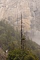 Yosemite Falls Trail May 2011 004.jpg 2,560 × 3,840; 5.29 MB
-
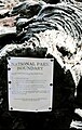 Yosemite N.P., carteles 1989 01.jpg 658 × 1,038; 912 KB
.jpg)
.jpg)
.jpg)
.jpg)


.jpeg)

.jpg)
.jpg)
.jpg)
.jpg)
.jpeg)

.jpeg)
_14.JPG)
_15.JPG)
_16.JPG)
.jpg)
.jpg)


.jpg)
.jpg)


.jpg)
.jpeg)

