Category:De Vriendschap, Bleskensgraaf
Jump to navigation
Jump to search
| Object location | | View all coordinates using: OpenStreetMap |
|---|
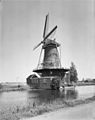
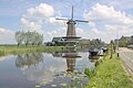
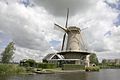
windmill in Bleskensgraaf, Netherlands  | |||||
| Upload media | |||||
| Instance of | |||||
|---|---|---|---|---|---|
| Location | Bleskensgraaf, South Holland, Netherlands | ||||
| Street address |
| ||||
| Located on street |
| ||||
| Has use | |||||
| Heritage designation |
| ||||
| Source of energy | |||||
 | |||||
|
This is a category about rijksmonument number 9633
|
| Address |
|
Media in category "De Vriendschap, Bleskensgraaf"
The following 24 files are in this category, out of 24 total.
-
 Around holland - Flickr - bertknot.jpg 2,312 × 1,720; 1.33 MB
-
 Bleskensgraaf - molen de Vriendschap - panoramio - Rokus C (1).jpg 1,504 × 1,000; 148 KB
-
 Bleskensgraaf - molen de Vriendschap - panoramio - Rokus C (2).jpg 1,000 × 1,504; 128 KB
-
 Bleskensgraaf - molen de Vriendschap - panoramio - Rokus C.jpg 1,504 × 1,000; 177 KB
-
 Bleskensgraaf - molen de Vriendschap - panoramio.jpg 1,000 × 1,504; 157 KB
-
 Bleskensgraaf - molen De Vriendschap.jpg 1,400 × 2,100; 1.59 MB
-
 Bleskensgraaf De Vriendschap.jpg 3,456 × 4,608; 6.34 MB
-
 Bleskensgraaf, molen foto1 2007-03-15 14.33.JPG 1,704 × 2,272; 1.96 MB
-
 De linge (8230679337).jpg 2,272 × 1,704; 1 MB
-
 De Vriendschap Bleskensgraaf.jpg 850 × 637; 66 KB
-
 De Vriendschap.JPG 1,248 × 936; 258 KB
-

-
 Exterieur OVERZICHT - Bleskensgraaf - 20276764 - RCE.jpg 953 × 1,200; 213 KB
-
 Molen De Vriendschap aan de Alblas - Bleskensgraaf - 20466445 - RCE.jpg 1,200 × 900; 116 KB
-
 Molen De Vriendschap.jpg 4,770 × 3,177; 2.13 MB
-
 Molenfotoo's (171).jpg 1,932 × 2,576; 687 KB
-
 Overzicht van de molen - Bleskensgraaf - 20421094 - RCE.jpg 1,200 × 800; 173 KB
-
 Overzicht van de molen - Bleskensgraaf - 20421095 - RCE.jpg 1,200 × 800; 137 KB
-
 Overzicht van de molen - Bleskensgraaf - 20421096 - RCE.jpg 1,200 × 800; 159 KB
-
 Overzicht van de molen aan het water - Bleskensgraaf - 20421093 - RCE.jpg 1,200 × 800; 175 KB
-

-

-
 Vriendschap-Bleskensgraaf.JPG 388 × 583; 61 KB
-
 Windmill "De Vriendschap" (Friendship) , Bleskensgraaf (17295951116).jpg 3,937 × 5,906; 10.3 MB

.jpg)
.jpg)


.jpg)


.jpg)


_,_Bleskensgraaf_(17295951116).jpg)