Category:De Tuin (Groningen)
Jump to navigation
Jump to search
| Object location | | View all coordinates using: OpenStreetMap |
|---|
 | |||||
| Upload media | |||||
| Instance of | |||||
|---|---|---|---|---|---|
| Location | Groningen, Netherlands | ||||
| Street address |
| ||||
| Located on street |
| ||||
| Architectural style | |||||
| Architect | |||||
| Has use | |||||
| Heritage designation |
| ||||
| Inception |
| ||||
 | |||||
Nederlands: De Tuin, voormalig klooster, 1908, A.Th. van Elmpt
|
This is a category about rijksmonument number 485413
|
| Address |
|
Media in category "De Tuin (Groningen)"
The following 12 files are in this category, out of 12 total.
-
 Groningen - De Tuin - binnentuin (1).jpg 6,000 × 4,000; 9.72 MB
-
 Groningen - De Tuin - binnentuin (2).jpg 6,000 × 4,000; 7.54 MB
-
 Groningen - De Tuin - bovenverdieping.jpg 4,827 × 3,218; 8.64 MB
-
 Groningen - De Tuin - Eeterie de Globe.jpg 5,640 × 3,760; 7.54 MB
-
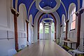
 Groningen - De Tuin - gang.jpg 3,986 × 5,979; 6.41 MB
-
 Groningen - De Tuin - gevelsteen.jpg 2,755 × 1,837; 3.67 MB
-
 Groningen - De Tuin - kapel (1).jpg 3,647 × 5,471; 6.82 MB
-
 Groningen - De Tuin - kapel (2).jpg 6,000 × 4,000; 7.84 MB
-
 Groningen - De Tuin - lichthof.jpg 4,000 × 6,000; 7.9 MB
-
 Groningen - Humanitas - binnentuin (1).jpg 6,000 × 4,000; 7.47 MB
-
 Groningen Akerkhof 22.JPG 3,264 × 2,448; 4.81 MB
-
 Overzicht kerktoren en zuidgevel - Groningen - 20330524 - RCE.jpg 956 × 1,200; 253 KB
.jpg)
.jpg)


.jpg)
.jpg)

.jpg)
