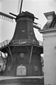
Category:De Ster, Winsum
Jump to navigation
Jump to search
| Object location | | View all coordinates using: OpenStreetMap |
|---|
windmill in Winsum, Netherlands  | |||||
| Upload media | |||||
| Instance of | |||||
|---|---|---|---|---|---|
| Location | Winsum, Het Hogeland, Groningen, Netherlands | ||||
| Street address |
| ||||
| Located on street |
| ||||
| Has use | |||||
| Heritage designation |
| ||||
| Inception |
| ||||
| Source of energy | |||||
 | |||||
Nederlands: Koren- en pelmolen De Ster
|
This is a category about rijksmonument number 39032
|
| Address |
|
Media in category "De Ster, Winsum"
The following 27 files are in this category, out of 27 total.
-

-
 Interieur van korenmolen De Ster te Winsum - Winsum - 20351970 - RCE.jpg 1,200 × 790; 190 KB
-
 Kerkstraat - Winsum - 20215130 - RCE.jpg 1,200 × 1,200; 284 KB
-
 Koren- en Pelmolen, "De Ster", aanzicht - Winsum - 20215078 - RCE.jpg 1,200 × 1,170; 227 KB
-
 Koren- en Pelmolen, "De Ster", aanzicht - Winsum - 20215079 - RCE.jpg 1,200 × 1,128; 333 KB
-
 Korenmolen "De Ster", aanzicht - Winsum - 20215080 - RCE.jpg 788 × 1,200; 195 KB
-
 Korenmolen "De Ster", details - Winsum - 20215081 - RCE.jpg 790 × 1,200; 203 KB
-
 Korenmolen "De Ster", details - Winsum - 20215082 - RCE.jpg 1,200 × 800; 268 KB
-
 Korenmolen "De Ster", details - Winsum - 20215083 - RCE.jpg 1,200 × 794; 209 KB
-
 Korenmolen "De Ster", details - Winsum - 20215084 - RCE.jpg 1,200 × 785; 148 KB
-
 Korenmolen De Ster te Winsum van achteren gefotografeerd - Winsum - 20215142 - RCE.jpg 1,188 × 1,200; 259 KB
-
 Korenmolen, Hoofdstraat - Winsum - 20215093 - RCE.jpg 1,200 × 1,200; 292 KB
-
 Molen De Ster Winsum.jpg 1,704 × 2,272; 876 KB
-
 Molens, diversen - Winsum - 20215090 - RCE.jpg 1,200 × 1,200; 259 KB
-
 Molens, diversen - Winsum - 20215091 - RCE.jpg 1,200 × 1,193; 276 KB
-
 Molenstraat - Winsum - 20215140 - RCE.jpg 1,200 × 1,199; 296 KB
-
 Overzicht linker zijgevel met straatbeeld - Winsum - 20364315 - RCE.jpg 1,200 × 956; 229 KB
-

-

-
 Praedimiusstraat - Winsum - 20215122 - RCE.jpg 1,200 × 1,192; 286 KB
-
 Praediniusstraat - Winsum - 20215157 - RCE.jpg 1,200 × 1,200; 275 KB
-
 Praediniusstraat - Winsum - 20215158 - RCE.jpg 1,197 × 1,200; 353 KB
-
 Praediniusstraat - Winsum - 20215159 - RCE.jpg 1,195 × 1,200; 254 KB
-
 W aanzicht - Winsum - 20215032 - RCE.jpg 1,200 × 1,200; 324 KB
-
 Winsum - Molenstraat.jpg 3,835 × 2,877; 4.02 MB
-
 Winsumerdiep Noord - Winsum - 20215189 - RCE.jpg 1,190 × 1,200; 325 KB
-
 Zijaanzicht van koren- pelmolen De Ster - Winsum - 20469653 - RCE.jpg 1,200 × 900; 118 KB


