Category:De Meijershof, Borne
Jump to navigation
Jump to search
| Object location | | View all coordinates using: OpenStreetMap |
|---|
 | |||||
| Upload media | |||||
| Instance of | |||||
|---|---|---|---|---|---|
| Part of | |||||
| Location | Borne, Overijssel, Netherlands | ||||
| Street address |
| ||||
| Located on street |
| ||||
| Heritage designation |
| ||||
 | |||||
|
This is a category about rijksmonumentcomplex number 527731
|
Boerderij
|
This is a category about rijksmonument number 526231
|
Wagenschuur
|
This is a category about rijksmonument number 527732
|
| Address |
|
Media in category "De Meijershof, Borne"
The following 8 files are in this category, out of 8 total.
-
 Aanzicht (1879) - Borne - 20038543 - RCE.jpg 1,200 × 811; 327 KB
-
 Aanzicht (1879) - Borne - 20038544 - RCE.jpg 1,200 × 816; 266 KB
-
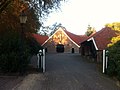
 Borne, Meijershof.JPG 4,000 × 3,000; 4.79 MB
-
 Meijershof, wagenloods.JPG 4,000 × 2,513; 3.73 MB
-
 Rijksmonument-526231-20111027004056.jpg 1,920 × 1,434; 740 KB
-
 Zij- en voorgevel nr. F 66-16 - Borne - 20477906 - RCE.jpg 1,200 × 900; 167 KB
-
 Zijgevel nr. F 66-18 - Borne - 20477907 - RCE.jpg 1,200 × 900; 190 KB
-
 Zijgevel nr. F 66-20 - Borne - 20477905 - RCE.jpg 1,200 × 900; 186 KB
_-_Borne_-_20038543_-_RCE.jpg)
_-_Borne_-_20038544_-_RCE.jpg)


