Category:De Hoop, Swartbroek
Jump to navigation
Jump to search
| Object location | | View all coordinates using: OpenStreetMap |
|---|
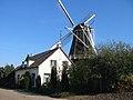
windmill in Swartbroek, Netherlands  | |||||
| Upload media | |||||
| Instance of | |||||
|---|---|---|---|---|---|
| Location | Swartbroek, Weert, Limburg, Netherlands | ||||
| Street address |
| ||||
| Located on street |
| ||||
| Has use | |||||
| Heritage designation |
| ||||
| Source of energy | |||||
 | |||||
|
This is a category about rijksmonument number 38468
|
| Address |
|
Media in category "De Hoop, Swartbroek"
The following 50 files are in this category, out of 50 total.
-

-
-

-

-

-
 De molenmakers worden gefeliciteerd - Swartbroek - 20296657 - RCE.jpg 1,200 × 1,200; 197 KB
-
 Exterieur IN BEDRIJFSTELLING - Swartbroek - 20296632 - RCE.jpg 1,191 × 1,200; 251 KB
-
 Interieur van achtkante stellingmolen - AMR Molenfoto - 20539155 - RCE.jpg 1,200 × 900; 184 KB
-
 Interieur van achtkante stellingmolen - AMR Molenfoto - 20539156 - RCE.jpg 1,200 × 900; 174 KB
-
 Interieur van achtkante stellingmolen - AMR Molenfoto - 20539157 - RCE.jpg 1,200 × 900; 188 KB
-
 Interieur van achtkante stellingmolen - AMR Molenfoto - 20539158 - RCE.jpg 1,200 × 900; 192 KB
-
 Interieur van achtkante stellingmolen - AMR Molenfoto - 20539159 - RCE.jpg 1,200 × 900; 180 KB
-
 Interieur van achtkante stellingmolen - AMR Molenfoto - 20539160 - RCE.jpg 1,200 × 900; 161 KB
-
 Interieur van achtkante stellingmolen - AMR Molenfoto - 20539161 - RCE.jpg 1,200 × 900; 202 KB
-
 Interieur van achtkante stellingmolen - AMR Molenfoto - 20539162 - RCE.jpg 1,200 × 900; 179 KB
-
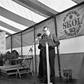
 INTERIEUR, TOESPRAAK - Swartbroek - 20296654 - RCE.jpg 1,200 × 1,200; 164 KB
-
 INTERIEUR, TOESPRAAK VAN BURGEMEESTER - Swartbroek - 20296655 - RCE.jpg 1,200 × 1,200; 193 KB
-
 Karakteristieke landschappen, korenmolens, zwartbroek, Bestanddeelnr 164-0239.jpg 3,302 × 2,374; 968 KB
-
 Korenmolen "De Hoop", aanzicht - Swartbroek - 20206962 - RCE.jpg 1,200 × 1,156; 245 KB
-
 Korenmolen "De Hoop", aanzicht - Swartbroek - 20206963 - RCE.jpg 1,200 × 1,144; 233 KB
-
 Korenmolen "De Hoop", aanzicht - Swartbroek - 20206964 - RCE.jpg 1,200 × 1,165; 227 KB
-
 Korenmolen "De Hoop", detail spoorwiel - Swartbroek - 20206972 - RCE.jpg 1,200 × 1,191; 301 KB
-
 Korenmolen "De Hoop", detail spoorwiel - Swartbroek - 20206973 - RCE.jpg 1,200 × 1,200; 330 KB
-
 Korenmolen "De Hoop", detail spoorwiel - Swartbroek - 20206974 - RCE.jpg 1,200 × 1,195; 248 KB
-
 Korenmolen "De Hoop", detail spoorwiel - Swartbroek - 20206975 - RCE.jpg 1,200 × 1,200; 309 KB
-
 Korenmolen "De Hoop", exterieur - Swartbroek - 20206977 - RCE.jpg 1,193 × 1,200; 210 KB
-
 Korenmolen "De Hoop", exterieur - Swartbroek - 20206978 - RCE.jpg 1,188 × 1,200; 271 KB
-
 Korenmolen "De Hoop", exterieur - Swartbroek - 20206979 - RCE.jpg 1,200 × 1,191; 237 KB
-
 Korenmolen "De Hoop", in restauratie - Swartbroek - 20206981 - RCE.jpg 1,200 × 1,193; 228 KB
-
 Korenmolen "De Hoop", in restauratie - Swartbroek - 20206982 - RCE.jpg 1,200 × 1,200; 284 KB
-
 Korenmolen "De Hoop", molenmaker bij de staart - Swartbroek - 20206980 - RCE.jpg 1,200 × 1,200; 249 KB
-
 Korenmolen "De Hoop", molenstomp - Swartbroek - 20206969 - RCE.jpg 1,188 × 1,200; 246 KB
-
 Korenmolen "De Hoop", overzicht - Swartbroek - 20206966 - RCE.jpg 1,200 × 1,183; 212 KB
-
 Korenmolen "De Hoop", overzicht - Swartbroek - 20206967 - RCE.jpg 1,200 × 1,179; 247 KB
-
 Korenmolen "De Hoop", overzicht - Swartbroek - 20206968 - RCE.jpg 1,200 × 1,188; 200 KB
-
 Korenmolen "De Hoop", overzicht - Swartbroek - 20206971 - RCE.jpg 1,200 × 1,200; 234 KB
-
 Korenmolen "De Hoop", overzicht - Swartbroek - 20206983 - RCE.jpg 1,200 × 1,195; 249 KB
-
 Korenmolen "De Hoop", overzicht - Swartbroek - 20206984 - RCE.jpg 1,191 × 1,200; 305 KB
-
 Korenmolen "De Hoop", tijdens restauratie - Swartbroek - 20206970 - RCE.jpg 1,193 × 1,200; 324 KB
-

-

-

-
 Korenmolen na verhoging - Swartbroek - 20206976 - RCE.jpg 1,197 × 1,200; 222 KB
-
 Molen, in restauratie - Swartbroek - 20206986 - RCE.jpg 1,200 × 1,200; 249 KB
-
 Molenmaker wordt geridderd door burgemeester - Swartbroek - 20296656 - RCE.jpg 1,200 × 1,184; 178 KB
-
 Molenmakerij, bouten smeden - Swartbroek - 20206985 - RCE.jpg 1,200 × 1,200; 289 KB
-
 Swartbroek DeHoop 01.jpg 3,000 × 4,000; 1.98 MB
-
 Swartbroek DeHoop.jpg 4,000 × 3,000; 1.76 MB
-
 Vergezicht met achtkante stellingmolen - AMR Molenfoto - 20539150 - RCE.jpg 1,200 × 900; 162 KB
-
 Vergezicht met achtkante stellingmolen - AMR Molenfoto - 20539151 - RCE.jpg 1,200 × 900; 163 KB


