Category:De Hamse Molen, Wanroij
Jump to navigation
Jump to search
| Object location | | View all coordinates using: OpenStreetMap |
|---|
windmill in Wanroij, Netherlands  | |||||
| Upload media | |||||
| Instance of | |||||
|---|---|---|---|---|---|
| Location | Wanroij, North Brabant, Netherlands | ||||
| Street address |
| ||||
| Located on street |
| ||||
| Has use | |||||
| Heritage designation |
| ||||
| Source of energy | |||||
 | |||||
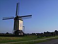
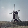
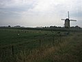
Nederlands: De Hamse molen, in de volksmond ook wel De Ster genoemd, is een maalvaardige standerdmolen in de Noord-Brabantse plaats Wanroij, die werd gebouwd van 1810 tot 1811. Na een restauratie in 1950 werd ze verwaarloosd en stortte de molen in 1974 elkaar, waarna ze in 1977 werd herbouwd.
|
This is a category about rijksmonument number 369534
|
| Address |
|
Media in category "De Hamse Molen, Wanroij"
The following 36 files are in this category, out of 36 total.
-
 2007-10-06 11.25 Wanroij, molen1.JPG 3,072 × 2,304; 1.7 MB
-
 Bovenas van standerdmolen, na instorting - Wanroij - 20249265 - RCE.jpg 1,200 × 795; 215 KB
-

-

-
 Overzicht - Wanroij - 20361398 - RCE.jpg 1,200 × 1,200; 223 KB
-
 Overzicht windmolen, standerdkorenmolen - Wanroij - 20348249 - RCE.jpg 1,190 × 1,200; 450 KB
-
 Overzicht windmolen, standerdkorenmolen - Wanroij - 20348250 - RCE.jpg 1,188 × 1,200; 358 KB
-
 Overzicht windmolen, standerdkorenmolen - Wanroij - 20348885 - RCE.jpg 783 × 1,200; 248 KB
-
 Overzicht windmolen, standerdkorenmolen - Wanroij - 20348887 - RCE.jpg 783 × 1,200; 196 KB
-
 Overzicht windmolen, standerdkorenmolen - Wanroij - 20348888 - RCE.jpg 783 × 1,200; 165 KB
-
 Restant van standerdmolen, na instorting - Wanroij - 20403602 - RCE.jpg 804 × 1,200; 134 KB
-
 Restanten van omgewaaide molen - Wanroij - 20401417 - RCE.jpg 1,200 × 805; 156 KB
-
 Restanten van omgewaaide molen - Wanroij - 20401418 - RCE.jpg 1,200 × 800; 165 KB
-

-
 Standaardmolen - Wanroij - 20249250 - RCE.jpg 958 × 1,200; 185 KB
-
 Standaardmolen - Wanroij - 20249251 - RCE.jpg 773 × 1,200; 151 KB
-
 Standaardmolen - Wanroij - 20249252 - RCE.jpg 770 × 1,200; 116 KB
-
 Standaardmolen De Ster - Wanroij - 20249253 - RCE.jpg 1,200 × 1,190; 169 KB
-
 Standaardmolen De Ster - Wanroij - 20249254 - RCE.jpg 1,200 × 1,188; 156 KB
-
 Standaardmolen De Ster - Wanroij - 20249255 - RCE.jpg 1,200 × 1,186; 183 KB
-
 Standaardmolen De Ster - Wanroij - 20249256 - RCE.jpg 1,200 × 1,197; 198 KB
-
 Standaardmolen De Ster - Wanroij - 20249257 - RCE.jpg 1,200 × 1,078; 150 KB
-
 Standaardmolen De Ster - Wanroij - 20249258 - RCE.jpg 1,200 × 1,197; 230 KB
-
 Standaardmolen, bovenwiel - Wanroij - 20249264 - RCE.jpg 1,200 × 887; 287 KB
-
 Standaardmolen, detail - Wanroij - 20249260 - RCE.jpg 792 × 1,200; 217 KB
-
 Standaardmolen, gedeelte gebroken askop - Wanroij - 20249261 - RCE.jpg 804 × 1,200; 330 KB
-
 Standaardmolen, halssteen - Wanroij - 20249263 - RCE.jpg 1,200 × 797; 240 KB
-
 Standaardmolen, omgewaaid 3 juli 1974 - Wanroij - 20249268 - RCE.jpg 1,200 × 790; 171 KB
-
 Standaardmolen, overzicht - Wanroij - 20249259 - RCE.jpg 798 × 1,200; 155 KB
-
 Standaardmolen, vang - Wanroij - 20249262 - RCE.jpg 1,200 × 797; 281 KB
-
 Standerdmolen, in restauratie - Wanroij - 20249269 - RCE.jpg 1,200 × 1,183; 229 KB
-
 Standerdmolen, in restauratie - Wanroij - 20249270 - RCE.jpg 1,200 × 1,188; 235 KB
-
 Standerdmolen, ophanging staart - Wanroij - 20249273 - RCE.jpg 1,200 × 1,195; 185 KB
-
 Standerdmolen, overzicht - Wanroij - 20249272 - RCE.jpg 1,200 × 1,200; 207 KB
-
 Steenbalk van standerdmolen, na instorting - Wanroij - 20249267 - RCE.jpg 1,200 × 799; 260 KB
-
 WanroijMolen.jpg 640 × 480; 36 KB


