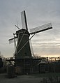
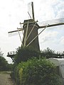
Category:De Eendracht, Dirksland
Jump to navigation
Jump to search
| Object location | | View all coordinates using: OpenStreetMap |
|---|
windmill in Dirksland, Netherlands  | |||||
| Upload media | |||||
| Instance of | |||||
|---|---|---|---|---|---|
| Location | Dirksland, South Holland, Netherlands | ||||
| Street address |
| ||||
| Located on street |
| ||||
| Has use | |||||
| Heritage designation |
| ||||
| Source of energy | |||||
 | |||||
|
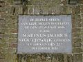
This is a category about rijksmonument number 42001
|
| Address |
|
Media in category "De Eendracht, Dirksland"
The following 20 files are in this category, out of 20 total.
-
 Afgebroken kap van korenmolen, "De Eendracht" - Dirksland - 20057754 - RCE.jpg 1,200 × 1,188; 232 KB
-
 Afgebroken kap van korenmolen, "De Eendracht" - Dirksland - 20057755 - RCE.jpg 1,200 × 1,174; 248 KB
-

-
 Bovenkant van korenmolen "De Eendracht", wieken kapot - Dirksland - 20057753 - RCE.jpg 1,200 × 1,172; 239 KB
-

-

-
 Dirksland molen De Eendracht.jpg 1,320 × 1,831; 1.33 MB
-
-
 Inrijpoort van ronde stenen stellingmolen - AMR Molenfoto - 20541634 - RCE.jpg 1,200 × 900; 240 KB
-
 Kop en kruiwerk, "De Eendracht" - Dirksland - 20057756 - RCE.jpg 1,200 × 1,183; 248 KB
-
 Kop en kruiwerk, "De Eendracht" - Dirksland - 20057757 - RCE.jpg 1,200 × 1,176; 289 KB
-

-

-

-

-

-
-

-
 Vergezicht met ronde stenen stellingmolen - AMR Molenfoto - 20541632 - RCE.jpg 1,200 × 900; 106 KB
-


