Category:De Drie Haringen (Deventer)
Jump to navigation
Jump to search
| Object location | | View all coordinates using: OpenStreetMap |
|---|
building in Deventer, The Netherlands  | |||||
| Upload media | |||||
| Instance of | |||||
|---|---|---|---|---|---|
| Location | Deventer, Overijssel, Netherlands | ||||
| Located on street |
| ||||
| Owned by | |||||
| Heritage designation |
| ||||
| official website | |||||
 | |||||
|
This is a category about rijksmonument number 12507
|
| Address |
|
Media in category "De Drie Haringen (Deventer)"
The following 35 files are in this category, out of 35 total.
-

-
 Brink 55 Deventer.jpg 1,712 × 2,560; 961 KB
-
 Brink 55-1 Deventer.jpg 1,712 × 2,560; 966 KB
-
 Brink naar Polstraat - Deventer - 20053963 - RCE.jpg 1,197 × 1,200; 311 KB
-
 De Drie Haringen - Deventer - 20055665 - RCE.jpg 857 × 1,200; 238 KB
-
 Deventer, Netherlands - panoramio (39).jpg 2,048 × 1,155; 580 KB
-
 Deventer, Netherlands - panoramio (67).jpg 2,048 × 1,155; 571 KB
-
 Deventer, Netherlands - panoramio (69).jpg 2,048 × 1,155; 609 KB
-
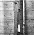
 Exterieur UITHANGTEKEN (3 VISSEN) - Deventer - 20281346 - RCE.jpg 1,190 × 1,200; 201 KB
-
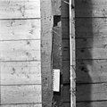
 Exterieur UITHANGTEKEN (3 VISSEN) - Deventer - 20354926 - RCE.jpg 1,200 × 775; 101 KB
-
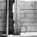
 Exterieur UITHANGTEKEN, SMEEDWERK (FAZANT) - Deventer - 20281315 - RCE.jpg 1,197 × 1,200; 301 KB
-

-
Het Waaggebouw Weeknummer 25-38 - Open Beelden - 29535.ogv 51 s, 384 × 288; 9.67 MB
-
 Huis in omgeving - Deventer - 20055559 - RCE.jpg 905 × 1,200; 281 KB
-
 INTERIEUR, EERSTE VERDIEPING, BALK MET GOTISCHE LETTERS - Deventer - 20270585 - RCE.jpg 1,200 × 1,195; 377 KB
-
 INTERIEUR, EERSTE VERDIEPING, BALK MET GOTISCHE LETTERS - Deventer - 20270586 - RCE.jpg 1,195 × 1,200; 359 KB
-
 INTERIEUR, EERSTE VERDIEPING, BALK MET GOTISCHE LETTERS - Deventer - 20270587 - RCE.jpg 1,188 × 1,200; 368 KB
-
 INTERIEUR, EERSTE VERDIEPING, BALK MET GOTISCHE LETTERS - Deventer - 20270588 - RCE.jpg 1,200 × 1,200; 322 KB
-
 INTERIEUR, EERSTE VERDIEPING, BALK MET GOTISCHE LETTERS - Deventer - 20270589 - RCE.jpg 1,193 × 1,200; 377 KB
-
 INTERIEUR, EERSTE VERDIEPING, BALK MET GOTISCHE LETTERS - Deventer - 20270590 - RCE.jpg 1,200 × 1,200; 347 KB
-
 INTERIEUR, EERSTE VERDIEPING, BALK MET GOTISCHE LETTERS - Deventer - 20270591 - RCE.jpg 1,191 × 1,200; 300 KB
-
 INTERIEUR, EERSTE VERDIEPING, BALK MET GOTISCHE LETTERS - Deventer - 20270592 - RCE.jpg 1,195 × 1,200; 348 KB
-
 Klmhuisje-nr92-1.jpg 1,180 × 2,840; 798 KB
-
 Museum achtergevel - Deventer - 20055560 - RCE.jpg 961 × 1,200; 274 KB
-

-
 Overzicht van de voorgevel en omringende bebouwing - Deventer - 20415493 - RCE.jpg 1,016 × 1,200; 241 KB
-
 Overzicht voorgevel en rechter zijgevel - Deventer - 20055170 - RCE.jpg 894 × 1,200; 255 KB
-
 Overzicht voorgevel en rechter zijgevel - Deventer - 20350862 - RCE.jpg 946 × 1,200; 273 KB
-
 Voor- en zijgevel - Deventer - 20055667 - RCE.jpg 958 × 1,200; 152 KB
-
 Voor- en zijgevel - Deventer - 20055668 - RCE.jpg 958 × 1,200; 183 KB
-
 Voorgevel - Deventer - 20055666 - RCE.jpg 969 × 1,200; 213 KB
-
 Voorgevel - Deventer - 20325716 - RCE.jpg 870 × 1,200; 176 KB
-

-
 Voorgevels - Deventer - 20055660 - RCE.jpg 808 × 1,200; 225 KB
-
 Zandpoort - Deventer - 20053954 - RCE.jpg 1,190 × 1,200; 364 KB


.jpg)
.jpg)
.jpg)
_-_Deventer_-_20281346_-_RCE.jpg)
_-_Deventer_-_20354926_-_RCE.jpg)
_-_Deventer_-_20281315_-_RCE.jpg)
_Architectur_der_Niederlande_(serietitel_op_object),_RP-F-2001-7-772B-22.jpg)


