Category:De Deen, Luyksgestel
Jump to navigation
Jump to search
| Object location | | View all coordinates using: OpenStreetMap |
|---|
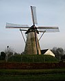
windmill in Luyksgestel, Netherlands  | |||||
| Upload media | |||||
| Instance of | |||||
|---|---|---|---|---|---|
| Location |
| ||||
| Street address |
| ||||
| Located on street |
| ||||
| Has use | |||||
| Heritage designation |
| ||||
| Source of energy | |||||
 | |||||
|
This is a category about rijksmonument number 26323
|
| Address |
|
Media in category "De Deen, Luyksgestel"
The following 28 files are in this category, out of 28 total.
-
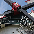 Baard De Deen.jpg 591 × 591; 266 KB
-
 Bijgebouw, voorgevel en rechter zijgevel - Luyksgestel - 20329011 - RCE.jpg 2,870 × 2,268; 1.64 MB
-
 Bijgebouwen bij de molen - Luyksgestel - 20329010 - RCE.jpg 2,870 × 2,260; 1.41 MB
-
 Brandschade aan bovenwiel, vang en voeghout - Luyksgestel - 20143308 - RCE.jpg 3,110 × 3,073; 1.35 MB
-
 Brandschade aan bovenwiel, vang en voeghout - Luyksgestel - 20143309 - RCE.jpg 3,110 × 3,084; 1.75 MB
-
 Brandschade aan bovenwiel, vang en voeghout - Luyksgestel - 20143310 - RCE.jpg 3,110 × 3,080; 1.99 MB
-
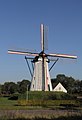 De Deen Windmolen Luiksgestel.jpg 1,367 × 2,000; 1.4 MB
-
 Exterieur BEHOEFT ENIG HERSTEL - Luyksgestel - 20290220 - RCE.jpg 1,200 × 1,200; 233 KB
-
 Korenmolen "De Deen", exterieur - Luyksgestel - 20143318 - RCE.jpg 788 × 1,200; 168 KB
-
 Luyksgestel, windkorenmolen De Deen RM26323 foto3 2012-09-16 16.20.jpg 4,416 × 3,312; 7.95 MB
-
 Molenbaard - Luyksgestel - 20143311 - RCE.jpg 1,200 × 796; 159 KB
-
 NB Luyksgestel de Deen beltmolen (03)w.JPG 955 × 1,200; 752 KB
-
 NB Luyksgestel de Deen beltmolen (10)w.JPG 1,200 × 1,185; 824 KB
-
 Overzicht molen - Luyksgestel - 20329008 - RCE.jpg 944 × 1,200; 219 KB
-
 Overzicht molen - Luyksgestel - 20329009 - RCE.jpg 939 × 1,200; 284 KB
-
 Overzicht van de achterkant - Luyksgestel - 20421288 - RCE.jpg 803 × 1,200; 126 KB
-
 Overzicht van de voorkant - Luyksgestel - 20421286 - RCE.jpg 803 × 1,200; 121 KB
-
 Overzicht van de voorkant - Luyksgestel - 20421287 - RCE.jpg 803 × 1,200; 132 KB
-

-

-

-

-
 Spil scheef in de molen - Luyksgestel - 20143304 - RCE.jpg 1,200 × 1,197; 236 KB
-
 Spil scheef in de molen - Luyksgestel - 20143305 - RCE.jpg 1,200 × 1,189; 322 KB
-
 Spil scheef in de molen - Luyksgestel - 20143306 - RCE.jpg 1,200 × 1,184; 282 KB
-
 Vergezicht met ronde stenen beltmolen - AMR Molenfoto - 20540680 - RCE.jpg 1,200 × 900; 124 KB
-

-
 Woonhuis bij ronde stenen beltmolen - AMR Molenfoto - 20540684 - RCE.jpg 1,200 × 900; 142 KB


w.JPG)
w.JPG)


