Category:De Dageraad, Zeeland
Jump to navigation
Jump to search
| Object location | | View all coordinates using: OpenStreetMap |
|---|
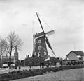
windmill in Zeeland, Netherlands  | |||||
| Upload media | |||||
| Instance of | |||||
|---|---|---|---|---|---|
| Location | Zeeland, North Brabant, Netherlands | ||||
| Street address |
| ||||
| Located on street |
| ||||
| Has use | |||||
| Heritage designation |
| ||||
| Source of energy | |||||
 | |||||
|
This is a category about rijksmonument number 40321
|
| Address |
|
Media in category "De Dageraad, Zeeland"
The following 11 files are in this category, out of 11 total.
-
 Korenmolen aan de Molenstraat (na stormschade) - Zeeland - 20221074 - RCE.jpg 796 × 1,200; 148 KB
-
 Korenmolen aan de Molenstraat - Zeeland - 20221067 - RCE.jpg 1,200 × 1,174; 257 KB
-
 Korenmolen aan de Molenstraat - Zeeland - 20221075 - RCE.jpg 1,200 × 1,180; 317 KB
-
 Korenmolen aan de Molenstraat - Zeeland - 20221076 - RCE.jpg 1,200 × 1,172; 240 KB
-
 Korenmolen aan de Oude Molenstraat, toestand verwaarloosd - Zeeland - 20221070 - RCE.jpg 1,200 × 1,197; 177 KB
-
 Korenmolen aan de Oude Molenstraat, toestand verwaarloosd - Zeeland - 20221071 - RCE.jpg 1,200 × 1,181; 198 KB
-
 Korenmolen in Dorp, aanzicht - Zeeland - 20221072 - RCE.jpg 1,200 × 1,190; 240 KB
-
 Korenmolen in Dorp, aanzicht - Zeeland - 20221073 - RCE.jpg 1,200 × 1,167; 243 KB
-
 Ronde stenen bergkorenmolen van heer van Aarsen - Zeeland - 20221065 - RCE.jpg 784 × 1,200; 150 KB
-
 Zeeland DeDageraad.JPG 3,000 × 4,000; 1.6 MB
-
 Zeeland, molen1 foto2 2010-04-10 13.07.JPG 2,530 × 3,373; 3.85 MB
_-_Zeeland_-_20221074_-_RCE.jpg)


