Category:Dayr Abu Salama
Jump to navigation
Jump to search
A former village in Ramle District, Mandatory Palestine  | |||||
| Upload media | |||||
| Instance of | |||||
|---|---|---|---|---|---|
| Location | Ramle Subdistrict | ||||
 | |||||
Media in category "Dayr Abu Salama"
The following 9 files are in this category, out of 9 total.
-
 Historical map series for the area of Dayr Abu Salama (1870s).jpg 739 × 743; 236 KB
-

-
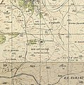 Historical map series for the area of Dayr Abu Salama (1940s).jpg 739 × 743; 272 KB
-
 Al-Haditha 1942.jpg 4,538 × 2,305; 3.64 MB
-
 Beit Nabala 1945.jpg 545 × 405; 149 KB
-
 'מצפה מודיעין' ביער בן שמן.jpg 2,048 × 1,536; 679 KB
-
 PikiWiki Israel 28961 Geography of Israel.JPG 2,586 × 3,058; 3.61 MB
-
 תחנת אוטובוס ליער בן שמן - panoramio.jpg 1,200 × 1,600; 297 KB
-
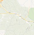 Historical map series for the area of Dayr Abu Salama (modern).jpg 739 × 743; 146 KB
.jpg)
.jpg)
.jpg)


.jpg)