Category:Davyhulme
Jump to navigation
Jump to search
town in Trafford, Greater Manchester, United Kingdom | |||||
| Upload media | |||||
| Instance of | |||||
|---|---|---|---|---|---|
| Location | Trafford, Greater Manchester, North West England, England | ||||
 | |||||
English: Davyhulme is situated in the Metropolitan Borough of Trafford
Subcategories
This category has the following 7 subcategories, out of 7 total.
B
D
- Davyhulme Circle (16 F)
- Davyhulme East (1 F)
- Davyhulme Park (14 F)
- Davyhulme Sewage Works (6 F)
- Davyhulme West (1 F)
M
Media in category "Davyhulme"
The following 189 files are in this category, out of 189 total.
-
 "Bowden View", Shawe Road, Urmston.jpg 4,032 × 3,024; 3.72 MB
-
 "Brentwood Flats", Flixton Road, Urmston.jpg 4,032 × 3,024; 3.79 MB
-
 "Clifton Villa", Westbourne Road, Urmston.jpg 4,032 × 3,024; 2.37 MB
-
 "Greenfield Terrace", Derwent Road, Woodsend, Urmston.jpg 4,032 × 3,024; 3.94 MB
-
 "Peel Terrace", Stretford Road, Urmston.jpg 4,032 × 3,024; 2.28 MB
-
 "Reade House", Western Road, Urmston.jpg 4,032 × 3,024; 3.91 MB
-
 "Ringmore", Brook Road, Urmston.jpg 4,032 × 3,024; 2.74 MB
-
 "Shaldon", Brook Road, Urmston.jpg 4,032 × 3,024; 2.13 MB
-
 'Bole Hill', Carrington Road, Urmston.jpg 4,032 × 3,024; 3.54 MB
-
 'Broad Oak', Crofts Bank Road, Urmston.jpg 3,024 × 4,032; 3.95 MB
-
 'Cottington', Old Crofts Bank, Urmston.jpg 4,032 × 3,024; 5.43 MB
-
 'Davyhulme House', Davyhulme Road, Urmston.jpg 4,032 × 3,024; 1.89 MB
-
 'Dee Mount', Flixton Road, Urmston.jpg 4,032 × 3,024; 2.47 MB
-
 'Duck Cottage', Flixton Road, Urmston.jpg 3,024 × 4,032; 2.33 MB
-
 'Edgefield Villas', Church Road, Flixton, Urmston.jpg 3,024 × 4,032; 2.19 MB
-
 'Edgewell Villas', Church Road, Flixton, Urmston.jpg 4,032 × 3,024; 2.45 MB
-
 'Ennenda', 97 Church Road, Urmston.jpg 3,024 × 4,032; 4.6 MB
-
 'Faburn Villa', Flixton Road, Urmston.jpg 4,032 × 3,024; 2.66 MB
-
 'Fern Acre', Crofts Bank Road, Urmston.jpg 4,032 × 3,024; 4.36 MB
-
 'Glenmaye' & 'Mayfield', Crofts Bank Road, Urmston.jpg 4,032 × 3,024; 2.18 MB
-
 'Halsteads', Marlborough Road, Urmston.jpg 4,032 × 3,024; 3.22 MB
-
 'Lulworth', Marlborough Road, Urmston.jpg 3,024 × 4,032; 3.32 MB
-
 'Market 41', Railway Road, Urmston.jpg 4,032 × 3,024; 2.99 MB
-
 'Mount Melfort' & 'Innisfallen', Church Road, Urmston.jpg 4,032 × 3,024; 2.46 MB
-
 'Ormeau Lodge', Church Road, Urmston.jpg 3,024 × 4,032; 4.08 MB
-
 'Priors Lee', 93 Church Road, Urmston.jpg 3,024 × 4,032; 3.59 MB
-
 'Raslie', Flixton Road, Urmston.jpg 3,024 × 4,032; 2.78 MB
-
 'Red House', 91 Church Road, Urmston.jpg 3,024 × 4,032; 3.79 MB
-
 'Rostherne Villa & Carlton Villa', Crofts Bank Road, Urmston.jpg 4,032 × 3,024; 2.57 MB
-
 'The Hollies', Davyhulme Road, Urmston.jpg 4,032 × 3,024; 5.1 MB
-
 'The Hollies', The Village, Flixton, Urmston.jpg 4,032 × 3,024; 4.9 MB
-
 'The Knoll', 109 Church Road, Urmston.jpg 4,032 × 3,024; 4.73 MB
-
 'The Old School', Davyhulme Road, Urmston.jpg 4,032 × 3,024; 2.96 MB
-
 'The Roost' & 'The Brackens', Stretford Road, Urmston.jpg 4,032 × 3,024; 4.28 MB
-
 3rd Davyhulme Scout Group, 57 Conway Road, Urmston.jpg 4,032 × 3,024; 4.48 MB
-
 A branch of Bent Lanes - geograph.org.uk - 6293228.jpg 6,000 × 4,000; 4.82 MB
-
 Abbotsfield Park Tennis Courts, Urmston.jpg 4,032 × 3,024; 4.45 MB
-
 Adrak, Flixton Road, Urmston.jpg 3,024 × 4,032; 2.48 MB
-
 An old part of Bent Lanes - geograph.org.uk - 6293242.jpg 6,000 × 4,000; 5.82 MB
-

-

-
 Annual Nags Head Christmas Tree Sales, Urmston.jpg 4,032 × 3,024; 1.97 MB
-
 Apsley Terrace, 394-402 Flixton Road, Urmston.jpg 4,032 × 3,024; 3.06 MB
-
 Autumn morning on Davyhulme Road, Urmston.jpg 4,032 × 3,024; 5.11 MB
-
 B&Q Manchester - Trafford Park, Redclyffe Raod, Stretford.jpg 4,032 × 3,024; 1.7 MB
-
 Benchmark Locator, Waypoint B52846, 66 Crofts Bank Road, Urmston.jpg 3,024 × 4,032; 4.24 MB
-
 Bent Lanes - geograph.org.uk - 2311404.jpg 640 × 480; 197 KB
-
 Bent Lanes - geograph.org.uk - 3364642.jpg 640 × 480; 73 KB
-
 Bent Lanes - geograph.org.uk - 3364649.jpg 640 × 480; 90 KB
-
 Bent Lanes Brook - geograph.org.uk - 2312728.jpg 640 × 480; 262 KB
-
 Beyond Education Tutoring, 175 Broadway, Urmston.jpg 4,032 × 3,024; 2.88 MB
-
 BrewChimp Urmston, Church Road, Urmston.jpg 4,032 × 3,024; 2.46 MB
-
 Brighton Grove street signs, Urmston.jpg 3,024 × 4,032; 3.54 MB
-
 Brighton Grove, Urmston.jpg 4,032 × 3,024; 4.26 MB
-
 Broadway, Davyhulme - geograph.org.uk - 3364673.jpg 640 × 480; 56 KB
-
 Broadway, Davyhulme, Manchester - geograph.org.uk - 2757322.jpg 640 × 480; 108 KB
-
 Brownfield Site by Trafford Golf Centre, Stretford.jpg 3,024 × 4,032; 2.75 MB
-
 Brownfield Site, Trafford Golf Centre, Stretford.jpg 4,032 × 3,024; 4.39 MB
-
 Burner Heating Spares & The Pawdressers Grooming Salon, Higher Road, Urmston.jpg 4,032 × 3,024; 1.94 MB
-
 Car Park Entrance, Davyhulme Millennium Nature Reserve - geograph.org.uk - 5689291.jpg 2,784 × 1,568; 2.23 MB
-
 Carlton Crescent, Urmston.jpg 4,032 × 3,024; 2.83 MB
-
 Carlton Road, Urmston.jpg 4,032 × 3,024; 3.27 MB
-

-
 Cheeky Cherubs, 1 Victoria Parade, Urmston.jpg 4,032 × 3,024; 3.41 MB
-
 Christ Church, Davyhulme - geograph.org.uk - 2311412.jpg 640 × 480; 238 KB
-
 Christ Church, Davyhulme - geograph.org.uk - 2311424.jpg 640 × 480; 227 KB
-
 Christ Church, Davyhulme - geograph.org.uk - 2311921.jpg 640 × 427; 225 KB
-
 Church Road to The Grove Passage, Flixton, Urmston.jpg 3,024 × 4,032; 5.98 MB
-
 Coberley Avenue, Urmston.jpg 4,032 × 3,024; 2.11 MB
-
 Coming soon..."Market 41", Urmston.jpg 4,032 × 3,024; 3.67 MB
-
 Coming soon...'Market 41', Railway Road, Urmston.jpg 4,032 × 3,024; 3 MB
-
 Coming soon...'Trafford Waters'.jpg 4,032 × 3,024; 1.82 MB
-
 Coming soon...Syriana (Levantine Cuisine), Crofts Bank Road, Urmston.jpg 3,024 × 4,032; 3.03 MB
-
 Coming soon...Trafford Waters.jpg 4,032 × 3,024; 1.64 MB
-
 Conway House (left) & Rhuddlan (right), Marlborough Road, Urmston.jpg 4,032 × 3,024; 2.37 MB
-
 Copper Hatch, Flixton Road, Urmston (For Sale).jpg 3,024 × 4,032; 2.82 MB
-
 Costa Coffee & Beyond, Trafford City, Trafford Way, Stretford.jpg 4,032 × 3,024; 2.88 MB
-
 Cranford Gardens, Urmston.jpg 4,032 × 3,024; 5.08 MB
-
 Cucumber Recruitment, 173 Broadway, Urmston.jpg 4,032 × 3,024; 2.84 MB
-
 Daisy Daisy Flowers, The Village, Flixton, Urmston.jpg 2,943 × 2,207; 2.45 MB
-
 Davyhulme Millennium Nature Reserve - geograph.org.uk - 2311287.jpg 640 × 480; 231 KB
-
 Davyhulme Millennium Nature Reserve - geograph.org.uk - 2311294.jpg 640 × 480; 230 KB
-
 Davyhulme Millennium Nature Reserve - geograph.org.uk - 2312715.jpg 640 × 480; 258 KB
-
 Davyhulme Millennium Nature Reserve - geograph.org.uk - 2312724.jpg 640 × 480; 193 KB
-
 Davyhulme Millennium Nature Reserve - geograph.org.uk - 5689304.jpg 2,784 × 1,568; 2.24 MB
-

-

-
 Davyhulme Park Gardens - panoramio (1).jpg 5,184 × 3,456; 11.4 MB
-
 Davyhulme Park Gardens - panoramio.jpg 5,184 × 3,456; 9.05 MB
-
 Davyhulme Park Golf Club - geograph.org.uk - 35367.jpg 640 × 480; 126 KB
-
 Davyhulme Park Pond Area - panoramio.jpg 5,184 × 3,456; 9.24 MB
-
 Davyhulme Road & Norrey's Urn, Urmston.jpg 3,024 × 4,032; 5.1 MB
-
 Davyhulme Road, Davyhulme - geograph.org.uk - 3195923.jpg 800 × 600; 158 KB
-
 Davyhulme wastewater treatment plant.JPG 4,608 × 3,456; 3.59 MB
-
-
 Derelict Acregate Golf Clubhouse, William Wroe Golf Course, Pennybridge Lane, Urmston.jpg 4,032 × 3,024; 3.81 MB
-
 Derelict Bar Area, William Wroe Golf Course, Pennybridge Lane, Urmston.jpg 3,024 × 4,032; 3.59 MB
-
 Domestic Road, Davyhulme Road, Urmston.jpg 4,032 × 3,024; 5.66 MB
-
 Eden Hall Drive, Urmston.jpg 4,032 × 3,024; 2.96 MB
-
 Empire Barbers, 24 Higher Road, Urmston.jpg 3,024 × 4,032; 1.83 MB
-
 Entrance to Davyhulme Waste Water Treatment Works - geograph.org.uk - 6292367.jpg 6,000 × 4,000; 5.84 MB
-
 Entrance to Trafford General Hospital - geograph.org.uk - 1974710.jpg 3,264 × 2,448; 1.96 MB
-
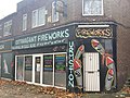 Extravagant Fireworks, Princess Road, Urmston.jpg 4,032 × 3,024; 2.19 MB
-
 Filey Avenue, Urmston.jpg 4,032 × 3,024; 2.49 MB
-
 Flixton Road Shops, Urmston - 52464724761.jpg 4,032 × 3,024; 2.87 MB
-
 Flixton Road Shops, Urmston.jpg 4,032 × 3,024; 3.71 MB
-
 Floribunda, 118 Flixton Road, Urmston.jpg 3,024 × 4,032; 2.76 MB
-
 Footpath behind the houses - geograph.org.uk - 6292376.jpg 6,000 × 4,000; 5.65 MB
-
 Former First For Tyres premises, Higher Road, Urmston.jpg 3,024 × 4,032; 2.51 MB
-
 Former Goddard & Staines, Higher Road, Urmston.jpg 4,032 × 3,024; 2.15 MB
-
 Former Kirkham's Store, Stretford Road, Urmston.jpg 4,032 × 3,024; 3.62 MB
-
 Glebe Road, Urmston.jpg 3,024 × 4,032; 2.37 MB
-
 Goodness Zero Waste, 10 Crofts Bank Road, Urmston.jpg 3,024 × 4,032; 2.96 MB
-
 Great War Memorial, St Mary's Davyhulme - geograph.org.uk - 2311931.jpg 480 × 640; 265 KB
-
 Haldi Indian Restaurant, Victoria Parade, Urmston.jpg 4,032 × 3,024; 2.97 MB
-
 Hayeswater Centre, Hayeswater Road, Urmston.jpg 4,032 × 3,024; 4.45 MB
-
 Hayley's Scran Van, Taylor Road, Stretford.jpg 4,032 × 3,024; 2.92 MB
-
 High Tension Junction Marker, Old Crofts Bank Road, Urmston.jpg 4,032 × 3,024; 2.76 MB
-

-
 Homecrafts Davyhulme.JPG 4,320 × 3,240; 3.24 MB
-
 Ilkley Drive, Urmston.jpg 4,032 × 3,024; 3.85 MB
-
 John R. Tollitt Funeral Service, Seren House, Atkinson Rd, Urmston.jpg 4,032 × 3,024; 1.94 MB
-

-
 Kingdom Hall of Jehovah's Witnesses, Higher Road, Urmston.jpg 4,032 × 3,024; 2.57 MB
-
 Kingsway Park, Davyhulme.JPG 4,320 × 3,240; 3.33 MB
-
 Kobella Beauty Salon & Coral Bookmakers, Flixton Road Shops, Urmston.jpg 4,032 × 3,024; 2.13 MB
-
 Lime Avenue to Abbotsfield Park Passage, Urmston.jpg 3,024 × 4,032; 3.09 MB
-
 Links Rise to Rossett Drive passage, Urmston.jpg 3,024 × 4,032; 3.56 MB
-

-
 Longfield Drive, Urmston.jpg 4,032 × 3,024; 4.89 MB
-
 Lowood Avenue, Urmston.jpg 3,024 × 4,032; 3.23 MB
-
 M60 motorway passes Davyhulme (1).JPG 4,320 × 3,240; 2.87 MB
-
 M60 motorway passes Davyhulme (2).JPG 4,320 × 3,240; 2.94 MB
-
 M60 motorway passes Davyhulme (3).JPG 4,320 × 3,240; 3.12 MB
-
 Manchester Ship Canal - geograph.org.uk - 2311219.jpg 960 × 1,280; 755 KB
-
 Manchester Ship Canal - geograph.org.uk - 2311222.jpg 1,280 × 960; 846 KB
-
 Manchester Ship Canal, Davyhulme - geograph.org.uk - 2312697.jpg 640 × 480; 124 KB
-
 Market 41, Railway Road, Urmston.jpg 4,032 × 3,024; 4.81 MB
-
 Marlborough Road, Urmston.jpg 3,024 × 4,032; 4.64 MB
-
 Moorside Road, Davyhulme - geograph.org.uk - 3195927.jpg 800 × 569; 137 KB
-
 Morris Hall, Atkinson Road, Urmston.jpg 3,024 × 4,032; 3.78 MB
-
 Nags Head Roundabout War Memorial, Urmston.jpg 4,032 × 3,024; 1.64 MB
-
 Nags Head Roundabout, Urmston.jpg 4,032 × 3,024; 2.09 MB
-
 Old gateposts on William Wroe Golf Course, Urmston.jpg 4,032 × 3,024; 6.11 MB
-
 Owl Wood Art at Hayeswater Centre, Urmston.jpg 3,024 × 4,032; 3.11 MB
-
 Passage from David Herd towards Brighton Avenue, Urmston.jpg 4,032 × 3,024; 2.64 MB
-
 Pleasant Drive, Urmston.jpg 4,032 × 3,024; 2.57 MB
-
 Premier Inn Manchester Trafford Centre North hotel, Trafford Boulevard, Stretford.jpg 4,032 × 3,024; 3.41 MB
-

-
 Public footpath - geograph.org.uk - 1428121.jpg 640 × 480; 156 KB
-
 Public footpath - geograph.org.uk - 1428140.jpg 640 × 480; 146 KB
-
 Pylon Near Davyhulme Millennium Nature Reserve - geograph.org.uk - 5689707.jpg 2,560 × 1,920; 3.3 MB
-
 Queen Elizabeth II Post Box Art, Flixton Road, Urmston.jpg 3,024 × 4,032; 4.49 MB
-
 Queen Elizabeth Tribute, Bridgewater Circle, Barton Dock Road, Stretford.jpg 4,032 × 3,024; 1.94 MB
-
 Rathan Road, Urmston.jpg 4,032 × 3,024; 4.38 MB
-
 Rear of Woodsend Road sign, Urmston.jpg 3,024 × 4,032; 3.42 MB
-
 Rossett Drive, Urmston.jpg 4,032 × 3,024; 5.12 MB
-
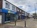
 Row of shops in Davyhulme - geograph.org.uk - 6293245.jpg 5,732 × 3,826; 3.54 MB
-
 Row of shops opposite Trafford General Hospital - geograph.org.uk - 2638048.jpg 3,872 × 2,592; 3.6 MB
-
 Ryeburn Walk, Urmston.jpg 3,024 × 4,032; 4.06 MB
-
 Santorini, Higher Road, Urmston (ceased trading).jpg 3,024 × 4,032; 2.46 MB
-

-
 Shetland Way, Davyhulme (1).JPG 4,320 × 3,240; 3.72 MB
-
 Shetland Way, Davyhulme (2).JPG 4,320 × 3,240; 3.85 MB
-
 Shops on Lostock Road, Davyhulme - geograph.org.uk - 2635593.jpg 3,872 × 2,592; 3.29 MB
-
 Small bridge between holes 2 & 3 of William Wroe Golf Course, Pennybridge Lane, Urmston.jpg 3,024 × 4,032; 5.83 MB
-
 Suburban housing on Lostock Road, Davyhulme - geograph.org.uk - 2635586.jpg 3,872 × 2,592; 4.83 MB
-
 Sunningdale Railway Bridge, Urmston.jpg 4,032 × 3,024; 4.1 MB
-
 Swinging Bridge Table Table, Trafford Blvd, Trafford Park, Urmston, Stretford.jpg 4,032 × 3,024; 3.2 MB
-
 Swinging Bridge Table Table, Trafford Boulevard, Trafford Park, Urmston, Stretford.jpg 4,032 × 3,024; 3.05 MB
-
 Syriana, 24 Crofts Bank Road, Urmston.jpg 4,032 × 3,024; 3.52 MB
-
 The Deli, Davyhulme Circle, Urmston.jpg 4,032 × 3,024; 2.4 MB
-
 The Garrick's Head - geograph.org.uk - 1428066.jpg 640 × 480; 88 KB
-
 The Grove to Church Road Passage, Flixton, Urmston.jpg 3,024 × 4,032; 4.46 MB
-
 The top of Bent Lanes - geograph.org.uk - 6293217.jpg 6,000 × 4,000; 5.03 MB
-
 Tim Hortons, 4 Traders Ave, Trafford Park, Stretford.jpg 4,032 × 3,024; 3.45 MB
-
 To Carrsvale Avenue Sign, Urmston.jpg 4,032 × 3,024; 3.16 MB
-
 Trafford General Hospital - geograph.org.uk - 2628529.jpg 3,785 × 2,449; 1.34 MB
-
 Trafford Retail Park - geograph.org.uk - 6292352.jpg 6,000 × 4,000; 6.61 MB
-
 Urmston Kurry House, 83 Stretford Road, Urmston.jpg 3,024 × 4,032; 2.84 MB
-
 Urmston Motor Store, Church Road, Urmston.jpg 3,024 × 4,032; 3.86 MB
-
 Vandalised Acregate Golf Clubhouse, William Wroe Golf Course, Pennybridge Lane, Urmston.jpg 4,032 × 3,024; 6.21 MB
-
 Victoria Terrace, Gloucester Road, Urmston.jpg 4,032 × 3,024; 2.83 MB
-
 Whats The Catch, 7 Station Road, Urmston.jpg 4,032 × 3,024; 2.52 MB
-
 William Wroe Golf Course, Pennybridge Lane, Urmston.jpg 3,024 × 4,032; 2.8 MB
-
 Woodhouse Road - geograph.org.uk - 6293237.jpg 5,732 × 3,826; 3.72 MB
-
 Woodland walk near Davyhulme - geograph.org.uk - 6293204.jpg 6,000 × 4,000; 4.66 MB
-
 Woodsend Fields, Urmston.jpg 4,032 × 3,024; 1.74 MB
-
 Woodsend Road South Passage, Urmston.jpg 3,024 × 4,032; 6.21 MB


_crop.jpg)
.jpg)


,_Crofts_Bank_Road,_Urmston.jpg)

_%26_Rhuddlan_(right),_Marlborough_Road,_Urmston.jpg)
.jpg)


.jpg)


.JPG)
.JPG)
.JPG)


.jpg)

.JPG)
.JPG)


