Category:Dat Taw Gyaint Waterfall
Jump to navigation
Jump to search
| Upload media | |||||
| Instance of | |||||
|---|---|---|---|---|---|
| Location |
| ||||
 | |||||
Media in category "Dat Taw Gyaint Waterfall"
The following 9 files are in this category, out of 9 total.
-
 Anesakhan, Myanmar (Burma) - panoramio.jpg 2,848 × 4,288; 9.74 MB
-
 Anisakan waterfall.jpg 500 × 667; 106 KB
-
 Anishakan Falls.jpg 2,592 × 1,944; 5.56 MB
-
 Dat Taw Gaint Waterfall, Pyin Oo Lwin, Mandalay.jpg 2,720 × 1,530; 3.92 MB
-
 Dat Taw Gyaint Fall.jpg 2,592 × 4,608; 5.23 MB
-
 Dat Taw Gyaint Waterfall.jpg 4,000 × 6,016; 11.35 MB
-
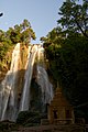
 Datt Taw Gaint Pagoda & Waterfall, Pyin Oo Lwin.jpg 2,449 × 1,425; 2.89 MB
-
 Dut-Taw-Gyint Waterfall 01(Ah-Nie-Sakhan).jpg 1,440 × 809; 1.48 MB
-
 Dut-Taw-Gyint Waterfall 02 (Ah-Nie-Sakhan).jpg 809 × 1,440; 1,008 KB
_-_panoramio.jpg)


.jpg)
.jpg)