Category:Darßer Ort
Jump to navigation
Jump to search
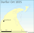
Deutsch: Darßer Ort ist der Name des nördlichsten Hakens der Halbinsel Fischland-Darß-Zingst, der durch Ablagerungen von Sedimenten in den vergangenen Jahrhunderten um ca. 6 km wuchs und dessen Küstenlinie ständig ihre Form verändert. Das abgelagerte Material stammt von der Abrasionsküste des Westdarß und wird durch die Meeresströmung der Ostsee transportiert.
| Object location | | View all coordinates using: OpenStreetMap |
|---|
northern point of the Fischland-Darss-Zingst peninsula on the German coast of the Baltic Sea  | |||||
| Upload media | |||||
| Instance of | |||||
|---|---|---|---|---|---|
| Location | Born auf dem Darß, Vorpommern-Rügen District, Mecklenburg-Western Pomerania, Germany | ||||
 | |||||
Subcategories
This category has the following 4 subcategories, out of 4 total.
Media in category "Darßer Ort"
The following 120 files are in this category, out of 120 total.
-
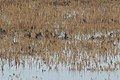 20181004 Limikole 001.jpg 1,365 × 906; 319 KB
-
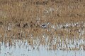 20181004 Limikole 002.jpg 1,365 × 906; 246 KB
-
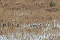
 20181004 Limikole 003.jpg 910 × 604; 145 KB
-
 20181004 Limikole 004.jpg 1,365 × 906; 246 KB
-
 20181004 Limikole 005.jpg 1,365 × 906; 296 KB
-
 20181004 Limikole 006.jpg 1,365 × 906; 275 KB
-
 20181004 Limikole 007.jpg 1,365 × 906; 256 KB
-
 Admiralty Chart No 2365 Coast of Prussia Sheet 1 Rostock to Arkona Light, Published 1855.jpg 16,252 × 11,139; 54.28 MB
-
-
 Ausblick vom Leuchtturm Darßer Ort - panoramio.jpg 1,511 × 1,458; 919 KB
-
 Baum am Natureum am darsser ort.jpg 2,272 × 1,704; 1.93 MB
-
 Blick vom Aussichtspunkt.jpg 3,742 × 2,818; 1.74 MB
-
 Boddenlandschaft am Darßer Ort frühmorgens im September.jpg 4,032 × 1,816; 1.91 MB
-
 Boddenlandschaft am Darßer Ort.jpg 7,613 × 5,734; 9.44 MB
-
 Born am Darß, hiking trail through the nature conservation area "Darßer Ort".jpg 2,657 × 1,772; 1.2 MB
-
 Born am Darß, in the natur conservation area "Darßer Ort".jpg 2,657 × 1,772; 952 KB
-
 Born am Darß, in the nature conservation area "Darßer Ort"-2.jpg 2,657 × 1,772; 1.03 MB
-
 Born am Darß, in the nature conservation area "Darßer Ort"-3.jpg 2,657 × 1,772; 1.03 MB
-
 Born am Darß, in the nature conservation area "Darßer Ort"-4.jpg 2,657 × 1,772; 966 KB
-
 Born am Darß, the entrance of the emergency port "Darßer Ort".jpg 2,657 × 1,772; 1.15 MB
-
 Born auf dem Darß, Germany - panoramio (2).jpg 1,024 × 768; 265 KB
-
 Born auf dem Darß, Germany - panoramio (3).jpg 1,024 × 768; 346 KB
-
 Born auf dem Darß, Germany - panoramio (4).jpg 4,000 × 3,000; 2.24 MB
-
 Born auf dem Darß, Germany - panoramio (5).jpg 4,000 × 3,000; 2.3 MB
-
 Born auf dem Darß, Germany - panoramio (6).jpg 4,000 × 3,000; 2.12 MB
-
 Born auf dem Darß, Germany - panoramio (7).jpg 3,072 × 2,304; 3.29 MB
-
 Bäume am Weststrand Darßer Ort.jpg 4,434 × 2,956; 9.57 MB
-
 Darss, Born a. Darss ( 1100869).jpg 4,000 × 3,000; 7.99 MB
-
 Darss, Born a. Darss ( 1100873).jpg 4,000 × 3,000; 9.15 MB
-
 Darsser Ort 01.jpg 5,472 × 3,648; 12.73 MB
-
 Darsser Ort 02.jpg 5,472 × 3,648; 10.24 MB
-
 Darsser Ort 03.jpg 5,472 × 3,236; 11.31 MB
-
 Darsser Ort 04.jpg 5,472 × 3,648; 12.95 MB
-
 Darsser Ort 05.jpg 5,089 × 3,484; 14.81 MB
-
 Darsser ort 1.jpg 2,272 × 1,704; 1.68 MB
-
 Darsser Ort 15.jpg 5,472 × 3,484; 14.61 MB
-
 Darsser ort 1835-2007.gif 450 × 439; 149 KB
-
 Darsser Ort 22.jpg 5,352 × 2,751; 11.19 MB
-
 Darsser Ort 34.jpg 5,471 × 2,646; 11.13 MB
-
 Darsser Ort DGzRS Rettungsschuppen Seenotrettungsstation 1.jpg 3,324 × 2,493; 3.47 MB
-
 Darsser Ort DGzRS Rettungsschuppen Seenotrettungsstation.jpg 3,030 × 2,272; 3.41 MB
-
 Darßer Ort Dünenlandschaft.jpg 4,000 × 3,000; 6.45 MB
-
 Darsser Ort Naturerlebnisweg 03.jpg 5,412 × 2,841; 13.89 MB
-
 Darsser Ort Naturerlebnisweg 04.jpg 5,128 × 3,140; 14.64 MB
-
 Darsser Ort Naturerlebnisweg 05.jpg 5,472 × 3,648; 14.32 MB
-
 Darsser Ort, Born a. Darss ( 1100872).jpg 4,000 × 3,000; 7.64 MB
-
 DarssOrtStrand.JPG 2,048 × 1,536; 687 KB
-
 Darß - Darßer Ort 2.jpg 3,264 × 1,836; 3.64 MB
-
 Darß - Darßer Ort.jpg 3,450 × 2,574; 4.36 MB
-
 Darß - Nähe Leuchtturm - panoramio.jpg 4,912 × 2,760; 3.88 MB
-
 Darß.jpg 691 × 518; 53 KB
-
 Darßer Nordspitze.jpg 798 × 596; 85 KB
-
 Darßer Ort - gefallener Baum.jpg 800 × 600; 261 KB
-
 Darßer Ort - panoramio.jpg 2,338 × 1,197; 1.92 MB
-
 Darßer Ort 01.jpg 3,817 × 2,540; 4.35 MB
-
 Darßer Ort 2.jpg 4,146 × 2,759; 5.58 MB
-
 Darßer Ort 2012 03.jpg 5,184 × 3,456; 3.38 MB
-
 Darßer Ort Herbst 2.jpg 2,048 × 1,536; 363 KB
-
 Darßer Ort Herbst.jpg 2,200 × 1,406; 1.04 MB
-
 Darßer Ort Hirschbrunft.JPG 3,648 × 2,736; 5.03 MB
-
 Darßer Ort Naturschutzgebiet Mecklenburg Vorpommern.jpg 1,200 × 1,600; 575 KB
-
 Darßer Ort Okt2010.JPG 3,648 × 2,736; 3.94 MB
-
 Darßer Ort Prerow Nationalpark Vorpommersche Boddenlandschaft Mecklenburg-Vorpommern.jpg 4,000 × 3,000; 4.72 MB
-
 Darßer Ort Strand.jpg 3,264 × 2,448; 1.69 MB
-

-
 Darßer Ort, Dünen am Rundwanderweg - geo-en.hlipp.de - 012093.jpg 640 × 480; 80 KB
-
 Darßer Ort- Wind.jpg 5,184 × 3,456; 16.68 MB
-
 Darßer Ort.jpg 3,888 × 2,592; 6.87 MB
-
 Darßer-Ort-Kernzone.jpg 4,077 × 3,000; 5.45 MB
-
 Darßer-Ort-Nothafen.jpg 4,764 × 3,456; 3.2 MB
-
 Darßwald, historische Küstenlinie - geo-en.hlipp.de - 012142.jpg 640 × 480; 155 KB
-
 Der Darß – Boddenlandschaft und Ostsee.jpg 3,836 × 2,159; 1.26 MB
-
 DuneAtDarsz BalticSea.jpg 2,980 × 1,977; 1.05 MB
-
 Dünenlandschaft am Darßer Ort morgens im September (1).jpg 9,248 × 6,422; 19.79 MB
-
 Dünenlandschaft am Darßer Ort morgens im September (2).jpg 9,248 × 6,936; 16.5 MB
-
 Dünenlandschaft am Darßer Ort morgens im September (3).jpg 9,090 × 6,818; 16.05 MB
-

-
 Ein Baum am Weststrand Darßer Ort.jpg 3,456 × 5,184; 11.43 MB
-
 Heidelandschaft am Darßer Ort - geo-en.hlipp.de - 011826.jpg 640 × 480; 109 KB
-
 Herbststimmung im Darßer Wald Ende September.jpg 6,936 × 9,248; 18.18 MB
-
 Hirsch Darßer Ort Nationalpark Vorpommersche Boddenlandschaft.jpg 2,493 × 1,840; 1.68 MB
-
 Hirschrudel am Darßer Ort, Nationalpark Vorpommersche Boddenlandschaft.jpg 7,952 × 4,472; 32.8 MB
-
 Holzbrücke im Darßer Ort.jpg 5,184 × 3,456; 18.19 MB
-
 Holzweg im Darßer Ort.jpg 3,456 × 5,184; 16.31 MB
-
 Kiefern (Windflüchter) am Weststrand Darßer Ort.jpg 3,253 × 1,580; 1.42 MB
-
 Kiefern am Weststrand Darßer Ort (1).jpg 9,095 × 6,821; 17.66 MB
-
 Kiefern am Weststrand Darßer Ort (2).jpg 3,936 × 1,706; 2.04 MB
-
 L1040831.jpg 6,000 × 4,000; 12.26 MB
-
 L1040834.jpg 6,000 × 4,000; 11.99 MB
-
 Landschaft darsser ort 1.jpg 1,704 × 2,272; 1.41 MB
-
 Landschaft darsser ort.jpg 2,272 × 1,704; 1.3 MB
-
 Leuchtfeuer Darßer Ort.jpg 2,028 × 1,387; 2.02 MB
-
 Leuchtturm am Darßer Ort - Prerow.jpg 2,560 × 1,607; 2.41 MB
-
 Leuchtturm Darßer Ort 2005.jpg 1,000 × 1,405; 378 KB
-
 Leuchtturm Darßer Ort 2016.jpg 2,448 × 3,264; 1.34 MB
-
 Leuchtturm Darßer Ort.jpg 922 × 691; 576 KB
-
 Maison sur le Darss.JPG 2,304 × 1,728; 2.84 MB
-
 Nationaler Geotop - Neudarß - Beschilderung (5).jpg 2,592 × 3,888; 2.34 MB
-
 Nationalpark Vorpommersche Boddenlandschaft 25.jpg 5,472 × 3,648; 17.48 MB
-
 Nationalpark Vorpommersche Boddenlandschaft Fahrrinne Nothafen Darßer Ort 19-9 DE-MV.jpg 5,184 × 2,920; 2.9 MB
-
 Nationalpark Vorpommersche Boddenlandschaft Fahrrinne Nothafen Darßer Ort DE-MV.jpg 4,604 × 3,456; 3.64 MB
-
 Naturlehrpfad Darßer Ort Nationalpark (NP) Mecklenburgische Boddenlandschaft.jpg 4,000 × 3,000; 3.26 MB
-
 Naturschutzgebiet Darßer Ort Mecklenburg Vorpommern.jpg 1,200 × 1,600; 557 KB
-
 Naturschutzgebiet. Der Darßer Ort - panoramio.jpg 2,397 × 1,059; 1.09 MB
-
 Novorbo5.jpg 2,592 × 1,552; 1.39 MB
-
 NVB-Weststrand01.jpg 2,592 × 1,944; 1.93 MB
-

-
 Prerow 20090526 x 01.JPG 3,888 × 1,810; 4.22 MB
-
 Prerow 20090526 x 02.JPG 3,625 × 2,513; 5.33 MB
-
 Sonnenaufgang am Darßer Ort (1).jpg 9,248 × 5,731; 8.97 MB
-
 Sonnenaufgang am Darßer Ort (2).jpg 4,032 × 1,528; 1.81 MB
-
 Strand Darss Ort.JPG 2,048 × 1,536; 782 KB
-

-
 Strandsee am Darßer Ort - geo-en.hlipp.de - 011820.jpg 640 × 480; 72 KB
-
 Wanderweg Darßer Ort Nationalpark.jpg 2,650 × 3,716; 9.55 MB
-

-
 Weststrand 2km südlich vom Darßer Ort.JPG 5,184 × 3,456; 7.17 MB
-
 Weststrand Darß.jpg 800 × 600; 54 KB
-
 Weststrand Darßer Ort.jpg 4,661 × 3,107; 10.55 MB
-


.jpg)
.jpg)
.jpg)
.jpg)
.jpg)
.jpg)

.jpg)
.jpg)


.jpg)


.jpg)
.jpg)
.jpg)
_Mecklenburgische_Boddenlandschaft.jpg)


_am_Weststrand_Dar%C3%9Fer_Ort.jpg)
.jpg)
.jpg)


.jpg)


_Mecklenburgische_Boddenlandschaft.jpg)


_Mecklenburgische_Boddenlandschaft.jpg)


.jpg)

_Mecklenburgische_Boddenlandschaft.jpg)


_Mecklenburgische_Boddenlandschaft.jpg)
.jpg)