Category:Dappled light and shadow in Staffordshire
Jump to navigation
Jump to search
Ceremonial counties of England: Bedfordshire · Berkshire · Buckinghamshire · Cambridgeshire · Cheshire · Cornwall · Cumbria · Derbyshire · Devon · Dorset · East Riding of Yorkshire · East Sussex · Essex · Gloucestershire · Greater London · Greater Manchester · Hampshire · Herefordshire · Hertfordshire · Kent · Lancashire · Leicestershire · Lincolnshire · Merseyside · North Yorkshire · Northamptonshire · Northumberland · Nottinghamshire · Oxfordshire · Rutland · Shropshire · Somerset · South Yorkshire · Staffordshire · Suffolk · Surrey · Tyne and Wear · Warwickshire · West Midlands · West Sussex · West Yorkshire · Wiltshire · Worcestershire
City-counties:
Former historic counties:
Other former counties:
City-counties:
Former historic counties:
Other former counties:
Media in category "Dappled light and shadow in Staffordshire"
The following 24 files are in this category, out of 24 total.
-
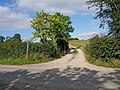 Access road to Compton Park Farm - geograph.org.uk - 1490938.jpg 640 × 480; 101 KB
-
 Blocked Footpath - geograph.org.uk - 421950.jpg 640 × 480; 176 KB
-
 Bridge, Trent and Mersey canal - geograph.org.uk - 498805.jpg 640 × 480; 130 KB
-

-
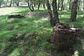
 Cannock Chase wash-house remains - 02.JPG 3,008 × 2,000; 2.98 MB
-
 Cannock Chase wash-house remains - 03.JPG 3,008 × 2,000; 2.94 MB
-
 Cannock Chase wash-house remains - 04.JPG 3,008 × 2,000; 2.95 MB
-
 Cannock Chase wash-house remains - 05.JPG 3,008 × 2,000; 2.97 MB
-
 Cannock Chase wash-house remains - 07.JPG 3,008 × 2,000; 3 MB
-
 Cannock Chase wash-house remains - 09.JPG 3,008 × 2,000; 2.87 MB
-
 Cannock Chase wash-house remains - 10.JPG 3,008 × 2,000; 3.02 MB
-
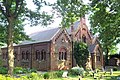 St. Anne's Church, Chasetown - geograph.org.uk - 188201.jpg 640 × 427; 143 KB
-
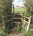 Concealed Stile - geograph.org.uk - 388169.jpg 574 × 640; 162 KB
-
 Footpath From Hints Church - geograph.org.uk - 982217.jpg 640 × 480; 140 KB
-
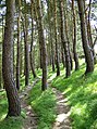
 Footpath in Greatgate Wood - geograph.org.uk - 230544.jpg 640 × 480; 214 KB
-
-

-
 Footpath To Hints - geograph.org.uk - 982190.jpg 640 × 480; 136 KB
-
 Footpath, Hadley End - geograph.org.uk - 969815.jpg 640 × 480; 134 KB
-

-
 Shoal Hill - geograph.org.uk - 164996.jpg 640 × 427; 158 KB
-
 Tyrley Locks - geograph.org.uk - 515029.jpg 640 × 428; 108 KB
-
 Woodland near Aqualate Mere - geograph.org.uk - 170373.jpg 640 × 481; 345 KB
-
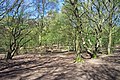
 Woods near Keele University - geograph.org.uk - 58756.jpg 640 × 480; 165 KB


_at_Knypersley_Reservoir_-_geograph.org.uk_-_940487.jpg)


