Category:Dannenwalde (Prignitz)
Jump to navigation
Jump to search
| Object location | | View all coordinates using: OpenStreetMap |
|---|
village in Prignitz district, Brandenburg state, Germany _-_Kolreper_Wiesenweg.JPG) | |||||
| Upload media | |||||
| Instance of |
| ||||
|---|---|---|---|---|---|
| Location | Gumtow, Prignitz District, Brandenburg, Germany | ||||
| Population |
| ||||
| Area |
| ||||
| Elevation above sea level |
| ||||
 | |||||
English: Since 2002 the village Dannenwalde is part of Gumtow municipality, Prignitz district, Brandenburg state, Germany
Deutsch: Seit 2002 ist das Dorf Dannenwalde ein Teil der Gemeinde Gumtow, Landkreis Prignitz, Land Brandenburg, Deutschland.
Français : Depuis 2002 le village Dannenwalde fait partie de la commune de Gumtow, arrondissement Prignitz, état fédéral de Brandebourg, Allemagne
Subcategories
This category has the following 6 subcategories, out of 6 total.
Media in category "Dannenwalde (Prignitz)"
The following 15 files are in this category, out of 15 total.
-
 Dannenwalde (Gumtow) - Kolreper Wiesenweg.JPG 3,888 × 2,592; 1.88 MB
-
 Dannenwalde - Bahndamm West.JPG 3,888 × 2,592; 6.12 MB
-
 Dannenwalde - Findling 666 Jahre Dannewalde.JPG 3,888 × 2,592; 6.49 MB
-
 Dannenwalde - Gutshof Nordwest.JPG 3,888 × 2,592; 3.24 MB
-
 Dannenwalde - Hinweisschild Turmhügel ("Weinberg").JPG 3,888 × 2,592; 2.41 MB
-
 Dannenwalde - Hinweistafel Dannenwald & Umgebung.JPG 3,888 × 2,592; 4.24 MB
-
 Dannenwalde - Hinweistafel Findlingspark.JPG 3,888 × 2,592; 3.3 MB
-
 Dannenwalde - Neubau - Kolreper Damm.JPG 3,888 × 2,592; 3.66 MB
-
 Dannenwalde - Zeittafel 1147 bis 1415.JPG 3,888 × 2,592; 2.74 MB
-
 Dannenwalde - Zeittafel 1759 bis 1945.JPG 3,888 × 2,592; 2.7 MB
-
 Dannenwalde - Zeittafel Weichseleiszeit bis Warmzeit.JPG 3,888 × 2,592; 2.91 MB
-
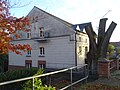
 DannenwaldeDorfstr27b.jpg 2,433 × 1,832; 1.64 MB
-
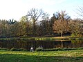
 DannenwaldeMühleNW.jpg 2,592 × 1,944; 1.99 MB
-
 DannenwaldeMühleSW.jpg 2,312 × 1,716; 1.96 MB
-
 DannenwaldeParl.jpg 2,592 × 1,944; 2.55 MB


.JPG)


