Category:Dalry, North Ayrshire
Jump to navigation
Jump to search
town in North Ayrshire, Scotland, UK  | |||||
| Upload media | |||||
| Instance of | |||||
|---|---|---|---|---|---|
| Location |
| ||||
| Population |
| ||||
 | |||||
Føroyskt: Dalry ( skotskt gæliskt: Dail Ruighe), er býur í North Ayrshire í Skotlandi við 5 398 íbúgvar (2001). Statiónsbýur á jarnbreytini millum Glasgow og Prestwick. Dalry er heimbýur William Sloans.
Gàidhlig: 'S e baile beag ann an Siorrachd Inbhir Àir a Tuath, ann an àird an iar-dheas Alba a tha ann an Dail Ruighe (Beurla: Dalry).
Norsk bokmål: Dalry ( Skotsk gælisk: Dail Ruighe) er en by (town) i regionen North Ayrshire i Skottland.
Subcategories
This category has the following 15 subcategories, out of 15 total.
?
- Swindridgemuir (18 F)
B
- Blairmains (5 F)
C
- Cleeves Cove (17 F)
D
- Dalry railway station (10 F)
- Drumcastle Mill (3 F)
- James Dunlop (3 F)
K
- Kersland Castle (9 F)
L
- Law Hill, Dalry (1 F)
- Lovers' Walk (6 F)
- Lynn Glen (5 F)
P
- Pitcon (5 F)
W
Media in category "Dalry, North Ayrshire"
The following 158 files are in this category, out of 158 total.
-

-
 A rail on the railway embankment of Douglas fireclay works..JPG 2,288 × 1,712; 1.3 MB
-
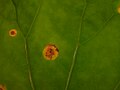
 A rust (Puccinia poarum) on lower surface of Coltsfoot.JPG 920 × 794; 171 KB
-
 Aiton's Map 1811.jpg 96 × 69; 25 KB
-
 Ashgrove Loch from High Smithstone.JPG 1,667 × 1,141; 755 KB
-
 Baidlandhill Farm - geograph.org.uk - 398706.jpg 640 × 480; 61 KB
-
 Bankhead farm, Dalry.JPG 2,186 × 1,349; 1.17 MB
-
 Barkip from the Stables.JPG 2,288 × 1,712; 1.85 MB
-
 Bellstone, Swindridgemuir.JPG 2,254 × 1,666; 1.56 MB
-
 Blairmains Well - entrance side view.JPG 4,147 × 2,988; 7.82 MB
-
 Blairmains Well - interior - view right.JPG 4,446 × 3,228; 3.94 MB
-
 Blairmains Well - interior view - left.JPG 4,530 × 3,350; 3.88 MB
-
 Blairmains Well - interior.JPG 4,606 × 3,454; 3.74 MB
-
 Blue Waters at Ravenscraig, North Lissens.JPG 4,608 × 3,456; 3.63 MB
-
 Blue Waters, Ravenscraig Quarry, Dalry.JPG 4,608 × 3,456; 3.63 MB
-
 Bombo Burn at Swindridgemuir Bridge.JPG 1,666 × 2,254; 2.14 MB
-
 Boyd of Pitcon.jpg 395 × 554; 149 KB
-
 Broadlie Dam.JPG 2,288 × 1,712; 1.28 MB
-
 Broadlie House Dam.JPG 1,712 × 2,288; 1.37 MB
-
 Broomhill Limestone Quarry looking north.JPG 2,199 × 1,224; 1.06 MB
-
 Caaf Water, Lynn Glen, Dalry.JPG 4,608 × 3,456; 6.01 MB
-
 Cleeve Cove.JPG 1,710 × 2,288; 2.12 MB
-
 Cleevescove1.JPG 2,288 × 1,712; 1.34 MB
-
 Coltsfoot lower epidermis with rust (Puccinia poarum).JPG 2,288 × 1,712; 1.26 MB
-
 Coltsfoot upper epidermis with Puccinia poarum.JPG 2,288 × 1,712; 1.56 MB
-
 Conocephalum conicum in Lynn Glen.JPG 2,288 × 1,712; 1.35 MB
-
 Craig Mill splash wall and water wheel pit, etc.JPG 4,608 × 3,456; 3.58 MB
-
 Craig Mill Water powered water pump.JPG 3,456 × 4,608; 5.15 MB
-
 Craig Mill water pump detail.JPG 4,608 × 3,456; 3.49 MB
-
 Craig Mill water pump roof.JPG 3,732 × 2,959; 5.64 MB
-
 Craig Mill Water Pump.JPG 3,456 × 4,608; 4.96 MB
-
 Craig Mill wheel pit modified as a water powered water pump.JPG 2,998 × 4,199; 3.8 MB
-
 Craighead Farm, Dalry.JPG 2,092 × 1,387; 651 KB
-
 Craigmill entrance, Dalry.JPG 2,288 × 1,712; 1.23 MB
-
 Dalry - East Kirkland estate 1993 - geograph.org.uk - 817919.jpg 640 × 428; 81 KB
-
 Dalry and Pitcon from near old East Kersland Mill.JPG 2,288 × 1,712; 1.31 MB
-
 Dalry bypass flyover (geograph 6994367).jpg 1,024 × 717; 200 KB
-
 Dalry Cholera Pit Site.JPG 2,288 × 1,712; 1.52 MB
-
 Dalry Fire Station - geograph.org.uk - 991443.jpg 640 × 401; 69 KB
-
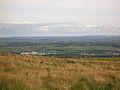 Dalry from Baidland Hill.JPG 2,288 × 1,712; 1.3 MB
-
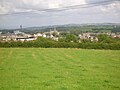 Dalry from Linncraigs Hill.JPG 2,288 × 1,712; 1.19 MB
-
 Dalry Manse and Kirkland.JPG 1,986 × 1,141; 1.28 MB
-
 Dalry Moor Road, Auldmuir Farm - geograph.org.uk - 178408.jpg 640 × 480; 70 KB
-
 Dalry Park looking north.JPG 2,278 × 1,700; 1.48 MB
-
 Dalry Park looking west.JPG 2,278 × 1,698; 1.73 MB
-
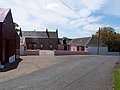
 Dalry streets and buildings.jpg 4,000 × 3,000; 5.69 MB
-
 Dalry Sycamore tree, Ayrshire.JPG 2,288 × 1,712; 1.24 MB
-
-
 Dalry, inc the Royal Hotel.jpg 4,000 × 3,000; 5.65 MB
-
 Dalry, Laigh Lynn Hamlet.JPG 2,288 × 1,712; 1.29 MB
-
 Detail of Puccinia poarum on Coltsfoot upper leaf surface.JPG 2,288 × 1,712; 1.4 MB
-
 Doggartland Bridge Gas Light.JPG 1,712 × 2,288; 1.41 MB
-
 DSM Dalry railway connection.JPG 2,288 × 1,712; 1.27 MB
-
 Dusk Water at Cleeve Cove.JPG 2,288 × 1,712; 2.71 MB
-
 Dykehead Farm - geograph.org.uk - 167662.jpg 640 × 479; 121 KB
-
 East Kersland Mill and farm.JPG 2,288 × 1,712; 1.28 MB
-
 East Kersland Mill, lane to Highfield Road.JPG 1,372 × 1,013; 958 KB
-
 East Kersland Mill, old millpond sites.JPG 2,288 × 1,712; 1.42 MB
-
 Elder growing on Sycamore, Dalry, Scotland.JPG 1,712 × 2,288; 1.3 MB
-
 Embankment of Monkcastle Fireclay mine railway.JPG 2,288 × 1,712; 1.32 MB
-
 Farm Track, Dalry - geograph.org.uk - 991467.jpg 640 × 480; 99 KB
-
 Gable of Linncraigs in Dalry.JPG 2,288 × 1,712; 1.35 MB
-
 Geum rivale, the Water Avens in the Lynn Glen, dalry.JPG 4,608 × 3,456; 3.43 MB
-
 Giffen House, near Dalry, Ayrshire - geograph.org.uk - 1606260.jpg 480 × 640; 87 KB
-
 Giffordland Moot Hill approach.JPG 2,288 × 1,712; 1.38 MB
-
 GlasgowManholeCover2017.jpg 5,472 × 3,648; 9.02 MB
-
 Gorbie Glen and the Dusk Water footbridge.JPG 4,606 × 3,454; 6.8 MB
-
 Handmade wrought iron gate, Parkhill House, dalry.JPG 2,003 × 1,451; 1.94 MB
-
 High Swindridgemuir Farm ruins.JPG 2,006 × 1,288; 1.32 MB
-
 Highfield - B777 and old pub.JPG 2,288 × 1,712; 1.25 MB
-
 Highfield - Littleacre.JPG 2,288 × 1,712; 1.35 MB
-
 Highfield - looking towards B777.JPG 2,288 × 1,712; 1.28 MB
-
 Highfield - looking towards Beith.JPG 2,288 × 1,712; 1.31 MB
-
 Highfield - looking towards Dalry.JPG 2,288 × 1,712; 1.22 MB
-
 Highfield - rear of Southfield, etc.JPG 2,288 × 1,712; 1.17 MB
-
 Highfield - The Creepies.JPG 2,288 × 1,712; 1.2 MB
-
 Highfield and Pastureland Cottages.JPG 2,288 × 1,712; 1.22 MB
-
 Highfield and the Creepies.JPG 2,288 × 1,712; 1.32 MB
-
 Highfield Cottage.JPG 2,288 × 1,712; 1.21 MB
-
 Highfield Farm.JPG 2,288 × 1,712; 1.19 MB
-
 Highfield pit ruins.JPG 2,288 × 1,712; 1.32 MB
-
 Highfield Pit site.JPG 2,288 × 1,712; 1.34 MB
-
 Highfiled - old wash-house.JPG 2,288 × 1,712; 1.24 MB
-
 Holmbyre Farm - geograph.org.uk - 171672.jpg 640 × 479; 68 KB
-
 Holms of Caaf Farm - geograph.org.uk - 171663.jpg 640 × 479; 97 KB
-
 Inosculation between beech and birch at Giffordland.JPG 1,712 × 2,288; 1.21 MB
-
 Kerland Row, Dalry.JPG 2,288 × 1,712; 1.37 MB
-
 Kersland House and farm.JPG 2,288 × 1,712; 1.23 MB
-
 Kersland Lane.JPG 2,288 × 1,712; 1.42 MB
-
 Kersland, grindstone.JPG 2,288 × 1,712; 1.39 MB
-
 Knopper Galls (Andricus quercuscalicis).jpg 2,288 × 1,712; 1.31 MB
-
 Knopper galls of Andricus quercuscalicis.jpg 1,526 × 1,142; 304 KB
-
 Laigh Lynn Hamlet, Dalry.JPG 2,288 × 1,712; 1.19 MB
-
 Linn Glen, Dalry.JPG 1,712 × 2,288; 1.32 MB
-
 Lovers' Walk Bridge.JPG 2,288 × 1,712; 2.01 MB
-
 Lovers' Walk from the Lover's Bridge.JPG 2,288 × 1,712; 2.27 MB
-
 Lovers' Walk, from Dalry Station.JPG 1,712 × 2,288; 2.19 MB
-
 Lynn Glen Primroses.JPG 2,288 × 1,712; 1.31 MB
-
 Lynn Spout and Caaf Water.JPG 2,288 × 1,712; 3.04 MB
-
 Lynn Spout Detail Dalry.JPG 1,712 × 2,288; 1.23 MB
-
 Lynn Spout turbine house.JPG 1,712 × 2,288; 1.36 MB
-
 Lynn Spout, Caaf Water.JPG 2,288 × 1,712; 1.38 MB
-
 Male & Female Sitka Spruce cones, Gorbie Glen.JPG 4,608 × 3,456; 3.59 MB
-
 Marcescence on Quercus (oak).jpg 1,468 × 1,512; 1.09 MB
-
 Mare's tail (Hippuris vulgaris) at the Blue Lagoon, Ravenscraig, North Lissens.JPG 4,608 × 3,456; 3.65 MB
-
 Mast - geograph.org.uk - 342523.jpg 480 × 640; 75 KB
-
 Monkcastle and North Ayrshire circa 1811.jpg 3,472 × 4,640; 2.56 MB
-
 Monkcastle Burn old course.JPG 2,288 × 1,712; 1.39 MB
-
 Monkcastle Burn small waterfall.JPG 2,288 × 1,712; 1.35 MB
-
 Monkcastle Glen.JPG 2,288 × 1,712; 1.32 MB
-
 Monkcastle House from Old Monkcastle.JPG 2,288 × 1,712; 1.37 MB
-
 Monkcastle House, Hunt, Dalry, North Ayrshire.jpg 1,569 × 1,060; 786 KB
-
 Old Monkcastle dovecot ruins.JPG 2,288 × 1,712; 1.33 MB
-
 Old Monkcastle to Monkcastle House gate.JPG 2,288 × 1,712; 1.36 MB
-
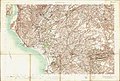 Ordnance Survey One-Inch Sheet 22 Kilmarnock, Published 1906.jpg 12,412 × 8,365; 13.66 MB
-
 Owl hole at Holms of Caaf Farm.jpg 2,590 × 1,548; 1.5 MB
-
 Parkhill House Datestone, Dalry.JPG 2,208 × 984; 1.57 MB
-
 Peden's other pulpit.JPG 1,712 × 2,288; 1.38 MB
-
 Peden's Pulpit Dalry.JPG 2,288 × 1,712; 1.33 MB
-
 Pitcon Estate.JPG 2,288 × 1,712; 1.18 MB
-
 Pitcon road end.JPG 2,288 × 1,712; 1.35 MB
-
 Pitcon tree planting.JPG 2,288 × 1,712; 1.29 MB
-
 Plucking post - Pigeon kill.JPG 2,288 × 1,712; 1.43 MB
-
 Plucking Post at Monkcastle.JPG 2,288 × 1,712; 1.35 MB
-
 Puccinia poarum on Coltsfoot leaf.JPG 2,288 × 1,712; 1.24 MB
-
 Puccinia poarum on Coltsfoot upper epidermis.JPG 2,288 × 1,712; 1.22 MB
-
 Ravenscraig Quarry railway - looking north.JPG 4,608 × 3,456; 7.49 MB
-
 Ravenscraig Quarry railway embankment, old trackbed.JPG 4,608 × 3,456; 3.69 MB
-
 Ravenscraig Quarry railway embankment.JPG 4,560 × 3,390; 5.81 MB
-
 River Garnock at the Lover's Walk, Dalry.JPG 2,288 × 1,712; 1.96 MB
-
 Rye Water Ford house.JPG 1,712 × 2,288; 1.23 MB
-
 Rye Water Ford, Dalry.JPG 2,288 × 1,712; 1.35 MB
-
 Site of Lovers' Walk.JPG 2,288 × 1,712; 2.75 MB
-
 Southfield at Highfield.JPG 2,288 × 1,712; 1.27 MB
-
 St Margarets Parish Church of Scotland, Dalry (geograph 3981975).jpg 1,600 × 1,067; 446 KB
-
 St Palladius RC Church, Aitken Street, Dalry (geograph 3981246).jpg 1,600 × 1,067; 554 KB
-
 Swindridgemuir entrance.JPG 2,288 × 1,712; 1.29 MB
-
 Swindridgemuir Lane.JPG 2,288 × 1,712; 1.29 MB
-
 Swindridgemuir policies.JPG 2,067 × 1,314; 1.15 MB
-
 Tanacetum vulgare at Lynn Glen.JPG 2,288 × 1,712; 1.28 MB
-
 The Blair Court Hill from the south-east, Dalry, North Ayrshire, Scotland.jpg 3,999 × 2,615; 3.85 MB
-
 The Blair Court Hill, Dalry, North Ayrshire, Scotland.jpg 4,608 × 2,882; 5.49 MB
-
 The Croft, Dalry, Ayrshire, the drawing-room.png 937 × 646; 921 KB
-
 The Croft, Dalry, Ayrshire.png 939 × 644; 914 KB
-
 The Dusk Water in Gorbie Glen Woods.JPG 4,606 × 3,454; 7.07 MB
-
 The gates of Dalry Parish Church. - geograph.org.uk - 997389.jpg 640 × 428; 100 KB
-
 The ruins of Monkcastle , Dalry.jpg 2,752 × 3,312; 1.08 MB
-
 Todhills Muir, Kersland.JPG 2,288 × 1,712; 1.34 MB
-
 West Lynn, Dalry, North Ayrshire, Scotland.jpg 4,896 × 2,752; 2.77 MB
-
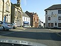
 Dalry - geograph.org.uk - 320065.jpg 640 × 480; 101 KB
-
 Dalry Moor Road, another Wind Farm - geograph.org.uk - 178421.jpg 640 × 480; 80 KB
-
 Dalry Moor Road, Giffordland Bridge - geograph.org.uk - 178412.jpg 640 × 480; 149 KB
-
 Dalry Moor Road, Railway Bridge - geograph.org.uk - 178430.jpg 640 × 480; 142 KB
-
 Drainage Ditch - geograph.org.uk - 88642.jpg 640 × 479; 107 KB
-
 Gravel Pit - geograph.org.uk - 88639.jpg 640 × 479; 76 KB
-
 Holmbyre Cattery - geograph.org.uk - 167661.jpg 640 × 479; 114 KB
-
 Spoil Heap - geograph.org.uk - 62965.jpg 640 × 479; 97 KB
-
 Trees down Turbines up - geograph.org.uk - 342537.jpg 480 × 640; 97 KB


_on_lower_surface_of_Coltsfoot.JPG)


.JPG)


.jpg)


.jpg)


.jpg)
_at_the_Blue_Lagoon,_Ravenscraig,_North_Lissens.JPG)


.jpg)
.jpg)


