Category:Dale (Gelderland)
Jump to navigation
Jump to search
| Object location | | View all coordinates using: OpenStreetMap |
|---|
hamlet in Aalten, Netherlands   | |||||
| Upload media | |||||
| Spoken text audio | |||||
|---|---|---|---|---|---|
| Instance of | |||||
| Location | Aalten, Gelderland, Netherlands | ||||
 | |||||
Media in category "Dale (Gelderland)"
The following 9 files are in this category, out of 9 total.
-

-
Nl-Dale (Gelderland)-article.ogg 1 min 12 s; 713 KB
-
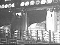
 Bedstede - Dale - 20476021 - RCE.jpg 1,200 × 900; 172 KB
-
 Bedstede - Dale - 20476022 - RCE.jpg 1,200 × 900; 168 KB
-
 Erf - Dale - 20476019 - RCE.jpg 1,200 × 900; 237 KB
-
 Interieur woonkamer dia 5949 - Dale - 20476023 - RCE.jpg 1,200 × 900; 160 KB
-
 Keitjesvloer in woonkamer - Dale - 20476024 - RCE.jpg 1,200 × 900; 228 KB
-
 Voor- en zijgevel - Dale - 20476018 - RCE.jpg 1,200 × 900; 184 KB
-


