Category:Dalbeattie
Jump to navigation
Jump to search
town in Dumfries and Galloway, Scotland, UK  | |||||
| Upload media | |||||
| Instance of |
| ||||
|---|---|---|---|---|---|
| Location |
| ||||
| Population |
| ||||
| official website | |||||
 | |||||
English: Dalbeattie ( Gaelic: Dail Bheithe, "Valley of the Birch Trees") is a town in Dumfries and Galloway, Scotland.
Gàidhlig: 'S e baile ann an Dùn Phris is Gall-Ghaidhealaibh a tha ann an Dail Bheithe (Beurla: Dalbeattie). Tha e suidhichte ann an gleann air bruach Urr Water mu 6 cilemeatair (4 mìltean) ear air Caisteal Dhùghlais agus mu 19 cilemeatair (12 mìltean) iar-dheas air Dùn Phrìs. 'S e seo na co-chomharran aige: 54° 55′ 55.2″ Tuath agus 3° 49′ 19.2″ Iar.
Norsk bokmål: Dalbeattie ( Skotsk gælisk: Dail Bheithe) er en by (town) i regionen Dumfries and Galloway i Skottland. Dalbeattie ligger seks kilometer øst for Castle Douglas og 19 km sørvest for Dumfries.
Subcategories
This category has the following 7 subcategories, out of 7 total.
D
- Dalbeattie Forest (69 F)
- Dalbeattie railway station (2 F)
- Dalbeattie Reservoir (3 F)
- Dalbeattie Town Hall (10 F)
E
- Ewe Hill, Dalbeattie (1 F)
P
- Plantain Loch (1 F)
Media in category "Dalbeattie"
The following 40 files are in this category, out of 40 total.
-
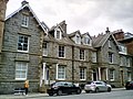 9-13 St Mary Street, Kirkcudbright, Scotland.jpg 1,600 × 1,200; 422 KB
-
 Car park, Dalbeattie Town Woods - geograph.org.uk - 1531540.jpg 640 × 480; 112 KB
-
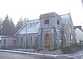
 Christ Church, Dalbeattie - geograph.org.uk - 444419.jpg 640 × 553; 110 KB
-
 Church, Dalbeattie - geograph.org.uk - 70093.jpg 480 × 640; 49 KB
-
 Colliston Bandstand - geograph.org.uk - 3770437.jpg 640 × 424; 81 KB
-
 Colliston Park - geograph.org.uk - 660071.jpg 640 × 480; 87 KB
-
 Common Blue Damselflies Mating FZ82 P1040626.jpg 4,896 × 3,672; 8.35 MB
-
 Dalbeattie River in full spate - geograph.org.uk - 1218099.jpg 640 × 480; 76 KB
-
 Dalbeattie Town Center.jpg 1,600 × 1,200; 648 KB
-
 Dalbeattie Town Centre - geograph.org.uk - 382637.jpg 640 × 480; 73 KB
-
-
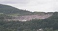 Dalbeattie, Craignair Quarry.jpg 2,635 × 1,412; 353 KB
-
 Dismantled Bridge - geograph.org.uk - 906598.jpg 640 × 480; 101 KB
-
 Farmland north of Dalbeattie - geograph.org.uk - 444620.jpg 640 × 480; 126 KB
-
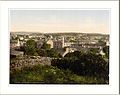 General view Dalbeattie Scotland.jpg 1,057 × 835; 167 KB
-
 General view, Dalbeattie, Scotland LOC 3450350630.jpg 1,024 × 773; 231 KB
-
 General view, Dalbeattie, Scotland-LCCN2001705965.jpg 3,627 × 2,738; 3.15 MB
-
 Housing - geograph.org.uk - 724397.jpg 640 × 480; 58 KB
-
 Intriguing sculpture in Colliston Park - geograph.org.uk - 211770.jpg 425 × 640; 133 KB
-
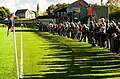 Islecroft Stadium.jpg 640 × 424; 138 KB
-
 Kinnairds in Dalbeattie - geograph.org.uk - 670604.jpg 640 × 458; 76 KB
-
 Looking towards Burn Street - geograph.org.uk - 670644.jpg 640 × 428; 73 KB
-
 Mapa dg dail bheithe.jpg 2,004 × 1,363; 599 KB
-
 Meikle Dalbeattie Farm - geograph.org.uk - 906396.jpg 640 × 356; 68 KB
-
 Memorial Tablet. - geograph.org.uk - 660152.jpg 640 × 480; 111 KB
-
 Munches House, Dalbeattie, Kirkcudbrightshire in 1797.jpg 600 × 376; 29 KB
-
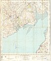 Ordnance Survey One-Inch Sheet 81 Dalbeattie, Published 1956.jpg 8,388 × 9,954; 8.52 MB
-
 Ordnance Survey One-Inch Sheet 81 Dalbeattie, Published 1963.jpg 10,937 × 13,121; 14.67 MB
-
 Picnic area, Dalbeattie Town Woods - geograph.org.uk - 1531545.jpg 640 × 480; 111 KB
-
 Ravens Craig overlooking the Urr Water - geograph.org.uk - 1274051.jpg 640 × 480; 102 KB
-
 Rockcliffe FZ82 P1040600 Horizon.jpg 3,488 × 4,651; 9.66 MB
-
 School patrol road sign - geograph.org.uk - 1309690.jpg 640 × 491; 81 KB
-
 Sign of the Times - geograph.org.uk - 691316.jpg 640 × 480; 136 KB
-
 Sunnyside, Barr Hill, Dalbeattie - geograph.org.uk - 950360.jpg 640 × 480; 71 KB
-
 The Bandstand. - geograph.org.uk - 660102.jpg 640 × 480; 86 KB
-

-
 The Ship Inn. - geograph.org.uk - 789861.jpg 640 × 306; 38 KB
-
 Wetland near Dalbeattie. - geograph.org.uk - 134255.jpg 640 × 480; 162 KB
-
 Wetland near Dalbeattie. - geograph.org.uk - 134600.jpg 480 × 640; 136 KB
-
 Dalbeattie High School - geograph.org.uk - 444615.jpg 640 × 480; 140 KB


_pre_restoration_-_geograph.org.uk_-_840407.jpg)


