Category:Daer Water
Jump to navigation
Jump to search
Daer Water is a tributary of the River Clyde.link
river in South Lanarkshire, Scotland, UK; its confluence with Potrail Water forms the River Clyde  | |||||
| Upload media | |||||
| Instance of | |||||
|---|---|---|---|---|---|
| Location | South Lanarkshire, Scotland | ||||
| Connects with |
| ||||
| Elevation above sea level |
| ||||
| Mouth of the watercourse |
| ||||
| Lake on watercourse | |||||
 | |||||
Media in category "Daer Water"
The following 16 files are in this category, out of 16 total.
-
 Bridge at Howe Cleuch - geograph.org.uk - 1511810.jpg 640 × 480; 145 KB
-
 Bridge over Howe Cleuch - geograph.org.uk - 1770527.jpg 2,816 × 2,112; 4.43 MB
-
 Bridge over Howe Cleuch burn - geograph.org.uk - 461989.jpg 640 × 472; 158 KB
-
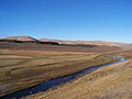 Daer Water - geograph.org.uk - 1691627.jpg 640 × 480; 67 KB
-
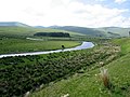
 Daer Water - geograph.org.uk - 461887.jpg 640 × 420; 105 KB
-
 Daer Water - geograph.org.uk - 634631.jpg 640 × 395; 52 KB
-
 Daer Water from Watchman Hill - geograph.org.uk - 669607.jpg 640 × 480; 133 KB
-
 Daer Water meander - geograph.org.uk - 221924.jpg 640 × 482; 77 KB
-
 Daer Water near Kirkhope - geograph.org.uk - 461976.jpg 640 × 477; 123 KB
-
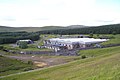 Daer Water Treatment Works - geograph.org.uk - 1398550.jpg 640 × 427; 54 KB
-
 Source of the River Clyde.JPG 2,276 × 1,064; 3.58 MB
-
 Trees and wall - geograph.org.uk - 1511865.jpg 480 × 640; 121 KB
-
 Across Daer Water to Glenochar - geograph.org.uk - 669545.jpg 640 × 480; 123 KB
-
 Across the Daer Hass - geograph.org.uk - 1511878.jpg 640 × 480; 122 KB
-
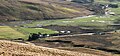
 Daer Water - geograph.org.uk - 461960.jpg 640 × 480; 123 KB
-
 Daer Water - geograph.org.uk - 669549.jpg 640 × 480; 124 KB


