Category:DOCUMERICA photographs by Hope Alexander
Jump to navigation
Jump to search
Media in category "DOCUMERICA photographs by Hope Alexander"
The following 200 files are in this category, out of 355 total.
(previous page) (next page)-

-

-

-

-

-
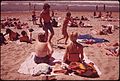
 A WALK ON THE BEACH - NARA - 547599.jpg 3,000 × 2,036; 655 KB
-
 ABANDONED AUTO AT FIELDS POINT ON NARRAGANSETT BAY - NARA - 547484.jpg 3,000 × 2,026; 617 KB
-
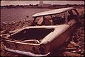 ABANDONED CAR AT FIELDS POINT ON NARRAGANSETT BAY - NARA - 547481.jpg 3,000 × 2,016; 985 KB
-
 ABANDONED CAR ON SEEKONK RIVER BANK - NARA - 547597.jpg 3,000 × 2,035; 765 KB
-
 ABANDONED FARM IN SOUTH KINGSTOWN - NARA - 547538.jpg 2,004 × 3,000; 1.8 MB
-
 ABANDONED FARM OVERLOOKING RHODE ISLAND SOUND - NARA - 547658.jpg 3,000 × 2,039; 819 KB
-
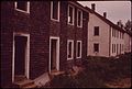 ABANDONED MILL HOUSES IN CHARLESTOWN - NARA - 547515.jpg 3,000 × 2,016; 999 KB
-

-
-

-
-
 ALLENS AVENUE-WATERFRONT INDUSTRIAL AREA - NARA - 547570.jpg 3,000 × 1,996; 810 KB
-
 ALONG THE SEEKONK RIVER - NARA - 547473.jpg 3,000 × 2,030; 1.35 MB
-
 ALONG THE SEEKONK RIVER - NARA - 547477.jpg 2,021 × 3,000; 1.12 MB
-

-

-
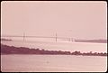
 ArthurKill VerticalLift Goethals bridges.jpg 3,000 × 2,040; 912 KB
-
 ATLANTIC SURF - NARA - 547609.jpg 3,000 × 2,022; 892 KB
-
 AUTO SHREDDER - NARA - 547468.jpg 2,003 × 3,000; 626 KB
-

-

-
 BARRIER BEACHES - NARA - 547629.jpg 2,012 × 3,000; 704 KB
-
 BARRIER BEACHES - NARA - 547632.jpg 3,000 × 2,042; 771 KB
-

-

-

-
-
 BEACH AT MIDDLETOWN - NARA - 547676.jpg 3,000 × 2,017; 842 KB
-
 BEACH PEA - NARA - 547613.jpg 2,028 × 3,000; 624 KB
-
 BEER CANS WERE TARGETS ON THIS STONE WALL - NARA - 547506.jpg 3,000 × 2,015; 980 KB
-
 BLACK-CROWNED NIGHT HERON - NARA - 547630.jpg 3,000 × 2,031; 1.01 MB
-
 BLACK-CROWNED NIGHT HERON IN FLIGHT - NARA - 547593.jpg 3,000 × 2,025; 884 KB
-
 BLUETS - NARA - 547642.jpg 2,013 × 3,000; 729 KB
-
 BLUETS AND BOULDER - NARA - 547646.jpg 2,032 × 3,000; 898 KB
-

-

-
 CANADA MAYFLOWER - NARA - 547635.jpg 2,023 × 3,000; 1.05 MB
-
 CAR ABANDONED ON SEEKONK RIVER BANK - NARA - 547601.jpg 3,000 × 1,993; 957 KB
-
 CAR ABANDONED ON SEEKONK RIVER BANK - NARA - 547605.jpg 3,000 × 2,033; 1.04 MB
-

-

-
-

-
 CLEANING UP AFTER AN OIL SPILL IN NARRAGANSETT BAY - NARA - 547498.jpg 2,035 × 3,000; 997 KB
-
 CLEANING-UP AFTER OIL SPILL FROM A TANKER IN NARRAGANSETT BAY - NARA - 547530.jpg 2,033 × 3,000; 935 KB
-
-

-

-

-

-

-

-

-

-

-
 CONVERSATION ON THE SEA WALL - NARA - 547595.jpg 3,000 × 2,031; 683 KB
-

-
-

-

-

-

-

-
 DEVELOPER'S SIGN AT POINT JUDITH ON BLOCK ISLAND SOUND - NARA - 547648.jpg 3,000 × 2,046; 1.19 MB
-
 DEVELOPMENT OF BARRIER BEACH - NARA - 547640.jpg 3,000 × 2,048; 809 KB
-

-

-

-

-

-
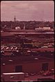
 DOWNTOWN PROVIDENCE LOOKING TOWARDS THE CENTRAL BUSINESS DISTRICT - NARA - 547651.jpg 3,000 × 2,030; 766 KB
-

-
 DRIVE-IN MOVIE AT FIELDS POINT - NARA - 547573.jpg 3,000 × 1,973; 782 KB
-
 DROSERA INTERMEDIA (SUNDEW), SEEN IN A TIVERTON MARSH - NARA - 547672.jpg 2,021 × 3,000; 994 KB
-
 DUMPED AT FIELDS POINT ON NARRAGANSETT BAY - NARA - 547590.jpg 3,000 × 1,996; 1.25 MB
-
 DUMPING ALONG THE SHORE OF NARRAGANSETT BAY AT FIELDS POINT - NARA - 547485.jpg 2,037 × 3,000; 980 KB
-

-
 DUMPING AT FIELDS POINT ALONG NARRAGANSETT BAY - NARA - 547598.jpg 3,000 × 2,018; 999 KB
-
 DUMPING ON NARRAGANSETT BAY SHORE - NARA - 547606.jpg 2,032 × 3,000; 1.11 MB
-
 DUNE BUGGY TRACKS ACROSS THE DUNE - NARA - 547616.jpg 2,019 × 3,000; 933 KB
-

-

-

-

-

-
 FARM IN WEST GREENWICH. STONE OUTCROPPINGS TYPIFY NEW ENGLAND SOIL - NARA - 547654.jpg 1,987 × 3,000; 1.27 MB
-

-

-

-

-
 FARMLANDS NEAR MIDDLETOWN - NARA - 547684.jpg 3,000 × 2,037; 967 KB
-
 FIELDS POINT - NARA - 547574.jpg 2,012 × 3,000; 793 KB
-

-

-

-

-

-
-

-

-

-

-

-

-
-
 FOREST OF BEECHES AND MAPLES - NARA - 547643.jpg 3,000 × 2,048; 1.64 MB
-
 FOREST OF OAKS AND MAPLES - NARA - 547647.jpg 3,000 × 2,021; 1.54 MB
-

-
-
 GATHERING PERIWINKLES (EDIBLE SNAILS) - NARA - 547504.jpg 3,000 × 2,031; 926 KB
-
 GETTY TANKER TERMINAL ON THE PROVIDENCE RIVER - NARA - 547627.jpg 3,000 × 2,037; 918 KB
-

-

-

-
-
 HOISTING AN AUTOMOBILE FOR SHREDDING INTO SCRAP METAL - NARA - 547621.jpg 2,056 × 3,000; 849 KB
-

-
 HOUSES ON THE DUNE - NARA - 547567.jpg 3,000 × 2,001; 877 KB
-
 HOUSES ON THE DUNE - NARA - 547641.jpg 3,000 × 1,975; 1.08 MB
-
 HOUSING DEVELOPMENT AT POINT JUDITH, ON BLOCK ISLAND SOUND - NARA - 547664.jpg 3,000 × 2,014; 1.17 MB
-
 HOUSING DEVELOPMENT AT WEST GREENWICH CENTER - NARA - 547652.jpg 3,000 × 2,039; 1.23 MB
-
 HOUSING ON BARRIER BEACH - NARA - 547636.jpg 3,000 × 2,042; 865 KB
-
 HOUSING ON DUNE OF BARRIER BEACH - NARA - 547645.jpg 3,000 × 2,027; 1.22 MB
-
 HOUSING ON THE DUNES - NARA - 547633.jpg 3,000 × 2,021; 762 KB
-
 Hudson Line train under High Bridge, April 1974.jpg 2,907 × 1,938; 3.15 MB
-
 HYDRANT MARKS LAND CLEARED FOR HOUSING DEVELOPMENT AT POINT JUDITH - NARA - 547653.jpg 3,000 × 2,043; 1.09 MB
-
 I-95 ALONG THE WATERFRONT - NARA - 547569.jpg 3,000 × 1,991; 730 KB
-

-
 IN THE STATE CAPITAL, A HEAVILY INDUSTRIALIZED CITY - NARA - 547666.jpg 2,006 × 3,000; 639 KB
-

-

-

-

-
-

-

-

-

-
 LAND ADVERTISED FOR SALE BY DEVELOPER AT POINT JUDITH - NARA - 547661.jpg 3,000 × 1,995; 1.42 MB
-
-
 LAND CLEARED FOR DEVELOPMENT AT POINT JUDITH - NARA - 547657.jpg 3,000 × 2,023; 1.06 MB
-
 LAND DEVELOPMENT AT POINT JUDITH - NARA - 547523.jpg 2,005 × 3,000; 1.23 MB
-
 LAND OFFERED FOR DEVELOPMENT AT POINT JUDITH - NARA - 547527.jpg 2,027 × 3,000; 1.12 MB
-

-
 LITTLE COMPTON BEACH ON RHODE ISLAND SOUND - NARA - 547496.jpg 2,012 × 3,000; 969 KB
-

-

-

-
 LOOKING ACROSS THE SALT MARSH TO THE MIDDLETOWN DUMP - NARA - 547543.jpg 3,000 × 2,026; 935 KB
-

-
-

-

-

-

-
-
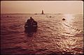
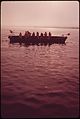
 MEMBERS OF THE SAKONNET RIVER FISHING FLEET - NARA - 547566.jpg 2,019 × 3,000; 1.05 MB
-
 MIDDLETOWN DUMP (BACKGROUND) BORDERS SALT MARSH - NARA - 547547.jpg 3,000 × 2,000; 1.13 MB
-
 MIDDLETOWN DUMP MEETS THE SALT MARSH - NARA - 547516.jpg 2,009 × 3,000; 1.1 MB
-
 MIDDLETOWN DUMP MEETS THE SALT MARSH - NARA - 547520.jpg 2,014 × 3,000; 1.27 MB
-
 MIDDLETOWN DUMP MEETS THE SALT MARSH - NARA - 547525.jpg 2,023 × 3,000; 1.07 MB
-
 MIDDLETOWN DUMP SPILLS OVER INTO SALT MARSH CREEK - NARA - 547517.jpg 2,021 × 3,000; 1.16 MB
-
 MIDDLETOWN DUMP SPILLS OVER INTO SALT MARSH CREEK - NARA - 547521.jpg 2,027 × 3,000; 1.01 MB
-

-
 MISQUAMICUT STATE BEACH - NARA - 547478.jpg 3,000 × 1,984; 1.03 MB
-
 MISQUAMICUT STATE BEACH - NARA - 547482.jpg 3,000 × 2,018; 972 KB
-
 MISQUAMICUT STATE BEACH - NARA - 547491.jpg 2,020 × 3,000; 949 KB
-
 MISQUAMICUT STATE BEACH - NARA - 547495.jpg 2,025 × 3,000; 771 KB
-
 MISQUAMICUT STATE BEACH - NARA - 547499.jpg 2,025 × 3,000; 703 KB
-
 MISQUAMICUT STATE BEACH - NARA - 547503.jpg 3,000 × 2,024; 921 KB
-
 MISQUAMICUT STATE BEACH - NARA - 547507.jpg 3,000 × 2,022; 938 KB
-
 MISQUAMICUT STATE BEACH - NARA - 547628.jpg 2,025 × 3,000; 1.07 MB
-

-
 MODERN VIEW OF ONE OF THE STATE'S OLDEST TOWNS - NARA - 547655.jpg 3,000 × 2,035; 983 KB
-
 MOTORCYCLING OVER THE SAND - NARA - 547588.jpg 3,000 × 2,053; 537 KB
-
-

-
 NARRAGANSETT BAY SHORE AT FIELDS POINT - NARA - 547472.jpg 3,000 × 2,029; 998 KB
-

-

-

-

-

-

-
 NEARBY FIELDS ARE FILLED WITH SMOKE FROM OPEN BURNING CITY DUMP - NARA - 547542.jpg 3,000 × 1,972; 477 KB
-
 NEARBY FIELDS ARE FULL OF SMOKE FROM OPEN BURNING IN CITY DUMP - NARA - 547535.jpg 3,000 × 2,005; 982 KB
-

-
 NEW HOUSING ON BARRIER BEACH DUNE - NARA - 547644.jpg 3,000 × 2,044; 839 KB
-

-

-

-

-
-

-


_WHICH_IS_PLENTIFUL_THROUGHOUT_THE_BIGHT_APEX_NEAR_THE_DUMP_SITES_AND_IN_POLLUTED_BAYS..._-_NARA_-_555837.jpg)


,_SEEN_IN_A_TIVERTON_MARSH_-_NARA_-_547672.jpg)


,_DETRITUS_AND_BACTERIA_PHOTOGRAPHED_AT_THE_ATLANTIC_MARINE..._-_NARA_-_555840.jpg)
_-_NARA_-_547504.jpg)


_BORDERS_SALT_MARSH_-_NARA_-_547547.jpg)


_READY_FOR_EXPORT_FROM_FIELDS_POINT_-_NARA_-_547480.jpg)


