Category:D21a (road sign, France)
Jump to navigation
Jump to search
Media in category "D21a (road sign, France)"
The following 200 files are in this category, out of 410 total.
(previous page) (next page)-
 Compo-panneau-2b.svg 1,360 × 369; 20 KB
-
 Compo-panneau-2b1.svg 1,358 × 307; 17 KB
-
 Compo-panneau-2b2.svg 1,359 × 340; 21 KB
-
 D21a.svg 279 × 71; 10 KB
-
 Carrefour-complexe.svg 432 × 1,013; 32 KB
-
 Carrefour-simple-trafic-fort.svg 405 × 1,006; 24 KB
-

-

-

-

-
 1LaCure.JPG 4,320 × 3,240; 5.48 MB
-
 2013-08-10 Viaduc de Cize-Bolozon (panneaux directions).JPG 3,672 × 4,896; 5.91 MB
-
 39130 Châtel-de-Joux, France - panoramio.jpg 2,560 × 1,920; 1.79 MB
-
 Accès Grand'Rue vers Cusset (Billy) 2015-08-12.JPG 2,816 × 2,112; 1.59 MB
-
 Allée de Marseigne (Jaligny-sur-Besbre) 2022-03-24.JPG 2,992 × 2,000; 2.02 MB
-

-

-

-
 Barques-FR-76-panneau indicateur-1.jpg 4,032 × 3,024; 2.93 MB
-
 Bellerive-sur-Allier - Dernier passage piétons de la D 6 2014-06-08.JPG 2,816 × 2,112; 1.45 MB
-
 Belval-Bois-des-Dames-FR-08-panneau indicateur-1.jpg 4,032 × 3,024; 2.96 MB
-
 Blanzat D 764 et bus 2015-04-10.JPG 2,816 × 2,112; 1.74 MB
-
 Bois Perrex 22.jpg 5,184 × 3,456; 8.2 MB
-
 Bonnefamille - 2015-05-03 - IMG-0293.jpg 5,184 × 3,456; 3.74 MB
-
 Bonnier5.JPG 800 × 600; 47 KB
-
 Breteau-FR-45-panneau d'itinéraire-a1.jpg 3,648 × 2,736; 2.35 MB
-
 Busset D 121 vers Le Mayet-de-M près mairie.JPG 2,048 × 1,536; 752 KB
-
 Busset Grande Rue vers Saint-Yorre.JPG 2,048 × 1,536; 958 KB
-
 Buzancy-FR-08-panneaux indicateurs-01.jpg 3,024 × 4,032; 2.95 MB
-
 Bévy - Panneau direction L'Étang-Vergy (nov 2018).jpg 4,032 × 3,016; 4.66 MB
-
 Bévy - Panneau direction Messanges (nov 2018).jpg 4,032 × 3,016; 4.19 MB
-
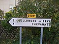 Bévy - Panneaux directionnels vers Collonges et Chevannes (nov 2018).jpg 4,032 × 3,016; 3.83 MB
-
 Bézu-Saint-Germain-FR-02-A-03.JPG 2,736 × 3,648; 909 KB
-
 Car Région Auvergne Rhône Alpes Intersection Route Vonnas Route St Jean St Cyr Menthon 3.jpg 4,032 × 3,024; 5.04 MB
-

-
 Carrefour D 3 à Chanonat 2016-09-13.JPG 2,816 × 2,112; 1.4 MB
-
 Carrefour D 906 direction Le Puy-en-Velay et D 7 (Courpière) 2022-05-15.JPG 2,992 × 2,000; 2.19 MB
-
 Carrefour-simple-trafic-faible.svg 384 × 899; 16 KB
-
 Charbogne-FR-08-panneau-03.JPG 2,601 × 3,526; 1.11 MB
-
 Charmeil D 27 intersection D 6 2014-06-14.JPG 2,816 × 2,112; 1.1 MB
-
 Chevry-sous-le-Bignon-FR-45-carrefour D33 & D146-a.jpg 4,032 × 3,024; 2.62 MB
-
 Chuelles-FR-45-panneau Michelin-05.JPG 2,613 × 3,509; 1.13 MB
-
 Cluny Vue.JPG 2,039 × 1,373; 690 KB
-
 Col de Boubon 1.JPG 3,648 × 2,736; 1.36 MB
-
 Col de l'Iseran.jpg 1,758 × 1,101; 306 KB
-
 Col de la Cambuse - Panneaux directionnels (août 2018).jpg 3,016 × 4,032; 3.3 MB
-
 Col de la Cambuse - Vue direction Meaux-la-Montagne (août 2018).jpg 4,032 × 3,016; 5.03 MB
-
 Col de la Croix de Marchampt - Panneaux directionnels 1 (mars 2019).jpg 4,608 × 3,456; 6.57 MB
-
 Col de la Croix de Marchampt - Panneaux directionnels 2 (mars 2019).jpg 4,608 × 3,456; 4.88 MB
-
 Col de la Croix Nicelle - Panneaux directionnels D9 vers Saint-Bonnet (avr 2023).jpg 4,032 × 3,024; 3.02 MB
-
 Col de la Croix Nicelle - Panneaux directionnels D9 vers Saint-Nizier (avr 2023).jpg 4,032 × 3,024; 3.71 MB
-
 Col du Galibier - Panneaux au col.JPG 3,648 × 2,736; 4.23 MB
-
 Col du Galibier - panoramio.jpg 2,048 × 1,536; 653 KB
-
 Col du Galibier 1.jpg 5,310 × 3,539; 5.49 MB
-
 Col du Galibier 2.jpg 5,472 × 3,648; 6.37 MB
-
 Col du Galibier 3 (cropped).jpg 4,707 × 3,135; 4.19 MB
-
 Col du Galibier 3.jpg 5,472 × 3,648; 5.78 MB
-
 Col du Galibier 4.jpg 2,832 × 2,128; 1,010 KB
-
 Col du Glandon - 2014-08-27 - IMG 6034.jpg 4,848 × 3,232; 11.26 MB
-
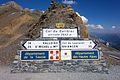
 Cormet de Roselend - Panneau (août 2018).jpg 1,600 × 1,200; 207 KB
-
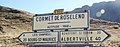 CormetRoselend.jpg 2,169 × 852; 387 KB
-
 Couloutre-FR-58-publiphone-01.jpg 3,648 × 2,736; 2.24 MB
-
 Craonne (Aisne) Vieux Craonne, panneaux de route.JPG 3,648 × 2,736; 4.21 MB
-
 Craonne-FR-02-Vieux Craonne-02.jpg 4,032 × 3,024; 2.9 MB
-
 Crenans - RD 296 direction Coulouvre (juil 2018).jpg 4,608 × 3,456; 4.44 MB
-
 Crenans - RD 331 direction Charchilla (juil 2018).jpg 4,608 × 3,456; 4.3 MB
-
 Croix Creux Replonges 5.jpg 3,456 × 5,184; 4.77 MB
-
 Croix Creux Replonges 8.jpg 3,456 × 5,184; 6.04 MB
-
 Croix Gonnières Chevroux Ain 1.jpg 5,184 × 3,456; 6.63 MB
-
 Cuzieu (Loire, Fr) mairie.JPG 4,000 × 3,000; 3.85 MB
-
 D 119 vers Gannat (Charmes, Allier) 2016-02-24.JPG 2,816 × 2,112; 1.81 MB
-
 D 12 à Pagnant (Saint-André-le-Coq) 2016-03-17.JPG 2,816 × 2,112; 1.49 MB
-
 D 121 et D 421 à La Chapelle 2016-03-15.JPG 2,816 × 2,112; 1.59 MB
-
 D 121 vers Cusset et Busset (La Chapelle) 2016-03-15.JPG 2,816 × 2,112; 1.75 MB
-
 D 122 vers Ferrières (La Guillermie) 2016-03-30.JPG 2,816 × 2,112; 1.59 MB
-
 D 122 vers Le Mayet-de-Montagne (La Guillermie) 2023-10-01.JPG 2,992 × 2,000; 1.99 MB
-
 D 122 vers Thiers (La Guillermie) 2016-03-30.JPG 2,816 × 2,112; 1.54 MB
-
 D 130 vers Saint-Gérand-le-Puy (Billy) 2022-08-13.JPG 2,992 × 2,000; 2.16 MB
-
 D 131 vers Hauterive, Bellerive-sur-Allier et Vichy depuis la D 131e 2022-05-28.JPG 2,992 × 2,000; 2.29 MB
-
 D 142 vers Marcenat (Saint-Rémy-en-Rollat) 2015-08-12.JPG 2,816 × 2,112; 1.89 MB
-

-
 D 210 vers Clermont-Ferrand (Surat) 2016-05-06 (cropped).JPG 1,666 × 1,316; 797 KB
-
 D 210 vers Thuret (Surat) 2016-05-06.JPG 2,816 × 2,112; 1.81 MB
-
 D 2209 Cusset Place Centenaire vers Moulins 2014-06-15.JPG 2,816 × 1,584; 993 KB
-
 D 221 vers Hauterive - Déviation sud de Fontsalive 2022-06-11.JPG 2,992 × 2,000; 2.76 MB
-
 D 26 panneaux D21a idéogramme SC5 2.jpg 5,472 × 3,648; 7.41 MB
-
 D 26 panneaux D21a idéogramme SC5.jpg 5,472 × 3,648; 6.82 MB
-
 D 26 vers Lapalisse, à la sortie d'Arfeuilles 2024-03-10.JPG 2,992 × 2,000; 2.05 MB
-
 D 260 vers Saint-Yorre et Vichy (Mariol) 2024-01-28.JPG 2,992 × 2,000; 1.9 MB
-
 D 327 vers Saint-Ignat (Saint-Laure) 2016-05-06.JPG 2,816 × 2,112; 1.63 MB
-
 D 35 à Saint-Bonnet-de-Rochefort 2016-03-18.JPG 2,816 × 2,112; 1.95 MB
-
 D 37 vers SBR (Mazerier) 2016-03-20.JPG 2,816 × 2,112; 1.71 MB
-
 D 4 vers Vinzelles (Charnat) 2017-08-19.JPG 2,816 × 2,112; 1.65 MB
-
 D 422 vers Lavoine (La Guillermie) 2023-10-01.JPG 2,992 × 2,000; 2.16 MB
-

-

-

-
 D 6 vers Montluçon (Saint-Rémy-en-Rollat) 2015-08-12.JPG 2,816 × 2,112; 1.55 MB
-
 D 6 vers Montluçon (Saint-Rémy-en-Rollat) 2024-02-18.JPG 2,992 × 2,000; 2.06 MB
-
 D 6 vers Vichy (Saint-Rémy-en-Rollat) 2015-08-12.JPG 2,816 × 2,112; 1.67 MB
-
 D 62 après giratoire vers Orcines (Saint-Ours) 2023-07-02.JPG 2,992 × 2,000; 2.01 MB
-
 D 68 Panneau D21a Chénas 4 Fleurie 7 idéogramme SI5 zoom.jpg 5,472 × 3,648; 7.96 MB
-
 D 68 Panneau D21a Chénas 4 Fleurie 7 idéogramme SI5.jpg 5,472 × 3,648; 9.13 MB
-
 D 906 vers Thiers (Puy-Guillaume) 2016-03-13.JPG 2,816 × 2,112; 1.38 MB
-
 D 906 vers Vichy (Puy-Guillaume) 2016-03-13.JPG 2,816 × 2,112; 1.67 MB
-
 D 943 après giratoire vers Clermont-Ferrand (Saint-Ours) 2023-07-02.JPG 2,992 × 2,000; 1.97 MB
-
 D 953 vers Bourbon-l'Archambault (Moulins RG) 2015-08-26.JPG 2,816 × 2,112; 1.52 MB
-
 D 96 vers Authezat (Vic-le-Comte, Longues) 2015-08-20.JPG 2,816 × 2,112; 1.32 MB
-
 D 984 vers Aigueperse (limite 63 et 03) 2016-03-01.JPG 2,816 × 2,112; 1.83 MB
-
 D 984 vers Vichy (limite 63 et 03) 2016-03-01.JPG 2,816 × 2,112; 2.02 MB
-
 D 985 vers Aigueperse (Artonne) 2016-05-24.JPG 2,816 × 2,112; 1.58 MB
-
 D 985 vers Combronde (Artonne) 2016-05-24.JPG 2,816 × 2,112; 1.57 MB
-
 D 989 vers Le Donjon (Jaligny-sur-Besbre) 2022-03-24.JPG 2,992 × 2,000; 2.2 MB
-
 D 996 Varennes-sur-Usson vers Ambert et Usson au second plan 2017-08-19.JPG 2,816 × 2,112; 1.48 MB
-
 D21 a D605.JPG 1,936 × 1,288; 1.46 MB
-
 D269 Menthon-St-Bernard.jpg 4,000 × 2,248; 4.16 MB
-
 Dammarie-en-Puisaye-FR-45-A-14.JPG 3,648 × 2,736; 1.19 MB
-
 Dernier passage piétons de la D 6 (Bellerive-sur-Allier) 2023-08-19.JPG 2,992 × 2,000; 1.94 MB
-
 Des panneaux à Molinges (Jura, France) en juillet 2018.jpg 3,024 × 4,032; 4.15 MB
-
 Directional road sign in Belcastel.jpg 2,955 × 1,970; 5.88 MB
-
 Dixmont-FR-89-La Grande Hâte-panneaux indicateurs-01.jpg 3,648 × 2,736; 1.91 MB
-
 Dixmont-FR-89-panneaux indicateurs-01.jpg 3,648 × 2,736; 1.66 MB
-
 Début D 2009 (Moulins RG) 2015-08-26.JPG 2,816 × 2,112; 1.34 MB
-
 Début D 985 (Aigueperse) 2016-02-23.JPG 2,816 × 2,112; 1.46 MB
-
 Début de l'avenue de Thiers (Saint-Yorre) 2023-11-11.JPG 2,992 × 2,000; 2.01 MB
-
 Début N542 (1).jpg 6,360 × 3,816; 11.96 MB
-
 Début N542 (2).jpg 5,722 × 3,816; 12.52 MB
-
 E44 Cartouche de panneau directionnel pour chemin communal ou rural.jpg 800 × 600; 531 KB
-
 Effiat D 984 vers Aigueperse - Randan 2016-03-01.JPG 2,816 × 2,112; 1.32 MB
-
 Effiat D 984 vers Vichy 2016-03-01.JPG 2,816 × 2,112; 1.68 MB
-
 Entrée Savoie.jpg 1,984 × 1,488; 560 KB
-
 Etais.Sauvin-Croix-10.JPG 3,648 × 2,564; 352 KB
-
 Ferrachapt, déversoir et panneaux.jpg 4,608 × 3,456; 3.75 MB
-
 Fin de la D 122 au col de la Plantade (1) 2023-10-01.JPG 2,992 × 2,000; 2.05 MB
-
 Fin de la D 122 au col de la Plantade (2) 2023-10-01.JPG 2,992 × 2,000; 1.96 MB
-
 Fin de la D 201 au col de la Plantade, vers Palladuc 2023-10-01.JPG 2,992 × 2,000; 2.03 MB
-
 Fontaine-la-Gaillarde-FR-89-panneaux routiers-a1.jpg 3,024 × 4,032; 3.62 MB
-
 France - 17 - Le Mung - Croix.JPG 3,456 × 4,608; 3.24 MB
-
 Frontière France - Suisse - Genève BF 114 situation.jpg 6,048 × 4,032; 18.38 MB
-
 GAMACHES 09171 2.jpg 2,560 × 1,920; 2.03 MB
-
 Garchy-FR-58-panneaux routiers-01.jpg 4,032 × 3,024; 2.87 MB
-
 Gard Intersection D 232 - D 999.jpg 4,000 × 3,000; 3.43 MB
-
 Gex (01) - Douane de la Faucille.JPG 2,048 × 1,536; 2.05 MB
-
 Glandon- nouvel écriteau 2.JPG 2,592 × 1,944; 2.14 MB
-
 Grand Colombier -directissime 19W.JPG 2,592 × 1,944; 2.29 MB
-
 Grande Rue vers Saint-Yorre (Busset) 2022-04-17.JPG 2,992 × 2,000; 2.65 MB
-
 Grange-de-Vaivre (Jura) le 5 janvier 2018 - 10.JPG 3,024 × 4,032; 2.23 MB
-
 Gumiane - Panneaux du col Lescou.jpg 3,840 × 2,160; 4.07 MB
-
 Gy-les-Nonains-FR-45-panneaux indicateurs-01.jpg 2,736 × 3,648; 2.01 MB
-
 Hameau de La Chapelle à Cruet en hiver (2019).JPG 2,007 × 1,494; 1.93 MB
-
 Idéogramme saut à skis sur panneau D21b.jpg 5,472 × 3,648; 7.63 MB
-
 Intersection D 1093-D 221 (Brugheas) - D 1093 vers Vichy 2022-06-11.JPG 2,992 × 2,000; 2.43 MB
-
 Intersection D 1093-D 221 (Brugheas) - D 221 vers Hauterive 2022-06-11.JPG 2,992 × 2,000; 2.2 MB
-
 Intersection D 201 et D 64 à Palladuc 2023-10-22.JPG 2,992 × 2,000; 1.96 MB
-
 Intersection D 2089 (vers Thiers) et D 46a (Saint-Jean-d'Heurs) 2022-12-27.JPG 2,992 × 2,000; 2.14 MB
-
 Intersection D 55 et D 433 (SPB) 2015-10-04.JPG 2,816 × 2,112; 1.22 MB
-
 Intersection D1079-D80 St Cyr Menthon 1.jpg 5,184 × 3,456; 6.63 MB
-
 Intersection D1079-D80 St Cyr Menthon 2.jpg 5,184 × 3,456; 7.49 MB
-
 Intersection D902 D1091 col du Lautaret.jpg 4,000 × 3,000; 4.67 MB
-
 Intersection Route Dommartin Route Bâgé St Genis Menthon 1.jpg 4,032 × 3,024; 5.19 MB
-
 Intersection Route Vonnas Route St Jean St Cyr Menthon 1.jpg 4,032 × 3,024; 5.01 MB
-
 Intersection Route Vonnas Route St Jean St Cyr Menthon 2.jpg 4,032 × 3,024; 5.49 MB
-
 Intersection routes D2 D80 St Trivier Courtes 1.jpg 5,184 × 3,456; 7.38 MB
-
 Intersection routes D2 D80 St Trivier Courtes 2.jpg 5,184 × 3,456; 8.16 MB
-
 Intersection routes D2 D80 St Trivier Courtes 3.jpg 5,184 × 3,456; 8.32 MB
-
 Intersection routes D26 D80a Béréziat 2.jpg 5,184 × 3,456; 9.45 MB
-
 Island-89-panneau-K09.JPG 2,327 × 3,234; 1.06 MB
-
 Issac, many signs.jpg 3,644 × 2,733; 1.7 MB
-
 Jouy - 2015-08-09 - IMG - 0356.jpg 5,184 × 3,456; 3.25 MB
-
 La Côte-en-Couzan - Panneaux directionnels D21 (juin 2023).jpg 4,032 × 3,024; 3.01 MB
-
 La Côte-en-Couzan - Panneaux directionnels D44 (juin 2023).jpg 4,032 × 3,024; 1.79 MB
-
 La Forêt Perrex 1.jpg 5,184 × 3,456; 10.9 MB
-
 La Touche - Panneaux directionnels RD 127 (mai 2022).jpg 4,032 × 3,024; 20.42 MB
-
 Laborel - direction.jpg 3,225 × 2,150; 1.22 MB
-
 Laffaux-FR-02-panneau d'itinéraire-01.jpg 3,024 × 4,032; 2.24 MB
-
 Lainsecq-FR-89-La Breuille-01.jpg 2,736 × 3,648; 1.63 MB
-
 Lainsecq-FR-89-La Breuille-02.jpg 2,736 × 3,648; 1.22 MB
-
 Lavans-lès-Saint-Claude - Panneaux directionnels (juil 2018).jpg 4,032 × 3,016; 5.66 MB
-
 Lay - Panneau directionnel vers RN7 et Fourneaux (juin 2023).jpg 4,032 × 3,024; 3.87 MB
-
 Le Bois-d'Oingt - Panneau direction Saint-Vérand D39 (août 2018).jpg 2,747 × 3,232; 3.21 MB
-
 Le Chesne-08-panneaux-RN77.JPG 2,536 × 3,514; 606 KB
-
 Le Morthomme-FR-08-panneaux-02.JPG 2,736 × 3,648; 1.12 MB
-
 Les Alleux-08-Panneaux-A01.jpg 2,618 × 3,570; 688 KB
-
 Les Guittons, D 190 vers Bost 2015-08-26.JPG 2,816 × 2,112; 1.87 MB
-
 Les Sièges-FR-89-motos-01.jpg 4,032 × 3,024; 3.26 MB
-
 Lichemialle (Haute-Loire, Fr) gare St.Pal-de-Mons - St.Romain-Lachalm.JPG 3,000 × 4,000; 3.77 MB
-
 Liernais Commune PNR Morvan.JPG 3,648 × 2,736; 2.47 MB
-
 Mairie - Ordonnaz (FR01) - 2020-09-16 - 1.jpg 4,032 × 3,024; 4.27 MB
-
 Mairie - église Ozan.JPG 3,264 × 2,448; 2.64 MB
-
 Mairie Chisséria 6.jpg 5,184 × 3,456; 6.92 MB
-
 Mairie Ordonnaz 1.jpg 5,184 × 3,456; 6.21 MB
-
 Mairie Ordonnaz 2.jpg 5,184 × 3,456; 6.88 MB
-
 Mairie Ordonnaz 3.jpg 5,184 × 3,456; 6.87 MB
-
 Mairie Soultz-les-Bains.JPG 2,272 × 1,704; 1,004 KB
-
 Maquette de la tour du Mont Bessou, Meymac.jpg 2,304 × 3,456; 1.93 MB
-
 Memorial du Col Du Pas.jpg 4,736 × 2,664; 2.36 MB
-
 Molles D 208 vers La Bruyère 2014-05-23.JPG 2,048 × 1,536; 718 KB
-
 Molles D 208 vers Saint-Yorre 2014-05-23.JPG 2,048 × 1,536; 847 KB
-
 Molles D 62 vers Cusset 2014-05-23.JPG 2,048 × 1,536; 853 KB
-
 Mont Cindre - Panneaux directionnels (août 2019).jpg 4,608 × 3,456; 3.31 MB

_-_2020-09-13_-_1.jpg)
_-_2020-09-13_-_3.jpg)
_-_2020-09-13_-_4.jpg)
_-_2020-09-13_-_5.jpg)

.JPG)

_2015-08-12.JPG)
_2022-03-24.JPG)
_et_D_495_sortie_sud-est_de_Saint-Priest-la-Prugne_2022-02-27.JPG)
_-_2020-09-13_-_2.jpg)
_(1)_2022-07-14.JPG)


.jpg)
.jpg)
.jpg)


_2022-05-15.JPG)


.jpg)
.jpg)
.jpg)
.jpg)
.jpg)
.jpg)


.jpg)


.jpg)

_Vieux_Craonne,_panneaux_de_route.JPG)

.jpg)
.jpg)


_mairie.JPG)
_2016-02-24.JPG)
_2016-03-17.JPG)

_2016-03-15.JPG)
_2016-03-30.JPG)
_2023-10-01.JPG)
_2016-03-30.JPG)
_2022-08-13.JPG)

_2015-08-12.JPG)
_-_Nouvelle_travers%C3%A9e_cycliste_et_nouveau_passage_pi%C3%A9tons,_vers_l%27est_2022-08-06.JPG)
_2016-05-06_(cropped).JPG)
_2016-05-06.JPG)


_2024-01-28.JPG)
_2016-05-06.JPG)

_2016-03-20.JPG)
_2017-08-19.JPG)
_2023-10-01.JPG)
_2022-02-27.JPG)
_2022-02-27.JPG)
_vers_Vichy_2022-05-28.JPG)
_2015-08-12.JPG)
_2024-02-18.JPG)
_2015-08-12.JPG)
_2023-07-02.JPG)


_2016-03-13.JPG)
_2016-03-13.JPG)
_2023-07-02.JPG)
_2015-08-26.JPG)
_2015-08-20.JPG)
_2016-03-01.JPG)
_2016-03-01.JPG)
_2016-05-24.JPG)
_2016-05-24.JPG)
_2022-03-24.JPG)


_2023-08-19.JPG)
_en_juillet_2018.jpg)


_2015-08-26.JPG)
_2016-02-23.JPG)
_2023-11-11.JPG)
.jpg)
.jpg)


_2023-10-01.JPG)
_2023-10-01.JPG)


_-_Douane_de_la_Faucille.JPG)


_2022-04-17.JPG)
_le_5_janvier_2018_-_10.JPG)


.JPG)

_-_D_1093_vers_Vichy_2022-06-11.JPG)
_-_D_221_vers_Hauterive_2022-06-11.JPG)

_et_D_46a_(Saint-Jean-d%27Heurs)_2022-12-27.JPG)
_2015-10-04.JPG)


.jpg)
.jpg)

.jpg)


.jpg)
.jpg)
.jpg)


_gare_St.Pal-de-Mons_-_St.Romain-Lachalm.JPG)

_-_2020-09-16_-_1.jpg)


.jpg)
&filefrom=Montfleur+-+Panneau+direction+Bourg-en-Bresse.jpg#mw-category-media)