Category:D’n Olliemeulen
Jump to navigation
Jump to search
| Object location | | View all coordinates using: OpenStreetMap |
|---|
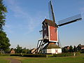
watermill in Oploo, Netherlands  | |||||
| Upload media | |||||
| Instance of | |||||
|---|---|---|---|---|---|
| Location | Oploo, Land van Cuijk, North Brabant, Netherlands | ||||
| Located in or next to body of water | |||||
| Street address |
| ||||
| Located on street |
| ||||
| Has use | |||||
| Heritage designation |
| ||||
| Source of energy | |||||
 | |||||
English: The oilmill in Oploo, North Brabant, the Netherlands
Nederlands: De olieslagerij in Oploo
|
This is a category about rijksmonument number 31772
|
| Address |
|
Media in category "D’n Olliemeulen"
The following 27 files are in this category, out of 27 total.
-
 D’n Olliemeulen aandrijving waterradas.jpg 2,272 × 1,704; 736 KB
-
 D’n Olliemeulen balk met standen voor waterschuif.jpg 1,704 × 2,272; 1.13 MB
-
 D’n Olliemeulen gaffelwiel.jpg 1,704 × 2,272; 883 KB
-
 D’n Olliemeulen koningsspil met links meelpijp.jpg 1,648 × 2,212; 744 KB
-
 D’n Olliemeulen koningsspil met rechter maalstoel.jpg 1,704 × 2,272; 1.15 MB
-
 D’n Olliemeulen koningsspil met steenspil.jpg 1,704 × 2,272; 851 KB
-
 D’n Olliemeulen spoorwiel met luitafel (1).jpg 1,704 × 2,272; 912 KB
-
 D’n Olliemeulen spoorwiel met luitafel.jpg 1,704 × 2,272; 726 KB
-
 D’n Olliemeulen waterrad.jpg 1,704 × 2,272; 1.18 MB
-
 D’n Olliemeulen waterschuif.jpg 1,704 × 2,272; 925 KB
-
 D’n Olliemeulen.jpg 2,228 × 1,615; 1.1 MB
-
 Exterieur OVERZICHT VANAF WATERRADMOLEN - Oploo - 20264686 - RCE.jpg 1,200 × 805; 259 KB
-
 Korenmolen De Korenbloem, aanzicht - Oploo - 20177393 - RCE.jpg 788 × 1,200; 180 KB
-
 Molen, aanzicht - Oploo - 20177408 - RCE.jpg 1,200 × 810; 227 KB
-
 Muurwerk behoeft onderhoud - Oploo - 20177410 - RCE.jpg 1,200 × 1,191; 409 KB
-
 Oploo 2Molens.JPG 2,288 × 1,712; 742 KB
-
 Oploo Watermolen1.JPG 2,288 × 1,712; 804 KB
-
 Oploo Watermolen2.JPG 2,288 × 1,712; 778 KB
-
 Overzicht - Oploo - 20177395 - RCE.jpg 1,200 × 804; 265 KB
-

-
 Overzicht voorgevel en linker zijgevel watermolen - Oploo - 20375694 - RCE.jpg 1,200 × 795; 182 KB
-
 Overzicht voorgevel en rechter zijgevel watermolen - Oploo - 20375697 - RCE.jpg 1,200 × 795; 195 KB
-
 Overzicht voorgevel watermolen - Oploo - 20375695 - RCE.jpg 1,200 × 795; 198 KB
-
 Overzicht voorgevel watermolen - Oploo - 20375696 - RCE.jpg 1,200 × 795; 218 KB
-
 Watermolen, Watermolenstraat, aanzicht - Oploo - 20177407 - RCE.jpg 1,200 × 804; 187 KB
-
 Waterrad en Standaardmolen, overzicht - Oploo - 20177406 - RCE.jpg 1,200 × 1,174; 301 KB
-
 Waterradmolen, muurwerk behoeft onderhoud - Oploo - 20177409 - RCE.jpg 1,200 × 1,200; 442 KB


.jpg)


