Category:Dūkštas in maps
Jump to navigation
Jump to search
This category includes the images that spot Dūkštas city in larger geographical area. For maps that specifically represent the city of Dūkštas more in detail, see Category:Maps of Dūkštas.
Media in category "Dūkštas in maps"
The following 4 files are in this category, out of 4 total.
-
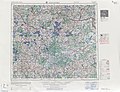
 R200 N35-02sw.jpg 2,303 × 1,477; 5.06 MB
-
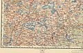
 WIG Mapa Operacyjna Polski - 27 Wilkomierz 1930.jpg 6,421 × 5,785; 16.76 MB
-
 USSR map NN 35-2 Daugavpils.jpg 5,724 × 4,385; 8.52 MB
-
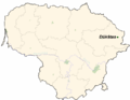 LietuvaDukstas.png 721 × 556; 28 KB


