Category:D'Entrecasteaux Islands
Jump to navigation
Jump to search
island group | |||||
| Upload media | |||||
| Instance of |
| ||||
|---|---|---|---|---|---|
| Location | Milne Bay Province, PNG | ||||
| Located in or next to body of water | |||||
| Area |
| ||||
| Elevation above sea level |
| ||||
 | |||||
Subcategories
This category has the following 6 subcategories, out of 6 total.
Media in category "D'Entrecasteaux Islands"
The following 18 files are in this category, out of 18 total.
-
Admiralty Chart No 2055 C. Vogel to C. Nelson, Published 1957.jpg 12,337 × 8,513; 25.68 MB
-
Admiralty Chart No 217 Ward Hunt Strait to St. George's Channel, Published 1959.jpg 17,612 × 11,292; 24.92 MB
-
Amphlett Group NASA Geocover 2000.png 728 × 627; 445 KB
-
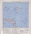
Amphlett Group txu-oclc-6552576-sc56-5.png 1,037 × 525; 713 KB
-
Amphlett Islands (Landsat).JPG 1,095 × 487; 101 KB
-
Archipel d'Entrecasteaux.jpg 5,000 × 3,154; 403 KB
-
DEntrecasteauxIslandsTopography.png 1,924 × 1,721; 1.19 MB
-
Die Gartenlaube (1886) b 367.jpg 696 × 736; 81 KB
-
Discoveries & surveys in New Guinea and the D'Entrecasteaux Islands.djvu 2,044 × 3,396, 408 pages; 9.85 MB
-
Dobu (Landsat).JPG 200 × 187; 14 KB
-
D’Entrecasteaux-Islands.jpg 4,271 × 4,728; 5.35 MB
-
Hylarana waliesa.jpg 900 × 600; 503 KB
-
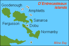
Karta PG D´Entrecasteaux isl.PNG 300 × 200; 4 KB
-
Louisiade white-eye.jpg 900 × 600; 423 KB
-
Mell109.jpg 711 × 438; 165 KB
-
Papua New Guinea - DPLA - 9d797892a5ed5dc2eb827bdb0fc8d274.jpg 2,552 × 3,272; 5.16 MB
-
Sanaroa (Landsat).JPG 488 × 453; 64 KB


