Category:Cyfronydd
Jump to navigation
Jump to search
Subcategories
This category has the following 2 subcategories, out of 2 total.
C
- Cyfronydd Hall (4 F)
- Cyfronydd railway station (14 F)
Media in category "Cyfronydd"
The following 22 files are in this category, out of 22 total.
-
 B4392 above Cyfronydd - geograph.org.uk - 500031.jpg 640 × 480; 93 KB
-
 B4392 leaving Cyfronydd - geograph.org.uk - 1562225.jpg 640 × 480; 106 KB
-
 Beside the Welshpool and Llanfair Light Railway 231778.jpg 640 × 480; 140 KB
-
 Brook through the pasture above Cyfronydd - geograph.org.uk - 498447.jpg 640 × 480; 140 KB
-
 Buttercup field at Pen-y-Coed - geograph.org.uk - 1333595.jpg 640 × 426; 104 KB
-
 Callbox at Cyfronydd - geograph.org.uk - 630027.jpg 640 × 480; 77 KB
-
 Cattle near Cyfronydd - geograph.org.uk - 1560354.jpg 640 × 426; 68 KB
-
 Cyfronydd crossing - geograph.org.uk - 1333582.jpg 640 × 426; 100 KB
-
 Cyfronydd Level Crossing - geograph.org.uk - 1559815.jpg 640 × 426; 83 KB
-
 Farm Cottage at Pen-y-Coed - geograph.org.uk - 212623.jpg 640 × 480; 151 KB
-
 Houses at Cyfronydd - geograph.org.uk - 1333586.jpg 640 × 426; 86 KB
-
 Lane approaching New House entrance - geograph.org.uk - 1572902.jpg 640 × 480; 83 KB
-
 Leaving Cyfronydd - geograph.org.uk - 1559817.jpg 640 × 426; 99 KB
-
 Limousin bull at Dolarddyn - geograph.org.uk - 601858.jpg 640 × 479; 98 KB
-
 New building at Cyfronydd - geograph.org.uk - 1562224.jpg 640 × 480; 71 KB
-
 Pasture above Cyfronydd - geograph.org.uk - 499840.jpg 640 × 481; 134 KB
-
 Pasture above Cyfronydd Station - geograph.org.uk - 629988.jpg 640 × 480; 77 KB
-
 Pool by Cyfronydd Station - geograph.org.uk - 629978.jpg 640 × 480; 136 KB
-
 Road junction on the A458 near Cyfronydd - geograph.org.uk - 220065.jpg 640 × 480; 145 KB
-
 Road to The Glyn - geograph.org.uk - 1472954.jpg 640 × 480; 77 KB
-
 Track at Y Figyn - geograph.org.uk - 1562233.jpg 640 × 480; 90 KB
-
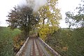 Viaduct west of Cyfronydd - geograph.org.uk - 1559812.jpg 640 × 426; 97 KB


