Category:Cushendun
Jump to navigation
Jump to search
English: Cushendun ( – otherwise known in Irish as Bun Abhann Duinne meaning "foot of the River Dun") is a small coastal village in County Antrim, Northern Ireland. It is situated off the A2 coast road about 20 kilometres to the south east of Ballycastle. It has a sheltered harbour and lies at the mouth of the River Dun and Glendun, one of the nine Glens of Antrim. The Mull of Kintyre in Scotland is only 15 miles away across the North Channel and can be seen easily on clear days. In the 2001 Census it had a population of 138 people and is situated in the Moyle District Council area.
Gaeilge: Is baile i nGlinntí Aontroma Bun Abhann Duinne (Cushendun i mBéarla). Tá sé taobh le Sruth na Maoile, an caolas atá idir Contae Aontroma in Éirinn, agus Ceann Tíre in Albain.
Nederlands: Cushendun is een plaats in het Noord-Ierse graafschap County Antrim. De plaats telt 138 inwoners.
village in County Antrim, Northern Ireland, UK  | |||||
| Upload media | |||||
| Instance of | |||||
|---|---|---|---|---|---|
| Location | County Antrim, Northern Ireland | ||||
| official website | |||||
 | |||||
Subcategories
This category has the following 8 subcategories, out of 8 total.
Media in category "Cushendun"
The following 196 files are in this category, out of 196 total.
-
 "Dympna" alongside the "Francis Ann" - geograph.org.uk - 1898878.jpg 640 × 480; 71 KB
-
 "Dympna" in the water, Cushendun - geograph.org.uk - 1898865.jpg 640 × 480; 57 KB
-
 "Dympna", Cushendun - geograph.org.uk - 1898858.jpg 640 × 480; 57 KB
-
 A tame goat, Cushendun - geograph.org.uk - 4061897.jpg 640 × 480; 172 KB
-
 Access at Cushendun Caves - geograph.org.uk - 6183768.jpg 1,024 × 685; 422 KB
-
 Apartments at Cushendun Harbour - geograph.org.uk - 3721071.jpg 1,024 × 741; 89 KB
-
 Approaching swan, Cushendun Harbour - geograph.org.uk - 4061841.jpg 640 × 480; 183 KB
-
 B92 Bay Road, Cushendun - geograph.org.uk - 1898643.jpg 640 × 480; 42 KB
-
 B92 Knocknacarry Road, Cushendun - geograph.org.uk - 4061912.jpg 640 × 480; 167 KB
-
 Boats, Cshendun - geograph.org.uk - 1898577.jpg 640 × 480; 62 KB
-
 Boats, Cushendun - geograph.org.uk - 4998308.jpg 640 × 480; 186 KB
-
 Boats, Cushendun Harbour - geograph.org.uk - 1898842.jpg 640 × 480; 72 KB
-
 Boats, Cushendun Harbour - geograph.org.uk - 4061836.jpg 640 × 480; 191 KB
-
-
 Bridge over the River Glendum - geograph.org.uk - 5085039.jpg 640 × 480; 504 KB
-
 Bridge, Main Street, Cushendun - geograph.org.uk - 1898570.jpg 640 × 480; 70 KB
-
 Castle Cara, Cushendun - geograph.org.uk - 1898793.jpg 640 × 480; 71 KB
-
 Castle Cara, Rockport House, Torr Road, Cushendun - geograph.org.uk - 4133881.jpg 2,048 × 1,360; 868 KB
-
 Castle Carra - geograph.org.uk - 467784.jpg 640 × 427; 221 KB
-
 Cat and BMW, Cushendun, September 2010.JPG 4,272 × 2,848; 3.51 MB
-
 Caves at Cushendun viewed from Tornamoney - geograph.org.uk - 2557844.jpg 1,024 × 768; 180 KB
-
 Coastline north of Cushendun - geograph.org.uk - 817082.jpg 640 × 480; 247 KB
-
 Corner House, Cushendun - geograph.org.uk - 5877450.jpg 1,024 × 768; 362 KB
-
 Cornish style cottages at Cushendun - geograph.org.uk - 3721607.jpg 1,024 × 753; 216 KB
-

-

-
 Cottages at The Square, Cushendun - geograph.org.uk - 3684361.jpg 1,024 × 768; 137 KB
-
 Cottages on the Square at Cushendun - geograph.org.uk - 2557458.jpg 1,024 × 768; 194 KB
-
 Cottages, Cushendun - geograph.org.uk - 5877446.jpg 1,024 × 768; 348 KB
-
 Cushendun (1) - geograph.org.uk - 5499916.jpg 4,320 × 3,240; 3.45 MB
-
 Cushendun (2) - geograph.org.uk - 5499921.jpg 4,320 × 3,240; 2.06 MB
-
 Cushendun (3) - geograph.org.uk - 5499929.jpg 4,213 × 3,160; 2.11 MB
-
 Cushendun (4) - geograph.org.uk - 5500259.jpg 4,107 × 3,081; 2.18 MB
-
 Cushendun - Northern Ireland - panoramio (1).jpg 3,872 × 2,592; 4.13 MB
-
 Cushendun - Northern Ireland - panoramio.jpg 3,709 × 2,592; 2.99 MB
-
 Cushendun Bay and town from Altagore - geograph.org.uk - 34204.jpg 640 × 480; 98 KB
-
 Cushendun Beach - geograph.org.uk - 5844849.jpg 1,024 × 755; 155 KB
-
 Cushendun Beach - geograph.org.uk - 5844871.jpg 1,024 × 768; 185 KB
-
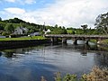
 Cushendun Bridge - geograph.org.uk - 5844857.jpg 1,024 × 768; 231 KB
-

-
 Cushendun Caves - geograph.org.uk - 5085021.jpg 640 × 480; 492 KB
-
 Cushendun Caves - geograph.org.uk - 6183772.jpg 1,024 × 685; 425 KB
-
 Cushendun Caves near Storm's End, The Stormlands - geograph.org.uk - 6183791.jpg 1,024 × 685; 536 KB
-
 Cushendun Cliffs - geograph.org.uk - 467795.jpg 640 × 409; 175 KB
-
 Cushendun Harbour - geograph.org.uk - 1898833.jpg 640 × 480; 71 KB
-
 Cushendun Harbour and Glendun River - geograph.org.uk - 6184849.jpg 1,024 × 685; 387 KB
-
 Cushendun Hotel - geograph.org.uk - 5844903.jpg 1,024 × 731; 108 KB
-
 Cushendun looking out to sea - geograph.org.uk - 3675534.jpg 3,648 × 2,736; 4.61 MB
-
 Cushendun Old Church - geograph.org.uk - 5844830.jpg 1,024 × 765; 226 KB
-
 Cushendun Post Office - geograph.org.uk - 1898650.jpg 640 × 480; 57 KB
-
 Cushendun Village - geograph.org.uk - 1898617.jpg 640 × 480; 47 KB
-
 Cushendun, cottages - geograph.org.uk - 5844864.jpg 1,024 × 740; 187 KB
-
 Cushendun, Country Antrim - geograph.org.uk - 1898204.jpg 640 × 480; 60 KB
-
 Cushendun, County Antrim - geograph.org.uk - 1898679.jpg 640 × 480; 67 KB
-
 Cushendun, Glendun River - geograph.org.uk - 5844860.jpg 1,024 × 768; 244 KB
-
 Cushendun, Glenmore Lodge - geograph.org.uk - 5844843.jpg 1,024 × 763; 188 KB
-
 Cushendun, Mary McBride's - geograph.org.uk - 5844863.jpg 1,024 × 768; 134 KB
-
 Cushendun, Maud Cottages - geograph.org.uk - 5844852.jpg 1,024 × 768; 148 KB
-
 Cushendun, path - geograph.org.uk - 5844866.jpg 1,024 × 759; 184 KB
-
 Cushendun, quay - geograph.org.uk - 5844886.jpg 1,024 × 670; 174 KB
-
 Cushendun, rocks ^ cliff - geograph.org.uk - 5844910.jpg 1,024 × 750; 215 KB
-
 Cushendun, water pillar - geograph.org.uk - 5844820.jpg 1,024 × 754; 250 KB
-
 Delivery van, Cushendun - geograph.org.uk - 4061950.jpg 640 × 480; 173 KB
-

-
 Farming at Knocknacarry - geograph.org.uk - 5028270.jpg 1,024 × 682; 183 KB
-
 Feeding birds, Cushendun - geograph.org.uk - 5877439.jpg 1,024 × 768; 365 KB
-
 Fishing vessel, Cushendun - geograph.org.uk - 4061874.jpg 640 × 480; 194 KB
-
 Fishing vessel, Cushendun - geograph.org.uk - 4061884.jpg 640 × 480; 140 KB
-
 Game of Thrones notice board, Cushendun - geograph.org.uk - 6183792.jpg 1,024 × 685; 503 KB
-
 Glendun Hotel, Cushendun - geograph.org.uk - 6184838.jpg 1,024 × 685; 423 KB
-
 Glendun River, Cushendun - geograph.org.uk - 4998306.jpg 640 × 480; 183 KB
-
 Glendun River, Cushendun - geograph.org.uk - 6183753.jpg 1,024 × 685; 396 KB
-
 Glendun River, Cushendun - geograph.org.uk - 6184845.jpg 1,024 × 685; 449 KB
-
 Glenmona House, Cushendun - geograph.org.uk - 2554670.jpg 1,024 × 634; 162 KB
-
 Glenmona Resource Centre, Cushendun - geograph.org.uk - 1898193.jpg 640 × 480; 59 KB
-
 Goat sculpture at Cushendun - geograph.org.uk - 1898695.jpg 640 × 480; 41 KB
-
 Goat sculpture, Cushendun - geograph.org.uk - 1898702.jpg 640 × 480; 64 KB
-
 Harbour at Cushendun - geograph.org.uk - 3675538.jpg 3,648 × 2,736; 3.76 MB
-
 Harbour, Cushendun - geograph.org.uk - 6184847.jpg 1,024 × 685; 405 KB
-
 Historic buildings, Cushendun - geograph.org.uk - 4061977.jpg 640 × 480; 173 KB
-
 Houses - Cushendun, Ballymena, Northern Ireland, UK - August 15, 2017.jpg 7,045 × 5,636; 15.7 MB
-
 Inscribed plaque, Cushendun - geograph.org.uk - 4061989.jpg 640 × 481; 121 KB
-
 Inscribed stone along Knocknacarry Road - geograph.org.uk - 4061927.jpg 640 × 360; 168 KB
-
 Johann sculpture, Cushendun - geograph.org.uk - 6183756.jpg 1,024 × 685; 395 KB
-
 Knocknacarry Road at the outskirts to Cushendun - geograph.org.uk - 3724875.jpg 1,024 × 767; 132 KB
-
 Launching "Dympna" , Cushendun - geograph.org.uk - 1898850.jpg 640 × 480; 52 KB
-

-
 Loughan - geograph.org.uk - 465551.jpg 640 × 415; 246 KB
-
 Main Street, Cushendun - geograph.org.uk - 1898592.jpg 640 × 480; 46 KB
-
 Main Street, Cushendun - geograph.org.uk - 1898600.jpg 640 × 480; 55 KB
-
 Main Street, Cushendun - geograph.org.uk - 1898603.jpg 640 × 480; 59 KB
-
 Main Street, Cushendun - geograph.org.uk - 1898671.jpg 640 × 480; 51 KB
-
 Main Street, Cushendun - geograph.org.uk - 4061907.jpg 640 × 480; 180 KB
-
 Main Street, Cushendun - geograph.org.uk - 5877448.jpg 1,024 × 768; 352 KB
-
 Main Street, Cushendun - geograph.org.uk - 5877452.jpg 1,024 × 768; 358 KB
-
 Main Street, Cushendun - geograph.org.uk - 6184844.jpg 1,024 × 685; 394 KB
-

-
 Mary McBride's Pub, Cushendun - geograph.org.uk - 4061892.jpg 640 × 480; 175 KB
-
 Maud Cottages - geograph.org.uk - 5499922.jpg 4,320 × 3,240; 3.17 MB
-
 Maud Cottages, Cushendun (side) - geograph.org.uk - 5877443.jpg 1,024 × 768; 337 KB
-
 Maud Cottages, Cushendun - geograph.org.uk - 1898632.jpg 640 × 480; 51 KB
-
 Maud Cottages, Cushendun - geograph.org.uk - 2556302.jpg 1,024 × 768; 217 KB
-
 Maud Cottages, Cushendun - geograph.org.uk - 5877440.jpg 1,024 × 768; 375 KB
-
 Maud's Cottage, Cushendun - geograph.org.uk - 3684181.jpg 1,024 × 769; 131 KB
-

-
 McBride's, Cushendun - geograph.org.uk - 6183733.jpg 1,024 × 685; 374 KB
-
 McBrides, Cushendun - geograph.org.uk - 1898587.jpg 640 × 480; 47 KB
-
 McBrides, Cushendun - geograph.org.uk - 5877454.jpg 1,024 × 768; 374 KB
-
 Mooring ropes, Cushendun - geograph.org.uk - 4061863.jpg 640 × 480; 209 KB
-
 Motorbiker, Cushendun - geograph.org.uk - 1898731.jpg 640 × 480; 67 KB
-
 New Housing Development at Cushendun - geograph.org.uk - 4673272.jpg 1,632 × 918; 295 KB
-
 North of Cushendun - geograph.org.uk - 25397.jpg 640 × 427; 69 KB
-
 Old water pillar - geograph.org.uk - 5499930.jpg 3,221 × 4,295; 3.42 MB
-
 Once a church - geograph.org.uk - 5500251.jpg 4,320 × 3,240; 3.85 MB
-
 Ordnance Survey One-Inch Sheet 02 North Antrim, Published 1938.jpg 12,940 × 10,196; 10.26 MB
-
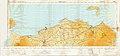 Ordnance Survey One-Inch Sheet 1 North Coast (Northern Ireland), Published 1961.jpg 16,924 × 7,967; 9.96 MB
-
 Path to Cushendun Caves - geograph.org.uk - 6183765.jpg 1,024 × 685; 388 KB
-
 Plaque, The Fuldiew Seat - geograph.org.uk - 4998311.jpg 640 × 480; 190 KB
-

-
 Reflections in the River Dun, Cushendun - geograph.org.uk - 4061855.jpg 640 × 480; 180 KB
-
 Rivermouth at Cushendun - geograph.org.uk - 5028278.jpg 1,024 × 665; 130 KB
-
 Riverview Crescent, Cushendun - geograph.org.uk - 4061945.jpg 640 × 480; 189 KB
-
 Road at Cushendun - geograph.org.uk - 5877445.jpg 1,024 × 768; 373 KB
-
 Robert Emmets GAC, Lig-na-Arigid Park, Cushendun - geograph.org.uk - 3721051.jpg 1,024 × 739; 133 KB
-
 Rock Port - geograph.org.uk - 467779.jpg 640 × 427; 253 KB
-
 Rock Port, Cushendun - geograph.org.uk - 239425.jpg 640 × 394; 68 KB
-
 Rocky shore, Cushendun - geograph.org.uk - 6183767.jpg 1,024 × 687; 424 KB
-
 Shane's Park Estate, Cushendun - geograph.org.uk - 3684459.jpg 1,024 × 768; 118 KB
-
 Shore - Cushendun, Ballymena, Northern Ireland, UK - August 15, 2017 01.jpg 20,000 × 6,816; 74.55 MB
-
 Shore - Cushendun, Ballymena, Northern Ireland, UK - August 15, 2017 02.jpg 7,360 × 4,912; 19.14 MB
-
 Slipway on the estuary of the Glendun River - geograph.org.uk - 2556208.jpg 1,024 × 759; 216 KB
-

-
 Strand View Park, Cushendun - geograph.org.uk - 6183762.jpg 1,024 × 685; 315 KB
-
 Swan, Cushendun - geograph.org.uk - 4061846.jpg 640 × 480; 192 KB
-
 Tame ducks, Cushendun - geograph.org.uk - 6184848.jpg 1,024 × 685; 498 KB
-
 Tea Room, Cushendun - geograph.org.uk - 1898660.jpg 640 × 480; 42 KB
-
 Telephone exchange building, Cushendun - geograph.org.uk - 4061918.jpg 640 × 480; 164 KB
-
 The "Francis Ann" - geograph.org.uk - 1898828.jpg 640 × 480; 58 KB
-
 The beach at Cushendun - geograph.org.uk - 4061866.jpg 640 × 480; 178 KB
-
 The beach at Cushendun - geograph.org.uk - 4998315.jpg 640 × 480; 146 KB
-
 The best of friends, Cushendun - geograph.org.uk - 1898809.jpg 640 × 480; 60 KB
-

-

-

-
 The estuary of the Glendun River at Cushendun - geograph.org.uk - 2556019.jpg 1,024 × 768; 141 KB
-
 The estuary of the Glendun River at Cushendun - geograph.org.uk - 3684480.jpg 1,024 × 768; 101 KB
-
 The former Cushendun Church of Ireland building - geograph.org.uk - 2554727.jpg 1,024 × 767; 158 KB
-
 The former Cushendun CoI Parish Church - geograph.org.uk - 3683458.jpg 1,024 × 768; 173 KB
-
 The former Cushendun Hotel - geograph.org.uk - 2556271.jpg 1,024 × 768; 245 KB
-

-
 The Fuldiew Seat (1) - geograph.org.uk - 5499919.jpg 4,320 × 3,240; 4.51 MB
-
 The Fuldiew Seat (2) - geograph.org.uk - 5499920.jpg 4,320 × 3,240; 4.49 MB
-
 The Fuldiew Seat, Cushendun - geograph.org.uk - 4998312.jpg 640 × 480; 189 KB
-
 The Glendun River above Cushendun Bridge - geograph.org.uk - 3684474.jpg 1,024 × 768; 224 KB
-
 The goats of Cushendun - geograph.org.uk - 2554887.jpg 767 × 1,024; 165 KB
-

-

-
 The northern end of Main Street at Cushendun - geograph.org.uk - 2583498.jpg 1,024 × 750; 135 KB
-
 The River Dun - Glendun River - geograph.org.uk - 4061937.jpg 640 × 480; 177 KB
-
 The sea at Cushendun - geograph.org.uk - 4061878.jpg 640 × 480; 183 KB
-
 The southern end of the Cushendun Bridge - geograph.org.uk - 2583482.jpg 1,024 × 638; 94 KB
-
 The Square - geograph.org.uk - 5500273.jpg 4,320 × 3,240; 2.61 MB
-
 The still waters of Cushendun Harbour - geograph.org.uk - 4061833.jpg 640 × 480; 202 KB
-
 Torr Road near the entrance to Villa Farm - geograph.org.uk - 2583515.jpg 1,024 × 682; 135 KB
-
 Tourists at Cushendun Caves - geograph.org.uk - 6183769.jpg 1,024 × 685; 375 KB
-
 Trap, Cushendun - geograph.org.uk - 1898800.jpg 640 × 480; 86 KB
-
 Vacant building, Cushendun - geograph.org.uk - 4061962.jpg 640 × 480; 150 KB
-

-
 View north along Cushendun's Main Street - geograph.org.uk - 3684213.jpg 1,024 × 768; 123 KB
-
 View north along the Strand at Cushendun - geograph.org.uk - 2554917.jpg 1,024 × 768; 185 KB
-
 View over Cushendun - geograph.org.uk - 4813923.jpg 1,593 × 1,077; 522 KB
-

-
 Well near Glenmona Resource Centre Cushendun - geograph.org.uk - 4133861.jpg 2,048 × 1,360; 903 KB
-
 Wooded slope above Cushleake Road - geograph.org.uk - 3721768.jpg 1,024 × 768; 189 KB
-
 Altmore Burn - geograph.org.uk - 465523.jpg 640 × 421; 239 KB
-
 B92 above Cushendun - geograph.org.uk - 465709.jpg 640 × 427; 231 KB
-
 Bay Road, Cushendun - geograph.org.uk - 817081.jpg 640 × 480; 270 KB
-
 Bunavoher - geograph.org.uk - 465703.jpg 640 × 427; 265 KB
-
 Carnaneigh - geograph.org.uk - 465567.jpg 640 × 427; 268 KB
-
 Carnasheeran - geograph.org.uk - 465814.jpg 640 × 427; 259 KB
-
 Clady - geograph.org.uk - 465731.jpg 640 × 427; 260 KB
-
 Coolranny Church - geograph.org.uk - 465558.jpg 640 × 478; 255 KB
-
 Dunouragan - geograph.org.uk - 465797.jpg 640 × 403; 237 KB
-
 Glendun - geograph.org.uk - 465767.jpg 640 × 427; 271 KB
-
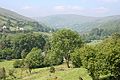 Glendun - geograph.org.uk - 465779.jpg 640 × 427; 265 KB
-
 Green Hill - geograph.org.uk - 465538.jpg 640 × 407; 240 KB
-
 Gruig Top - geograph.org.uk - 465804.jpg 640 × 427; 251 KB
-
 Ligadaughtan - geograph.org.uk - 465569.jpg 640 × 402; 206 KB
-
 Loughan - geograph.org.uk - 465555.jpg 640 × 427; 247 KB
-
 Loughan Bay - geograph.org.uk - 465547.jpg 640 × 404; 216 KB
-
 Loughareema - geograph.org.uk - 413135.jpg 640 × 480; 112 KB
-
 Loughareema - geograph.org.uk - 413143.jpg 640 × 480; 74 KB
-
 Near Cushendun - geograph.org.uk - 465718.jpg 640 × 385; 211 KB
-
 Near Cushendun - geograph.org.uk - 465723.jpg 640 × 427; 278 KB
-
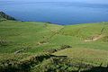
 Runabay Head - geograph.org.uk - 465563.jpg 640 × 427; 296 KB
-
 View from Green Hill - geograph.org.uk - 465544.jpg 640 × 416; 244 KB


_-_geograph.org.uk_-_5499916.jpg)
_-_geograph.org.uk_-_5499921.jpg)
_-_geograph.org.uk_-_5499929.jpg)
_-_geograph.org.uk_-_5500259.jpg)
.jpg)


_-_geograph.org.uk_-_5877443.jpg)


,_Published_1961.jpg)


_-_geograph.org.uk_-_5499919.jpg)
_-_geograph.org.uk_-_5499920.jpg)


