Category:Curran, County Londonderry
Jump to navigation
Jump to search
village in Londonderry, Northern Ireland  | |||||
| Upload media | |||||
| Instance of | |||||
|---|---|---|---|---|---|
| Location | County Londonderry, Northern Ireland | ||||
 | |||||
English: Curran is a small village in County Londonderry, Northern Ireland. In the 2001 Census it had a population of 132 people. It is situated in the Magherafelt District Council area. Once a thriving market village, Curran has been superseded in recent years by other surrounding towns and villages. The shop, post office and primary school have all closed, the latter being amalgamated with the new primary school in nearby Knockloughrim. Curran Presbyterian Church is a joint charge with Castledawson Presbyterian Church. The main A6 Belfast-Londonderry Road runs almost parallel to the village.
Media in category "Curran, County Londonderry"
The following 15 files are in this category, out of 15 total.
-
 Ruin at Rossgarren - geograph.org.uk - 569606.jpg 640 × 479; 52 KB
-
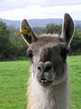 Then there was this llama - geograph.org.uk - 569581.jpg 479 × 640; 76 KB
-
 Broagh Townland - geograph.org.uk - 573472.jpg 640 × 479; 55 KB
-
 Broagh Townland - geograph.org.uk - 573480.jpg 640 × 479; 43 KB
-
 Broagh Townland - geograph.org.uk - 573481.jpg 640 × 479; 43 KB
-
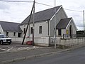 Curran Presbyterian Church - geograph.org.uk - 569571.jpg 640 × 479; 49 KB
-
 Curran Townland - geograph.org.uk - 569570.jpg 640 × 479; 64 KB
-
 Curran Townland - geograph.org.uk - 569598.jpg 640 × 479; 67 KB
-
 Drumlamph Townland - geograph.org.uk - 573495.jpg 640 × 479; 52 KB
-
 Plaque at Curran - geograph.org.uk - 569576.jpg 640 × 479; 71 KB
-
 Rocktown Road - geograph.org.uk - 573478.jpg 640 × 479; 62 KB
-
 Rossgarran Townland - geograph.org.uk - 569600.jpg 640 × 479; 65 KB
-
 Rossgarran Townland - geograph.org.uk - 569601.jpg 640 × 479; 60 KB
-
 Toberhead Townland - geograph.org.uk - 569579.jpg 640 × 479; 61 KB
-
 Toberhead Townland - geograph.org.uk - 569584.jpg 640 × 479; 70 KB


