Category:Culverts in Oxfordshire
Jump to navigation
Jump to search
Media in category "Culverts in Oxfordshire"
The following 18 files are in this category, out of 18 total.
-
 Chalgrove brook - geograph.org.uk - 1011714.jpg 640 × 480; 116 KB
-
 Cottisford Bridge - geograph.org.uk - 344188.jpg 428 × 640; 135 KB
-
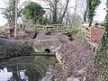 Culvert in the canal - geograph.org.uk - 1638891.jpg 640 × 480; 137 KB
-
 Culvert under the bridge - geograph.org.uk - 1638868.jpg 480 × 640; 133 KB
-
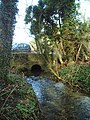
 Elm Bank Ditch Bridge - geograph.org.uk - 343040.jpg 640 × 418; 162 KB
-
 Gallos Brook - geograph.org.uk - 345157.jpg 480 × 640; 121 KB
-

-
 Culvert for the ditch - geograph.org.uk - 1199360.jpg 640 × 426; 112 KB
-
 Culvert in the canal - geograph.org.uk - 1199349.jpg 640 × 426; 117 KB
-
 Culvert under the road - geograph.org.uk - 1198072.jpg 640 × 426; 109 KB
-
 Lower Heyford Bridge culvert.jpg 1,842 × 2,912; 2.98 MB
-
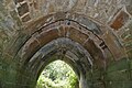 LowerHeyford Bridge culvert vault.jpg 3,008 × 2,000; 2.37 MB
-
 Oxey Mead railway bridges 03.jpg 4,128 × 3,096; 7.62 MB
-
 View of the bridge - geograph.org.uk - 1638906.jpg 640 × 480; 124 KB
-
 Culvert under the road - geograph.org.uk - 1638031.jpg 480 × 640; 126 KB
-
 Name in the concrete - geograph.org.uk - 1638901.jpg 640 × 480; 128 KB
-
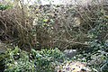 Aqueduct in the bushes - geograph.org.uk - 1207761.jpg 640 × 426; 130 KB
-
 Oxford Canal Feeder - geograph.org.uk - 143558.jpg 640 × 480; 270 KB


