Category:Cullaville
Jump to navigation
Jump to search
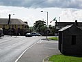
English: Culloville is a small village and townland of 145 acres in the Electoral Division of Crossmaglen, in Civil Parish of Creggan, in the Barony of Fews Upper, in the County of Armagh, two miles south of Crossmaglen. It is the southernmost settlement in South Armagh, and the southernmost settlement in Northern Ireland on the border with the Republic of Ireland. In the 2001 Census it had a population of 400 people. It lies within the Newry and Mourne District Council area. The Village is located on a busy crossroads, on the main Dundalk to Castleblaney road. Three of the roads lead to the South, two to county Monaghan and one to county Louth, while the fourth leads north to Crossmaglen
village in the United Kingdom  | |||||
| Upload media | |||||
| Instance of | |||||
|---|---|---|---|---|---|
| Location | Northern Ireland | ||||
 | |||||
Media in category "Cullaville"
The following 105 files are in this category, out of 105 total.
-

-
 Approaching a bend in Crossmaglen's Newry Road - geograph.org.uk - 4169636.jpg 1,024 × 732; 173 KB
-
 Approaching the Creamery Road junction on the B30 Newry Road - geograph.org.uk - 6147134.jpg 1,778 × 1,332; 1.42 MB
-

-

-

-

-
 Bend on the B30 on the northern edge of Culloville - geograph.org.uk - 6279580.jpg 2,414 × 1,614; 1.52 MB
-
 Blaney Road at Crossmaglen - geograph.org.uk - 3772425.jpg 1,024 × 769; 86 KB
-
 Border Town - geograph.org.uk - 4671073.jpg 1,632 × 918; 510 KB
-
 Bungalow near the Newry Road Service Station - geograph.org.uk - 6147139.jpg 3,850 × 2,788; 7.06 MB
-
 Bungalow on the Glencarron Care Home site - geograph.org.uk - 6275867.jpg 4,000 × 3,000; 2.29 MB
-

-
 Bungalows at the hamlet of Monog - geograph.org.uk - 6265636.jpg 3,902 × 1,950; 3.8 MB
-
 Carlingford Street, Crossmaglen - geograph.org.uk - 6264415.jpg 3,667 × 1,998; 4.24 MB
-
 Carran Court Estate - geograph.org.uk - 4171111.jpg 1,024 × 768; 194 KB
-
 Carran Road at the approach to Crossmaglen - geograph.org.uk - 4172219.jpg 1,024 × 768; 209 KB
-
 Casey's Spar Store, Culloville - geograph.org.uk - 6273341.jpg 3,878 × 1,918; 4.37 MB
-

-
 Concession Road, Cullaville - geograph.org.uk - 2361963.jpg 1,024 × 541; 105 KB
-
 Cornahave Lough from the Loughross Road - geograph.org.uk - 6270560.jpg 4,000 × 3,000; 2.89 MB
-
 Cornahove Lough from the Loughross Road - geograph.org.uk - 6280875.jpg 4,000 × 3,000; 2.84 MB
-
 Crossmaglen Enterprise Centre in Blaney Road - geograph.org.uk - 4168079.jpg 1,024 × 768; 198 KB
-
 Cullaville Cross Roads - geograph.org.uk - 6279341.jpg 3,265 × 1,998; 3.34 MB
-
 Cullaville Cross Roads from the north - geograph.org.uk - 3777404.jpg 1,024 × 635; 104 KB
-
 Cullaville Road, Cullaville - geograph.org.uk - 3769136.jpg 1,024 × 767; 116 KB
-
 Cullaville Road, Culloville - geograph.org.uk - 1447315.jpg 640 × 480; 79 KB
-
 Culloville Cross Roads from Culloville Road - geograph.org.uk - 6273355.jpg 3,790 × 1,891; 3.73 MB
-
 Culloville village - geograph.org.uk - 1447326.jpg 640 × 480; 61 KB
-
 Derelict cottages in Carran Road, Crossmaglen - geograph.org.uk - 4171091.jpg 1,024 × 768; 132 KB
-

-

-
 Empty bungalow on the Creamery Road - geograph.org.uk - 6275918.jpg 4,000 × 3,000; 2.88 MB
-
 Entering Crossmaglen along Carlingford Street - geograph.org.uk - 3777489.jpg 1,024 × 767; 163 KB
-

-

-
 Entering Cullaville from the west along the A37 - geograph.org.uk - 3078658.jpg 1,024 × 570; 103 KB
-

-

-
 Eurospar, Crossmaglen - geograph.org.uk - 6263482.jpg 3,977 × 2,189; 2.61 MB
-
 Exiting Crossmaglen on the B30 (Newry Road) - geograph.org.uk - 4168338.jpg 1,024 × 619; 133 KB
-
 Exiting Crossmaglen on the B30 (Newry Road) - geograph.org.uk - 6272047.jpg 4,000 × 3,000; 2.89 MB
-
 Fairy Glen Estate, Crossmaglen - geograph.org.uk - 6263485.jpg 3,896 × 2,858; 4.83 MB
-

-

-
 Glencarron Care Home, Creamery Road, Crossmaglen - geograph.org.uk - 6272155.jpg 4,000 × 3,000; 2.98 MB
-
 Glencarron Care Home, Creamery Road, Crossmaglen - geograph.org.uk - 6272177.jpg 4,000 × 3,000; 2.38 MB
-

-
 Hoey Fuels on the A37 at Cullaville - geograph.org.uk - 3777401.jpg 1,024 × 665; 101 KB
-

-

-
 Houses on the Ard Ross Estate, Crossmaglen - geograph.org.uk - 4171138.jpg 1,024 × 768; 172 KB
-

-
 Houses on the northern outskirts of Crossmaglen - geograph.org.uk - 4172239.jpg 1,024 × 768; 256 KB
-
 Hughes Kitchen Furniture Showrooms on the Concession Road - geograph.org.uk - 6278858.jpg 2,670 × 1,998; 2.94 MB
-

-
 Kernan Equestrian Centre, Crossmaglen - geograph.org.uk - 6272042.jpg 2,657 × 1,988; 1.86 MB
-
 Kernan Equestrian Centre, Crossmaglen - geograph.org.uk - 6272044.jpg 2,929 × 2,157; 3.96 MB
-
 Leaving Crossmaglen on the Blaney Road - geograph.org.uk - 3769243.jpg 1,024 × 768; 132 KB
-
 Lisseraw Road approaching the junction with the B30 - geograph.org.uk - 5924194.jpg 3,066 × 2,000; 5.02 MB
-
 Mac Namee's Grocery, Blaney Road, Crossmaglen - geograph.org.uk - 4168055.jpg 1,024 × 631; 161 KB
-
 Malachy Conlon Park, Culloville - geograph.org.uk - 1447334.jpg 640 × 480; 68 KB
-
 Manog Road on the eastern outskirts of Crossmaglen - geograph.org.uk - 6259112.jpg 3,439 × 1,948; 3.51 MB
-
 Monog Road approaching the hamlet of Monog from the East - geograph.org.uk - 6265630.jpg 2,702 × 2,310; 2.66 MB
-
 Newry Road Filling Station, Crossmaglen - geograph.org.uk - 4296374.jpg 1,387 × 1,600; 343 KB
-
 NIF^RS Station, Blaney Road, Crossmaglen - geograph.org.uk - 4168047.jpg 1,024 × 768; 185 KB
-
 Oriental Restaurant and Off-Licence, Culloville - geograph.org.uk - 6273300.jpg 3,578 × 1,806; 3.69 MB
-
 Reeds on the shore of Cornahove Lough - geograph.org.uk - 6280838.jpg 4,000 × 3,000; 2.9 MB
-
 Rough grazing on the margins of Crossmaglen - geograph.org.uk - 4172251.jpg 1,024 × 647; 128 KB
-

-
 Service station and store on the B30 (Newry Road) - geograph.org.uk - 6272143.jpg 3,987 × 1,712; 4.29 MB
-
 St Patrick's Catholic Chapel, Crossmaglen - geograph.org.uk - 6265637.jpg 2,625 × 2,426; 4.13 MB
-
 St Patrick's Catholic Church, Crossmaglen - geograph.org.uk - 3620721.jpg 1,024 × 758; 92 KB
-

-

-
 Terraced housing in Rathview Park, Crossmaglen - geograph.org.uk - 3616405.jpg 1,024 × 611; 113 KB
-

-

-

-
 The B30 (Newry Road) at Fairy Glen, Crossmaglen - geograph.org.uk - 4169630.jpg 1,024 × 767; 126 KB
-
 The B30 approaching Crossmaglen from the East - geograph.org.uk - 6275742.jpg 1,671 × 1,182; 866 KB
-
 The B30 north-east of Cullaville - geograph.org.uk - 6279594.jpg 3,099 × 1,756; 2.71 MB
-
 The Creamery Road junction on the B30 - geograph.org.uk - 6271355.jpg 4,000 × 3,000; 2.87 MB
-
 The eastern end of Cullaville village, Co Armagh - geograph.org.uk - 2362266.jpg 1,024 × 767; 151 KB
-
 The entrance into the Fairy Glen Estate at Crossmaglen - geograph.org.uk - 4296386.jpg 1,600 × 1,218; 279 KB
-
 The interior of St Patrick's Chapel, Crossmaglen - geograph.org.uk - 3620730.jpg 1,024 × 759; 167 KB
-
 The northern junction of the two sections of Lissaraw Road - geograph.org.uk - 5924186.jpg 2,669 × 2,000; 4.06 MB
-
 The northern outskirts of Cullaville - geograph.org.uk - 3777408.jpg 1,024 × 593; 116 KB
-
 The Post Office, North Street, Crossmaglen - geograph.org.uk - 4171043.jpg 1,024 × 767; 168 KB
-
 The shores of Cornahove Lough - geograph.org.uk - 6280859.jpg 4,000 × 3,000; 2.88 MB
-

-

-
 The town of Crossmaglen from the Greenkill Road - geograph.org.uk - 6273072.jpg 2,807 × 1,870; 2.72 MB
-

-
 Top Service Station at Cullaville - geograph.org.uk - 3769071.jpg 1,024 × 765; 130 KB
-
 Tree arch on Monog Road - geograph.org.uk - 6265639.jpg 2,669 × 1,999; 4.34 MB
-
 Ulsterbus Shelter at Cullaville. - geograph.org.uk - 6273368.jpg 3,986 × 2,982; 5.24 MB
-

-

-

-
 View ESE along the A37 in the direction of Culloville - geograph.org.uk - 6280775.jpg 4,000 × 3,000; 2.94 MB
-

-

-
 View SSW along Loughross Road - geograph.org.uk - 6280870.jpg 4,000 × 3,000; 2.87 MB
-
 Blacksmith's Anvil, Culloville - geograph.org.uk - 1447341.jpg 640 × 480; 105 KB


_approaching_the_Creamery_Road_cross_roads_-_geograph.org.uk_-_3771342.jpg)
_approaching_the_crossroads_with_Creamery_Road_-_geograph.org.uk_-_4169646.jpg)


_at_the_crossroads_in_the_centre_of_the_border_village_of_Cullaville_-_geograph.org.uk_-_3078675.jpg)


_-_geograph.org.uk_-_6279299.jpg)
_-_geograph.org.uk_-_6270865.jpg)

_-_geograph.org.uk_-_4168338.jpg)
_-_geograph.org.uk_-_6272047.jpg)


_-_geograph.org.uk_-_6272143.jpg)


_approaching_the_South_Armagh_village_of_Cullaville_-_geograph.org.uk_-_6270574.jpg)
-B30_crossroads_in_the_village_of_Cullaville_-_geograph.org.uk_-_6279304.jpg)
_on_the_northern_outskirts_of_Cullaville_-_geograph.org.uk_-_3769148.jpg)
_at_Fairy_Glen,_Crossmaglen_-_geograph.org.uk_-_4169630.jpg)


,_Crossmaglen_-_geograph.org.uk_-_4171102.jpg)


